Unbuilt Transit
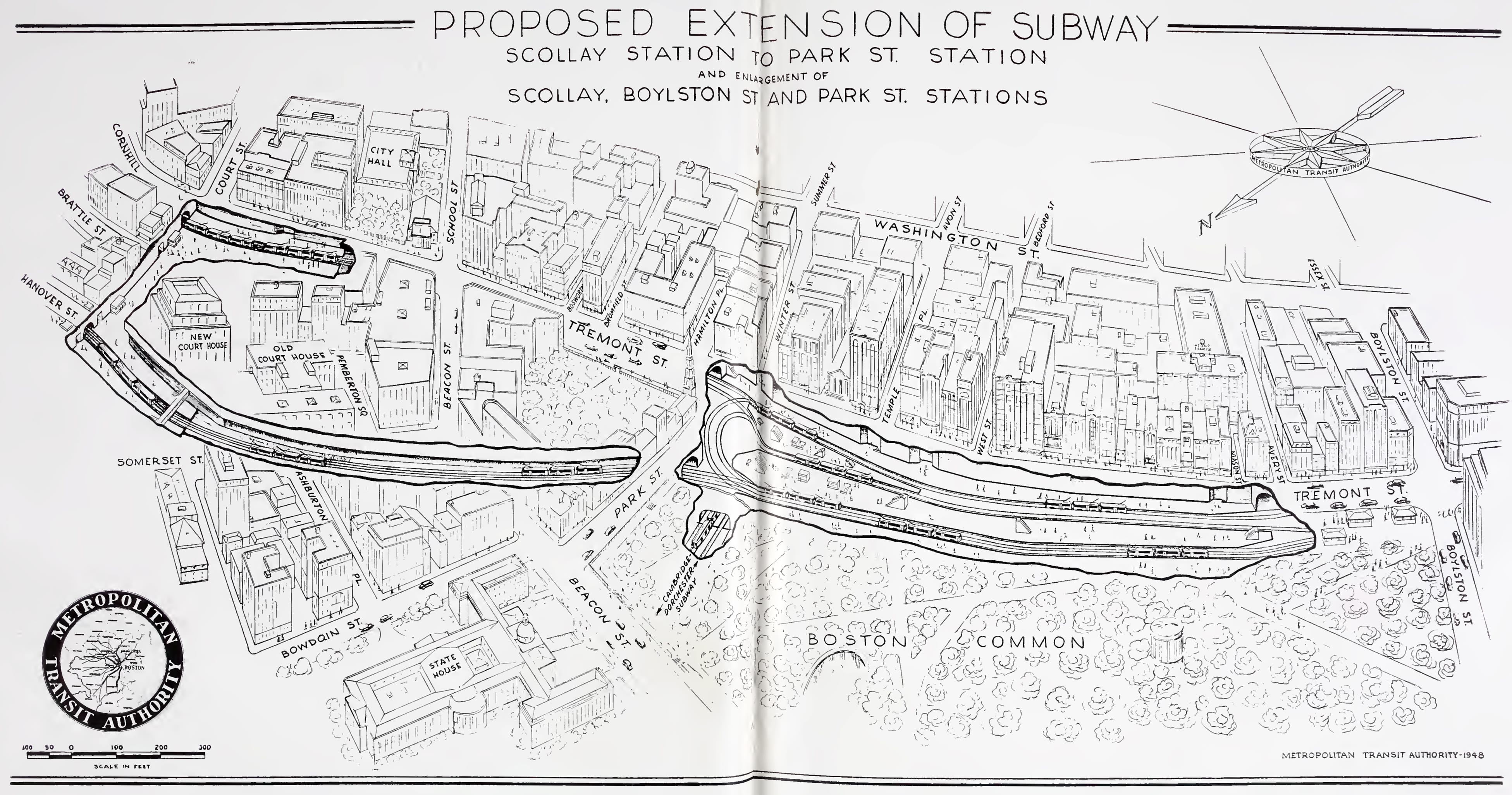
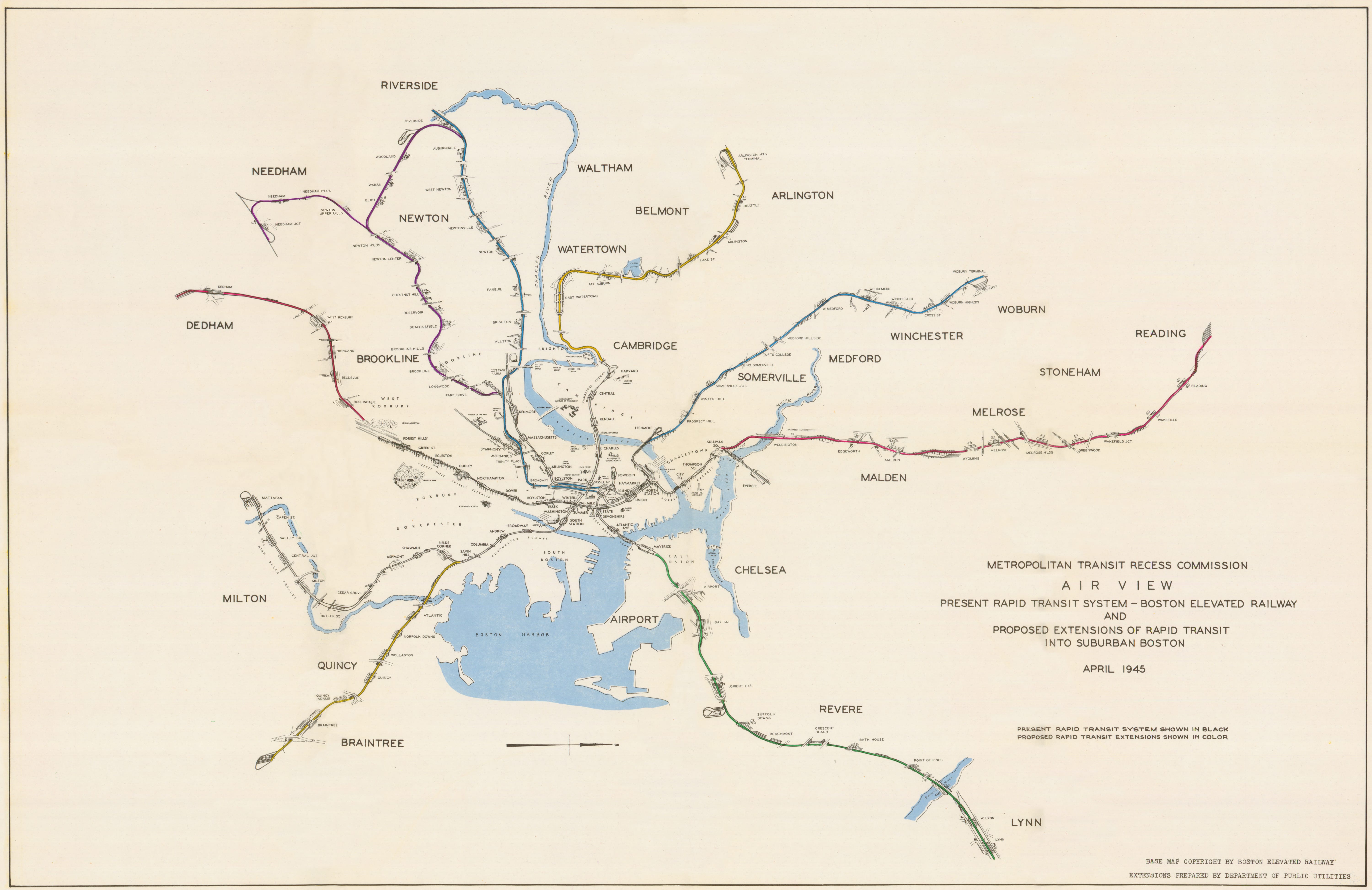
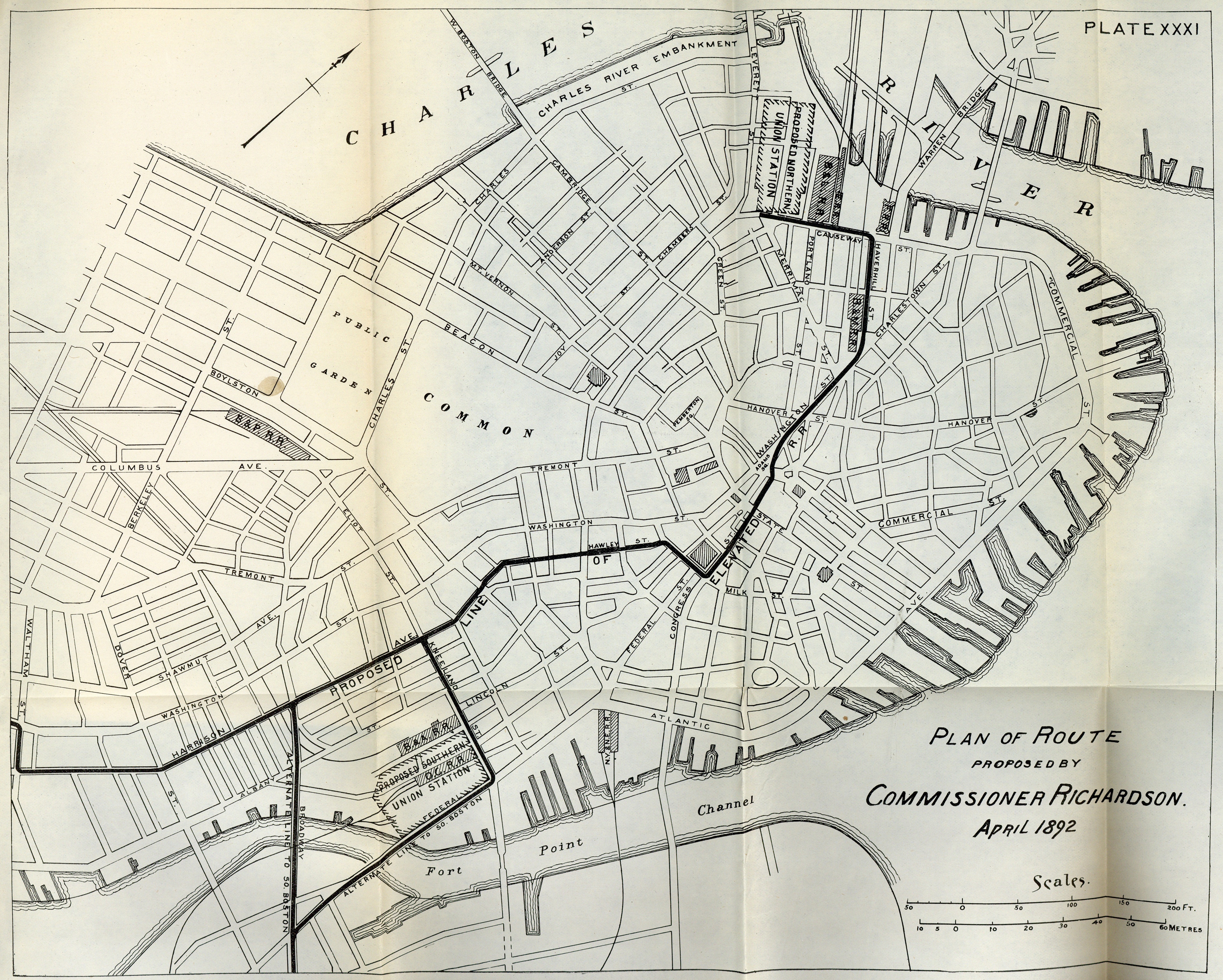
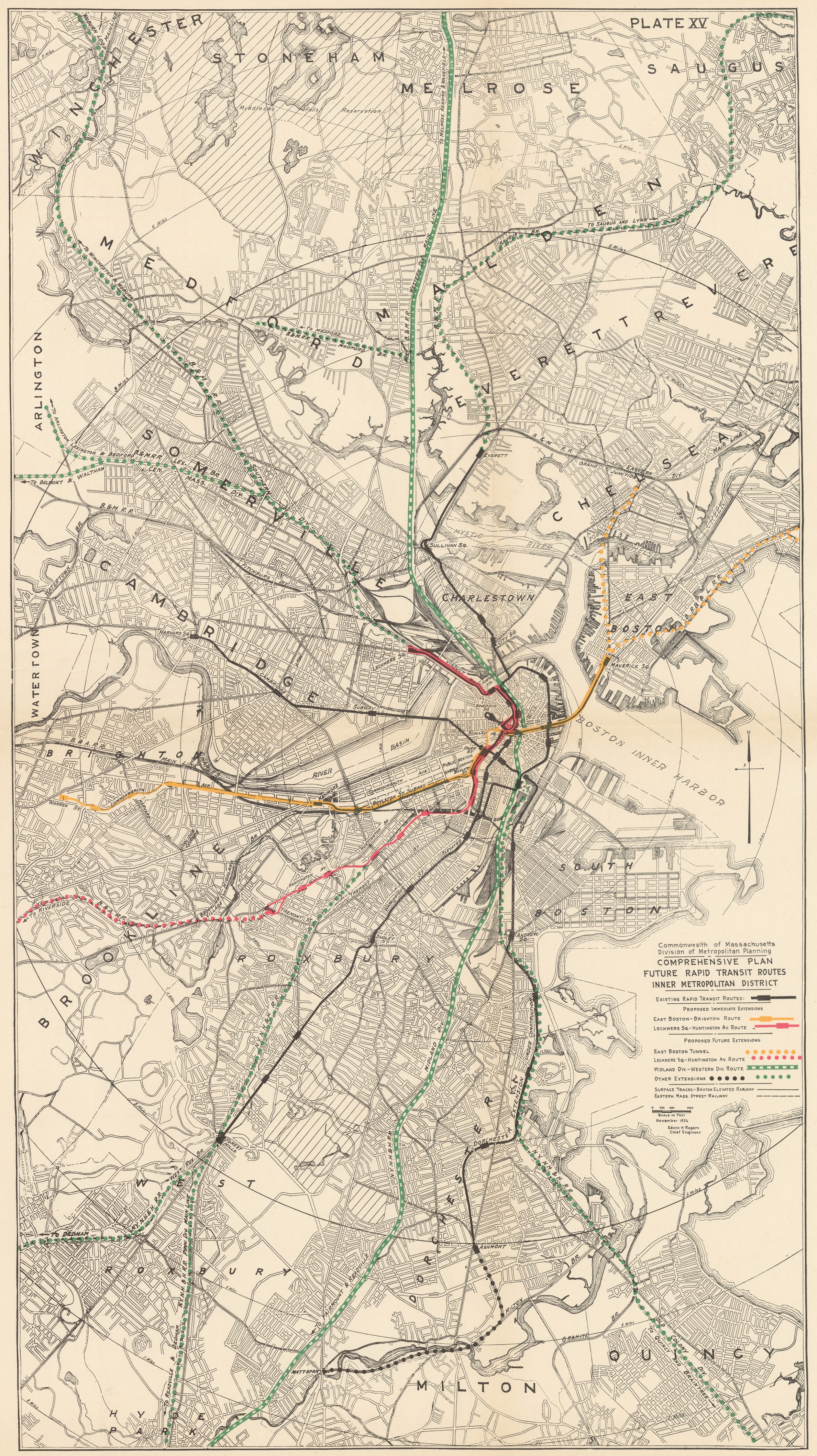
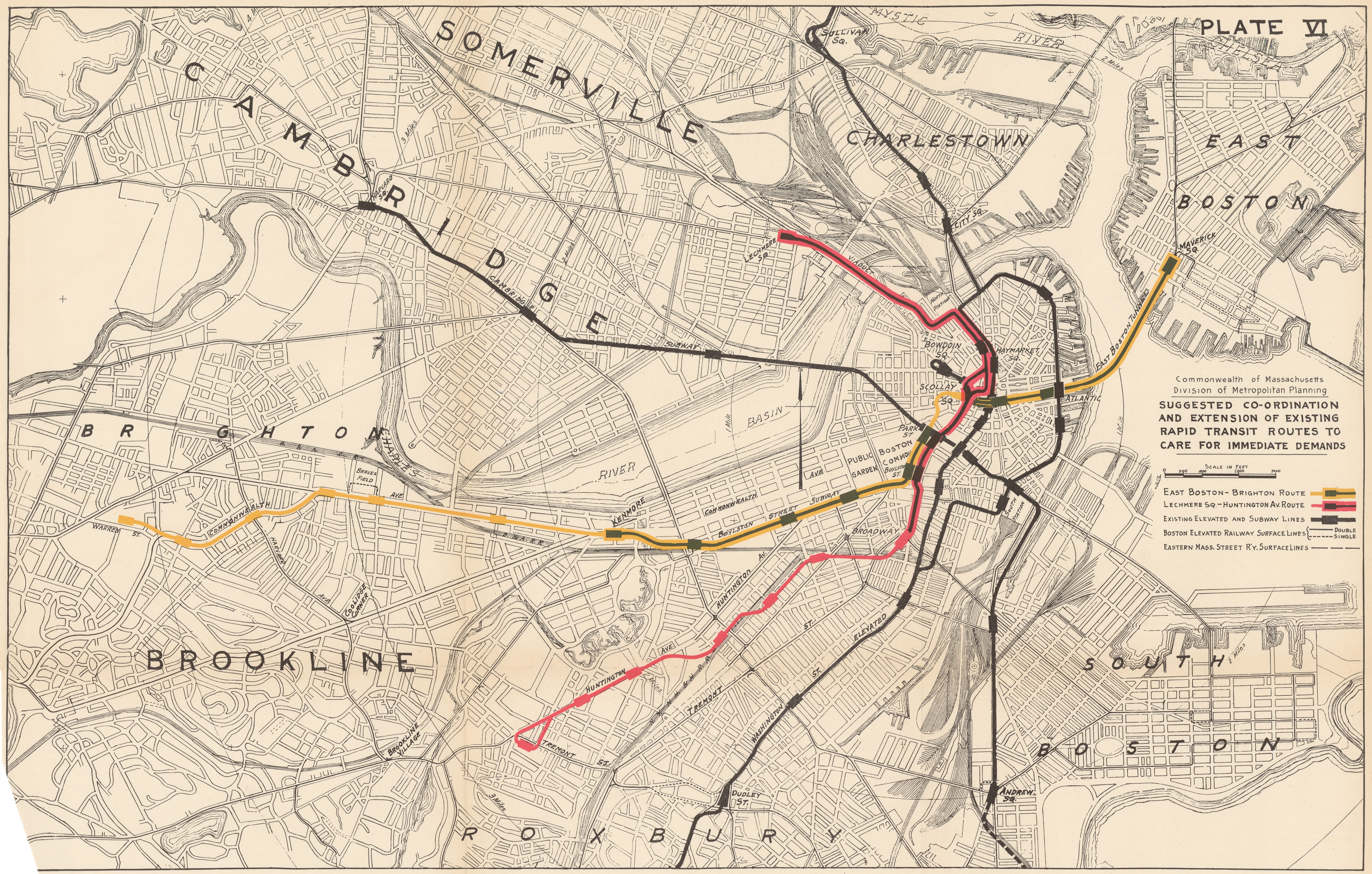
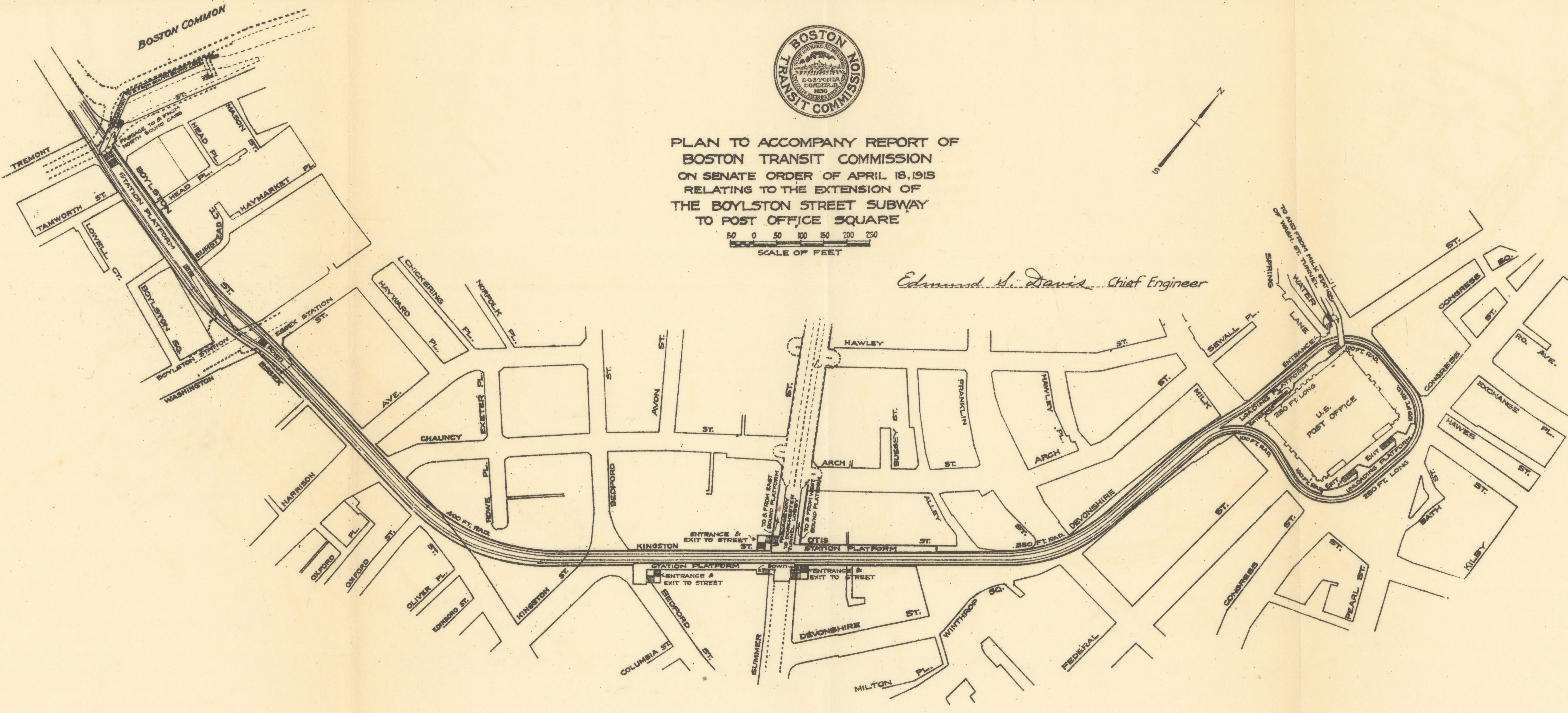
Since the nineteenth century, public agencies and various commissions have prepared formal recommendations for transit improvements for Boston, including a myriad of projects that remain unbuilt. In 1913, the Boston Transit Commission (BTC) proposed new tunnels to connect the Tremont Street Subway with an underground loop at Post Office Square. VC4.3 In 1926, the Massachusetts Division of Metropolitan Planning proposed aggressive extensions of transit lines into the suburbs, mostly following existing railroad rights of way. VC4.1 It also proposed improvements to central transit lines, VC4.2 including joining the East Boston Tunnel line with the Tremont Street Subway, converting it to rapid transit, and extending the line to Brighton. In 1947, the Metropolitan Transit Authority sought to combine the streetcar platforms at Scollay Square and Park Street Stations into a single superstation. VC4.4 Of all the maps of proposed transit expansion projects for Greater Boston, the 1945 map published by the Metropolitan Transit Recess Commission is among the most intriguing. VC4.5 With three-dimension pictorial representations of stations and key pieces of infrastructure, the map seamlessly combines what already existed and what had been proposed.
VC4.1
“Comprehensive Plan, Future Rapid Transit Routes, Inner Metropolitan District” from “Report on Improved Transportation Facilities in the Metropolitan District”
Massachusetts Division of Metropolitan Planning
1926
WardMaps LLC
VC4.2
“Suggested Co-Ordination and Extension of Existing Rapid Transit Routes to Care for Immediate Demands” from “Report on Improved Transportation Facilities in the Metropolitan District”
Massachusetts Division of Metropolitan Planning
1926
WardMaps LLC
VC4.3
“Plan … Relating to the Extension of the Boylston Street Subway to Post Office Square” from “Nineteenth Annual Report of the Boston Transit Commission”
Boston Transit Commission
1913
WardMaps LLC
VC4.4
“Proposed Extension of Subway: Scollay Station to Park St. Station and Enlargement of Scollay, Boylston St. and Park St. Stations” from “First Annual Report of the Board of Public Trustees of the MTA”
Metropolitan Transit Authority
1947
WardMaps LLC
VC4.5
Air View: Present Rapid Transit System - Boston Elevated Railway and Proposed Extensions of Rapid Transit Into Suburban Boston
Metropolitan Transit Recess Commission
1945
WardMaps LLC