Teen Curators
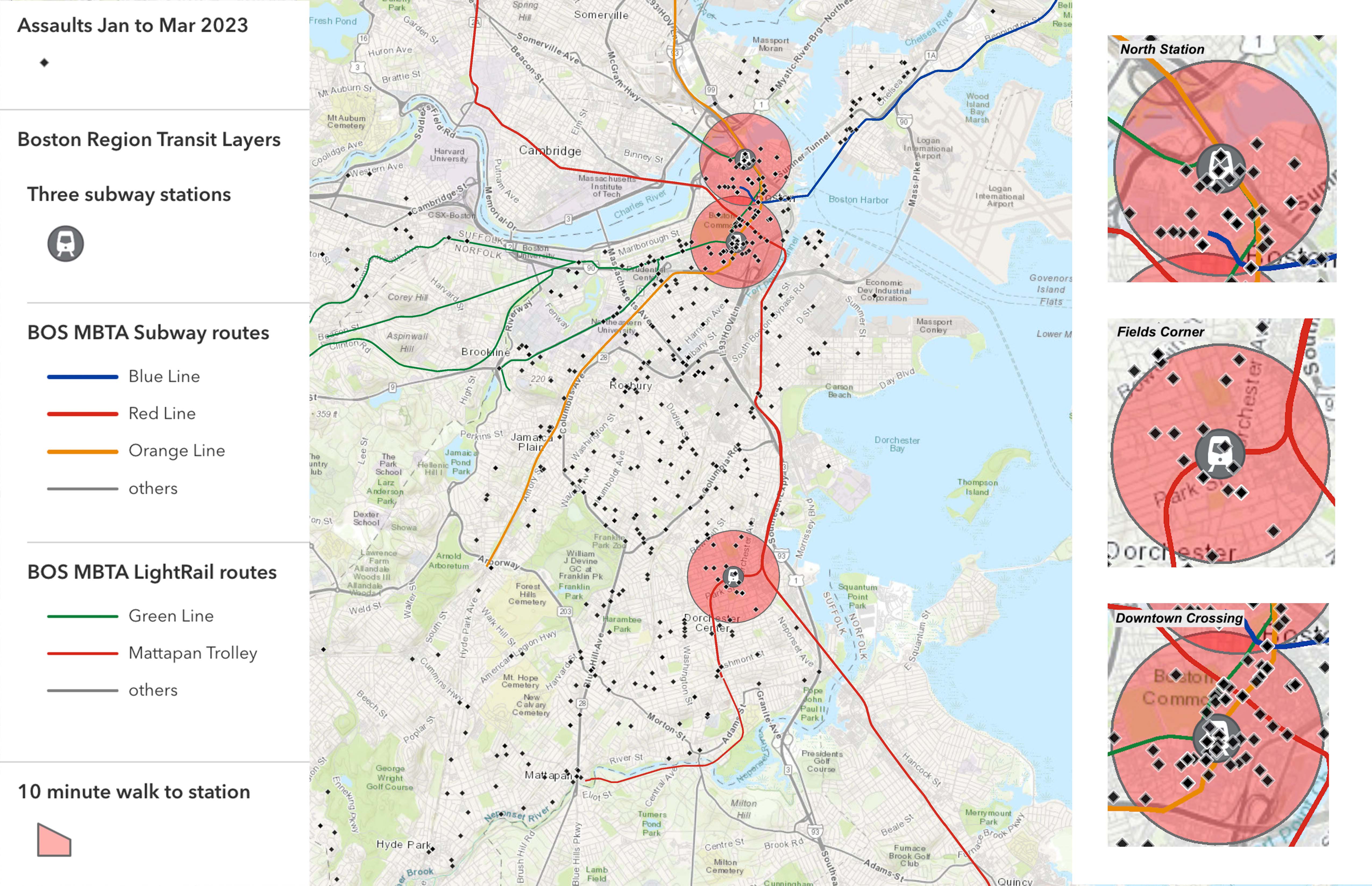
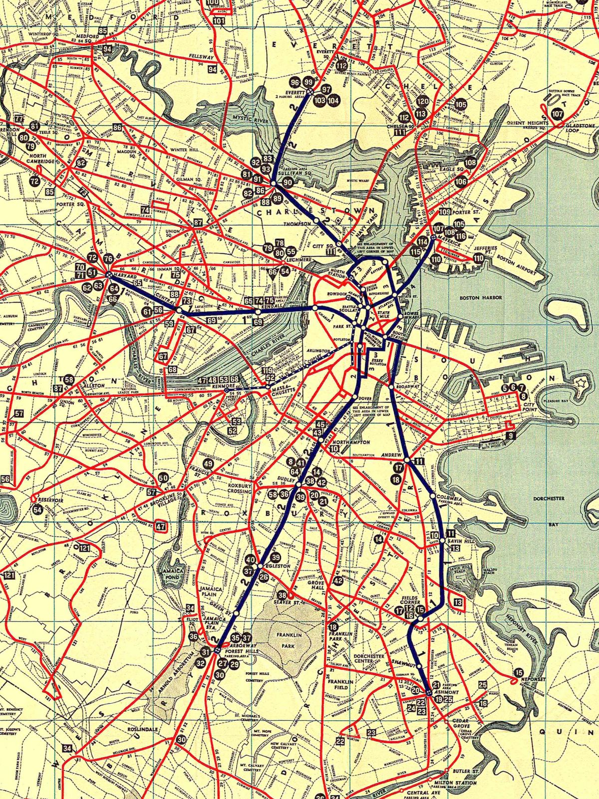
In the spring of 2023, Leventhal Center K-12 educators, in collaboration with the Boston Private Industry Council, hired Boston Public School students to create content for this exhibition. Students learned how information becomes geospatial by linking it to location and geography, and how it is used to create map-based visualizations using geographic information systems software (GIS).
The students practiced interpreting and evaluating data-based maps. They heard from professionals who use GIS maps in their work. Finally, they used the digital platform ArcGIS Online to make their own maps about transit in Boston.