Making and Trading
In the rising metropolis of the late nineteenth century, the spaces of the city were often dominated by commercial motives, of which there were no shortage in the Gilded Age. Urban atlases reveal the impact industrialization, commerce, and consumerism had on urban life.
——
MANUFACTURING CAMPUSES
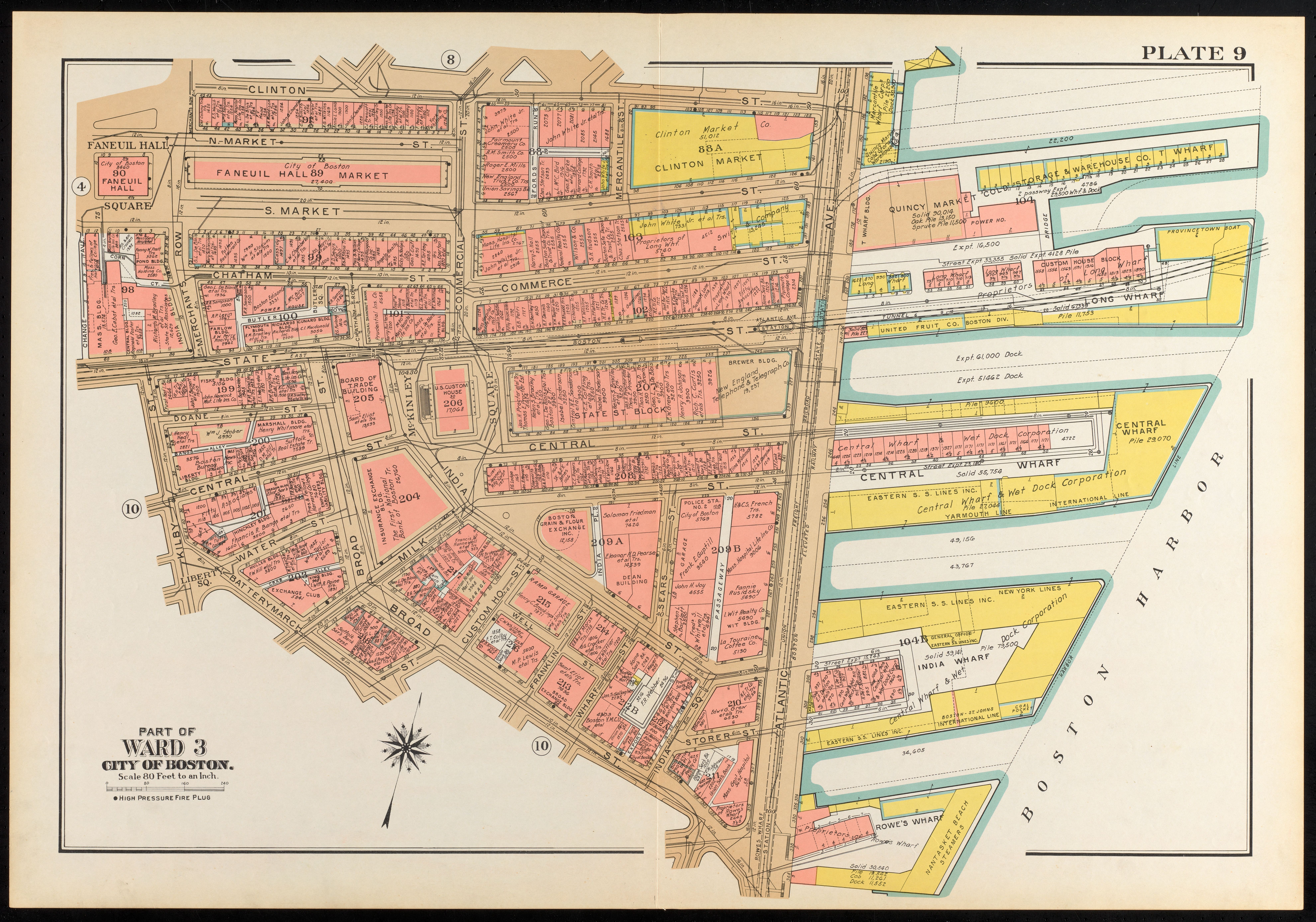
After the Civil War, as with many industries, rope-making gradually mechanized and the ropewalks became obsolete. Steam-powered pulling carts could efficiently distribute tension to strengthen rope, and the long swathes of land previously occupied by ropewalks were exchanged for new prospects in real estate. As this (82 1906 Bromley plate) shows, the landscape around (A Sewall Day & Co.) changed dramatically, too.
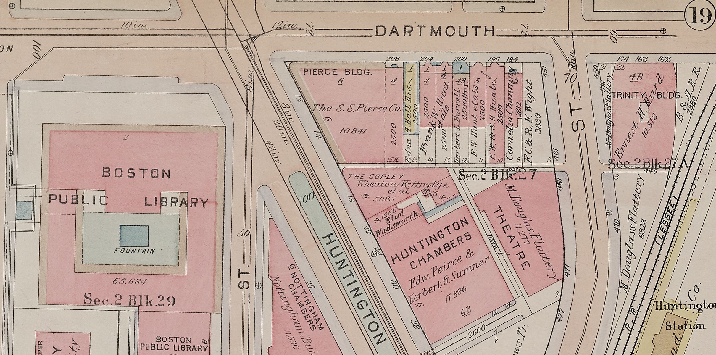
Detail of Atlas of the city of Boston, Roxbury, plate 14
G.W. Bromley & Co.
1915
Leventhal Map & Education Center
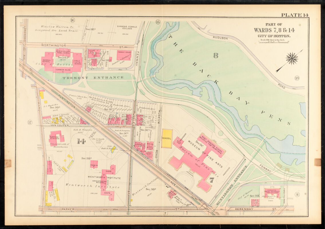
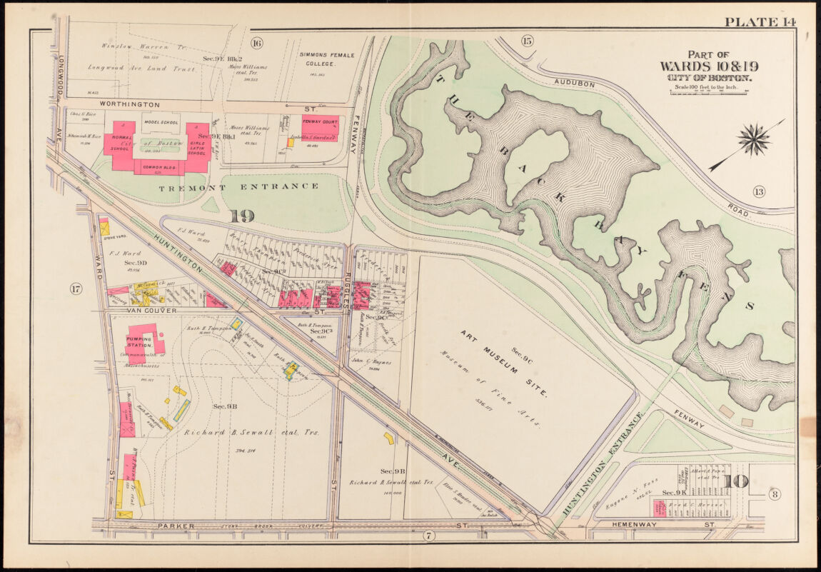
Ruggles Street has been extended upwards through the original Sewall land, and now intersects Huntington Avenue, which itself has been extended and resembles a boulevard with Parisian ambitions. In the original rope-making area, a dashed line shows where Stony Brook has been culverted. Sewall has transformed from a place of making into one of property ownership ready for development: this is no longer a pastoral scene. The Fens flanks a new site for the Museum of Fine Arts. Also notable are (A Isabella S. Gardener’s Fenway Court) (later the Isabella Stewart Gardner Museum) and (B Simmons College), an important women’s institution of higher learning. The whole area now resembles a collection of campuses. “Campus” indicates a built area devoted to education and culture, yet like this area, the word itself originates from “a field” and “a bend.”
Looking at the original parcel, by 1915, (A Wentworth Institute), flanked by machine shops on both wings, opens up towards Ruggles, while the (B Museum of Fine Arts) splays out onto Huntington Avenue.
FOOTPRINT OF ARTS AND CULTURE
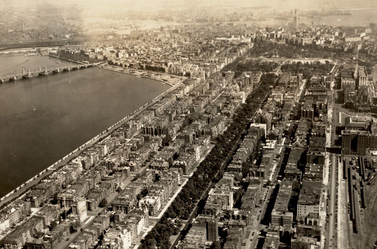
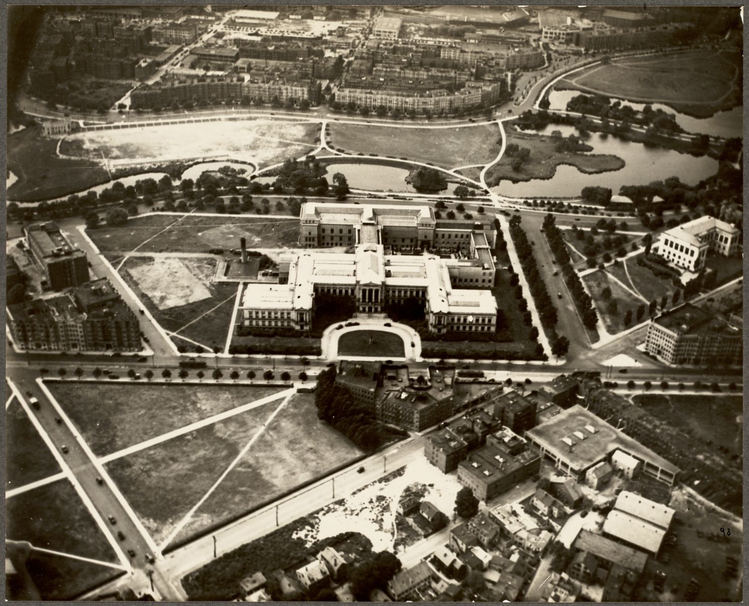
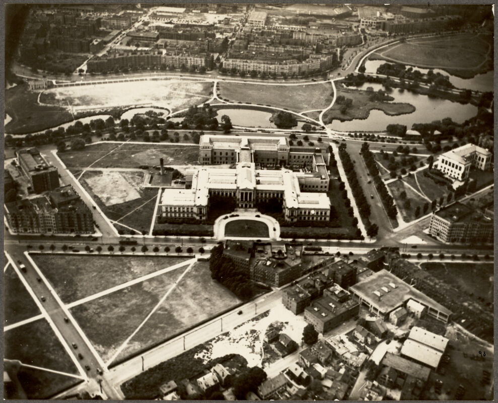
This 1931 Bromley plate alongside a 1930 aerial photograph of the same area shows just how much this landscape changed in less than a century. The union of manufacturing and natural features once visible in the Sewall Cordage area foreshadowed the emergence of a geometric landscape along a ceremonial thoroughfare.
Atlas of the city of Boston, Roxbury, plate 14
G.W. Bromley & Co.
1906
Leventhal Map & Education Center
Boston Museum of Fine Arts
Aero Scenic Airviews Co. (Boston, Mass.)
1930
Boston Public Library Arts Department
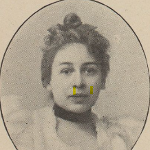
Florida's Story
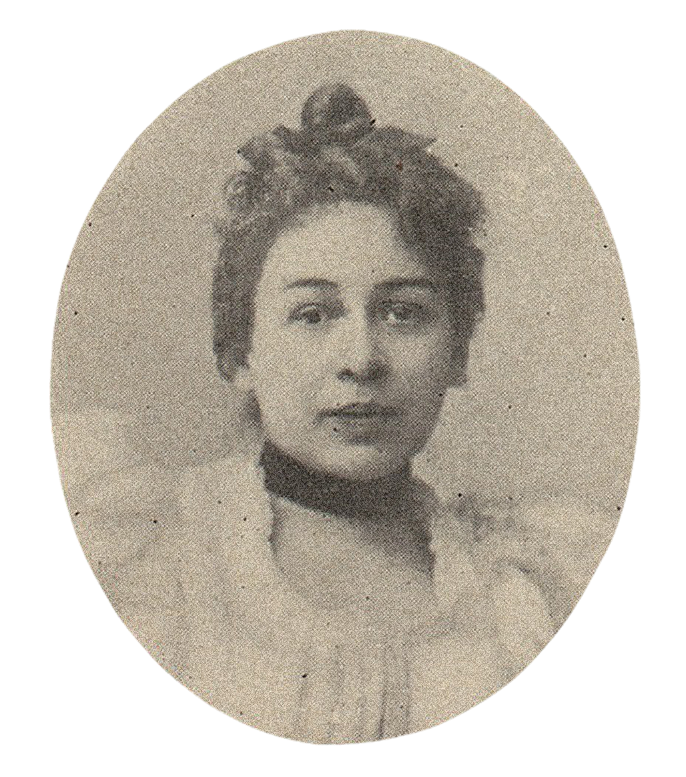
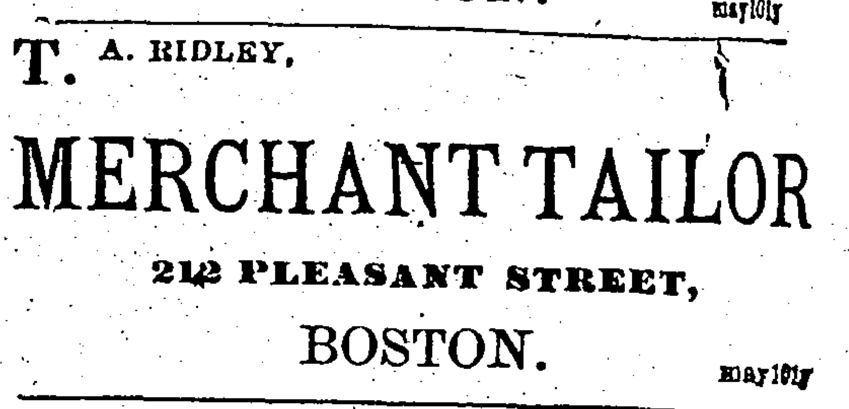
As members of the Black upper class, Florida’s family had access to education, money and the means to make a living. Florida’s father was the first Black judge in the United States. Florida herself trained as a teacher and worked in the Boston Public Schools in the 1880s. She married Ulysses A. Ridley, a successful merchant tailor.
For the majority of Black Bostonians in Florida’s lifetime, especially those who had recently migrated from southern states, racism presented a formidable barrier to stable employment. Black men in Boston often worked as bootblacks, janitors, laborers, servants, waiters, and porters, while women often found work as cooks, maids, seamstresses and nursemaids. Boston’s Black entrepreneurs operated businesses that employed black laborers, organizing many of them to engage in collective political action.
The maps in this exhibition rarely show us the names of Black businesses, but we can use other kinds of sources, like city directories and newspaper advertisements, to uncover their stories.
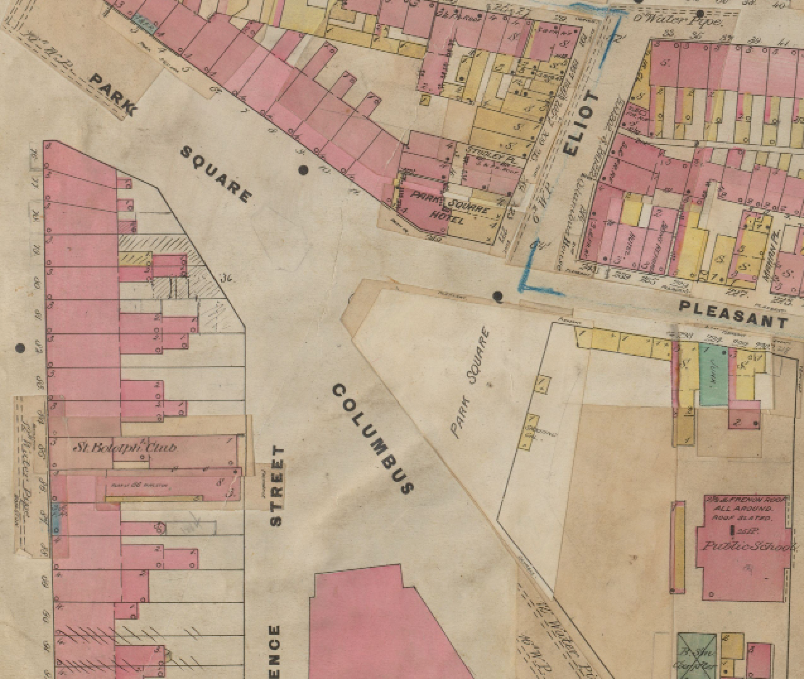
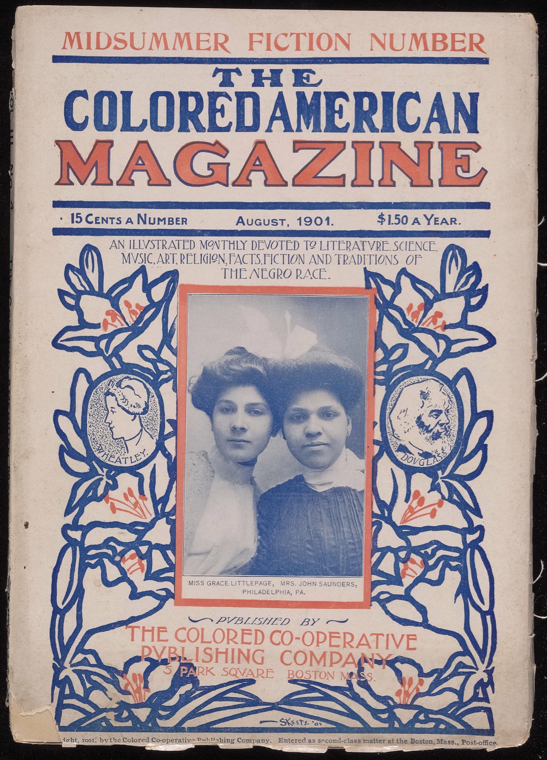
For example, Florida’s husband Ulysses A. Ridley ran his tailoring business in (Boston’s Park Square) (look for 212 Pleasant Street on the map), advertised here in the New York Globe newspaper. Next door to Ulysses’s shop, the offices of the groundbreaking Colored American Magazine bustled as they published new African-American literature and articles protesting racial injustice.
IN WHAT WAYS DO THE BUSINESSES WHERE YOU LIVE REFLECT AND SERVE YOUR COMMUNITY?
TWISTING TWINE BY THE BROOK
Straight dashed lines begin to cut through Sewall Day & Co. Cordage in this 1882 atlas plate. The scenes on the map set the stage for a story of dramatic transition from a site of industrial fabrication spread out along the winding brook to an educational site of public culture. As Boston shaped its Gilded Age identity, both natural features like the Stony Brook and industrial features like the ropewalks were replaced by very different forms of urban land use.
City atlas of Boston, Massachusetts, plate 18
G. M. Hopkins
1882
Leventhal Map & Education Center
In this illustrated view of the Cordage, some of the details of the natural geography shown in the atlases, such as water and open space, are seen as part of a pastoral depiction of a working landscape.
The ropewalk offered a view into the productive process of imagination in Henry Wadsworth Longfellow’s 1858 poem “The Ropewalks.” Features of the peculiar buildings are likened to accessories of the mind, which, like rope, invokes all manner of imagery and dreams, both light and dark.
In that building, long and low,
With its windows all a-row,
Like the port-holes of a hulk,
Human spiders spin and spin,
Backward down their threads so thin
Dropping, each a hempen bulk.
At the end, an open door;
Squares of sunshine on the floor
Light the long and dusky lane;
And the whirring of a wheel,
Dull and drowsy, makes me feel
All its spokes are in my brain.
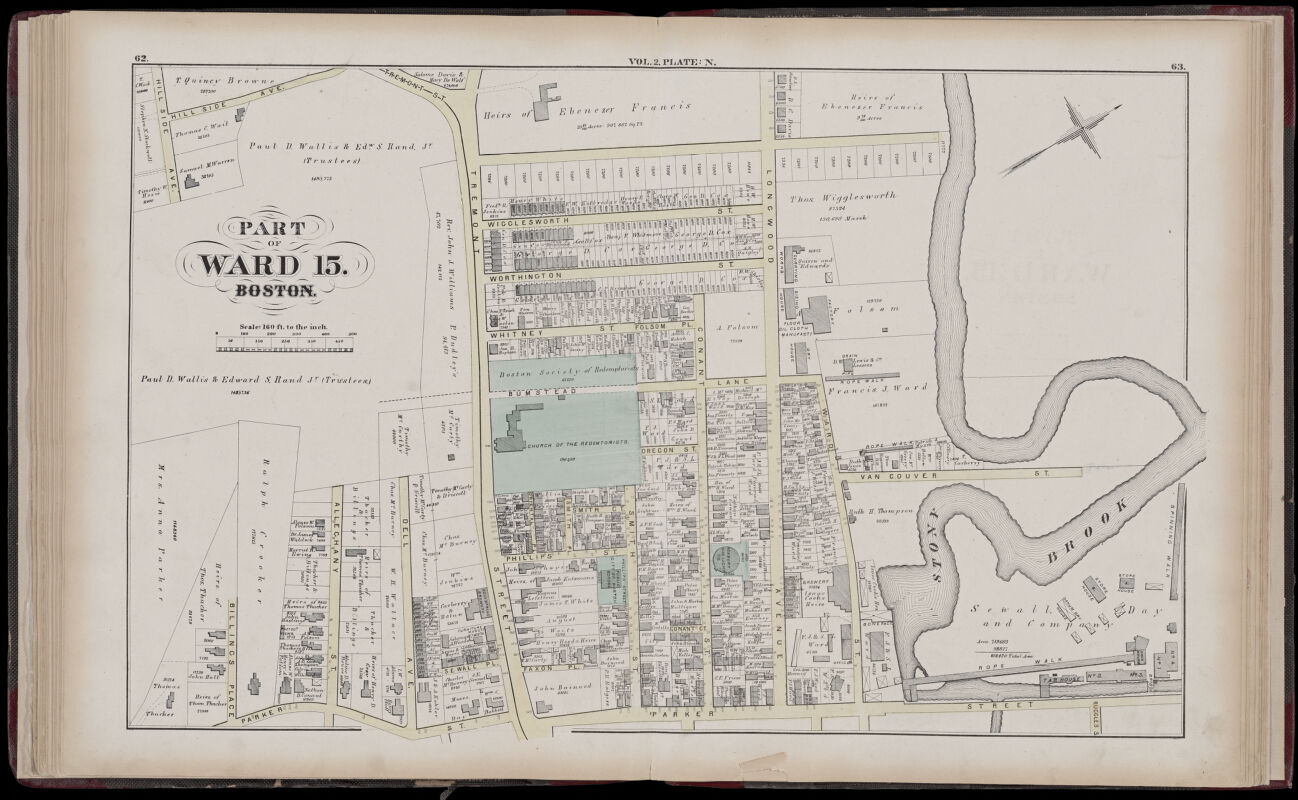
In this section of an 1873 Hopkins atlas plate, Stony Brook dominates the area bordered by Parker Street and Longwood Avenue. The watercourse winds through a manufacturing landscape dotted by workhouses and storerooms. At points, the brook conforms to manmade buildings and property lines. Perhaps the most peculiar of these structures are the “ropewalks,” long wooden sheds where workers wound hemp, flax, or other plant materials into cords which were then tightly braided into rope. The longer the shed, the longer the rope. The majority of the ropewalks in this atlas view lie on land owned by Sewall, Day & Co. Cordage
Detail of Atlas of the county of Suffolk, Massachusetts, vol. 2, plate N
G.M. Hopkins & Co.
1873
Leventhal Map & Education Center