Having Fun
It’s not that people didn’t have fun before the nineteenth century, but with all the new ways of seeing each other and the world, they seemed to demand more fun than in previous eras. As entertainment and recreation became hot commodities, urban atlases captured moments of spectacle in the built environment
SEEING HISTORY ALL AROUND: BOSTON’S CYCLORAMAS
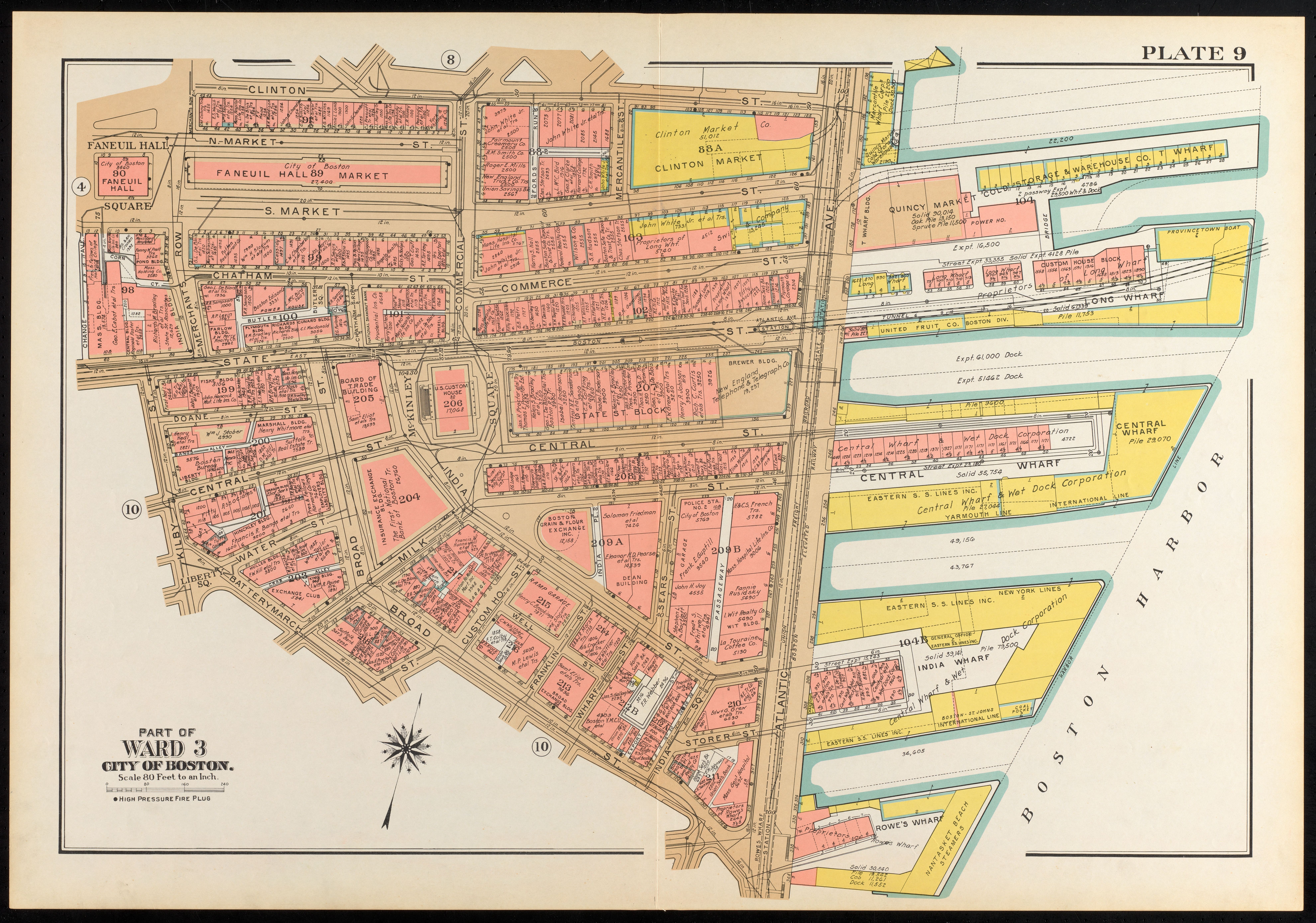
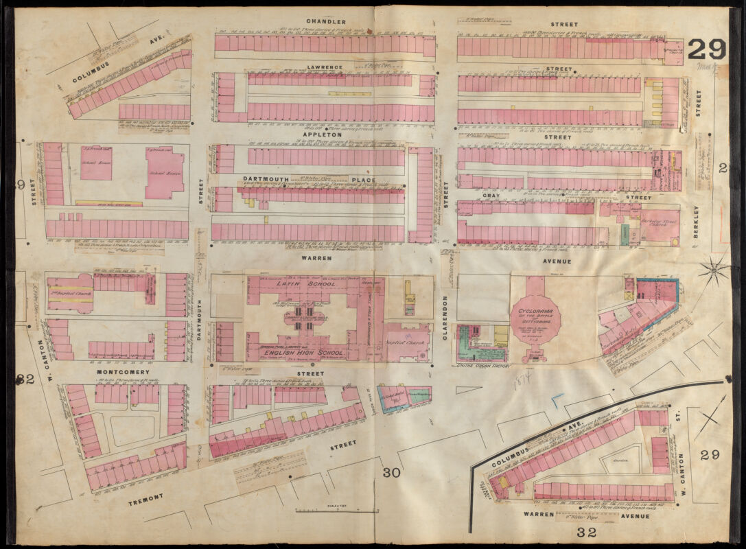
Among all the rectangles and lines on the atlas, every so often a more intriguing shape emerges. In these atlas plates of the South End, two multi-faceted structures resembling circles appear on oblong blocks, each with the label “cyclorama.” The cycloramas weren’t just curiosities on the maps; they were meant to be spectacles in real life, too. The circular walls were built specifically for the purpose of displaying an enlarged, 360-degree painting of a historic scene. The idea was to give visitors the illusion of being transported to another location, long before movies or virtual reality.
AN IMMERSIVE EXPERIENCE
In 1880s Boston, two cycloramas opened within four years and a few blocks of one another. The (A first cyclorama), visible in the 1885 Sanborn atlas, commemorated the Battle of Gettysburg, which was a turning point in the Civil War and would have been within living memory of most people visiting the installation.
Detail of Insurance maps of Boston, volume two, plate 29
D. A. Sanborn
1885
Leventhal Map & Education Center
The (B second cyclorama) opened (50 four years later), in 1888, and commemorated the Bunker Hill battle from the Revolutionary War. As the The Cambridge Press News wrote, “the new cyclorama…has been pronounced by press and public one of the most perfect illusions and most remarkable works of art which has been shown in this country for many years.” Cycloramas aimed to teach history by simulated physical immersion. Guides even encouraged tourists view the cyclorama before visiting Bunker Hill itself.
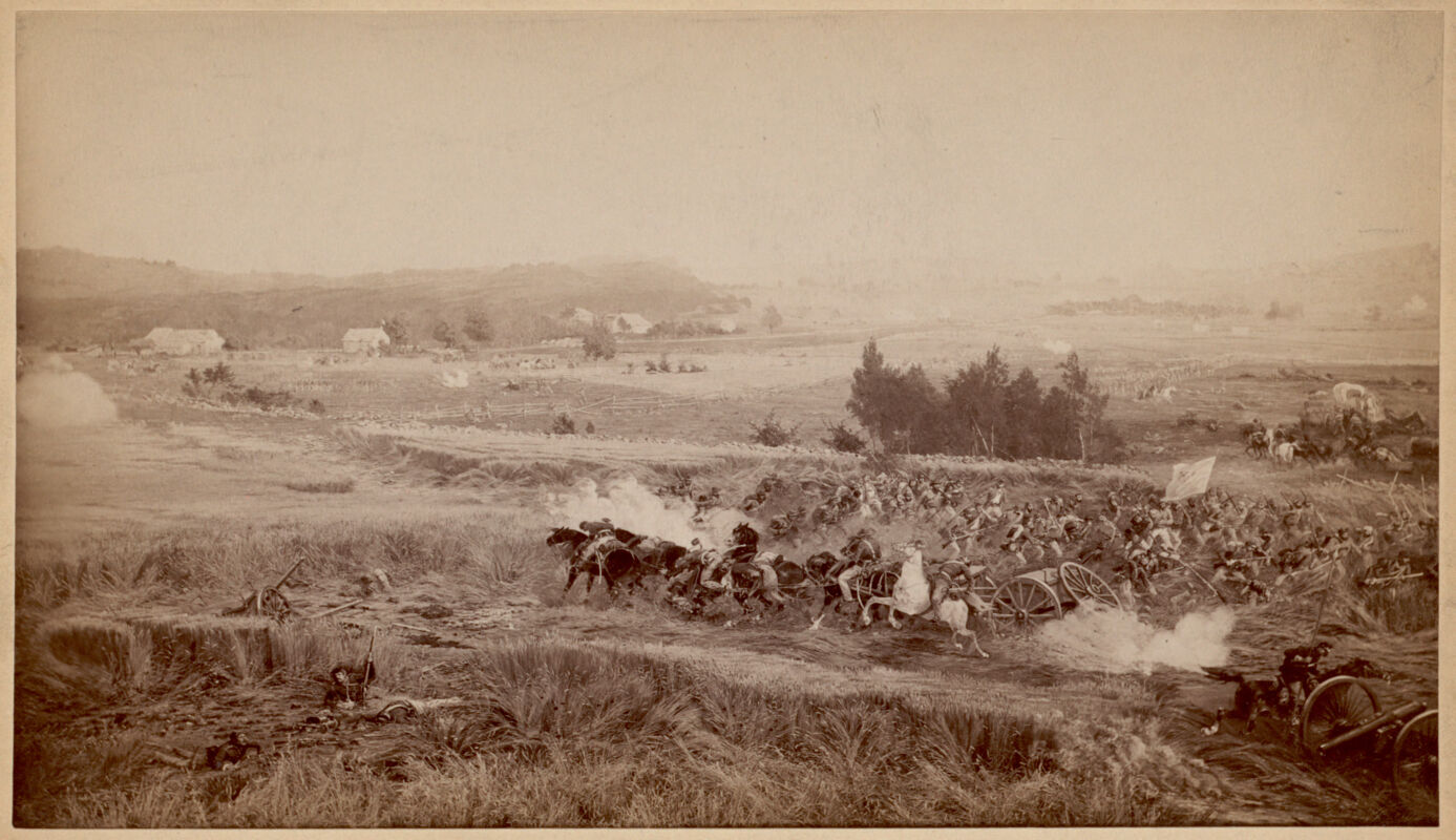
Below, you’ll find a portion of the painting displayed at the Battle of Gettysburg Cyclorama by French painter Paul Philippoteax.
“A cloud possessed the hollow field” - One of eight scenes from the Cyclorama - The Battle of Gettysburg
Paul Philippoteaux; Allen & Rowell
[ca. 1884]
Boston Public Library Arts Department
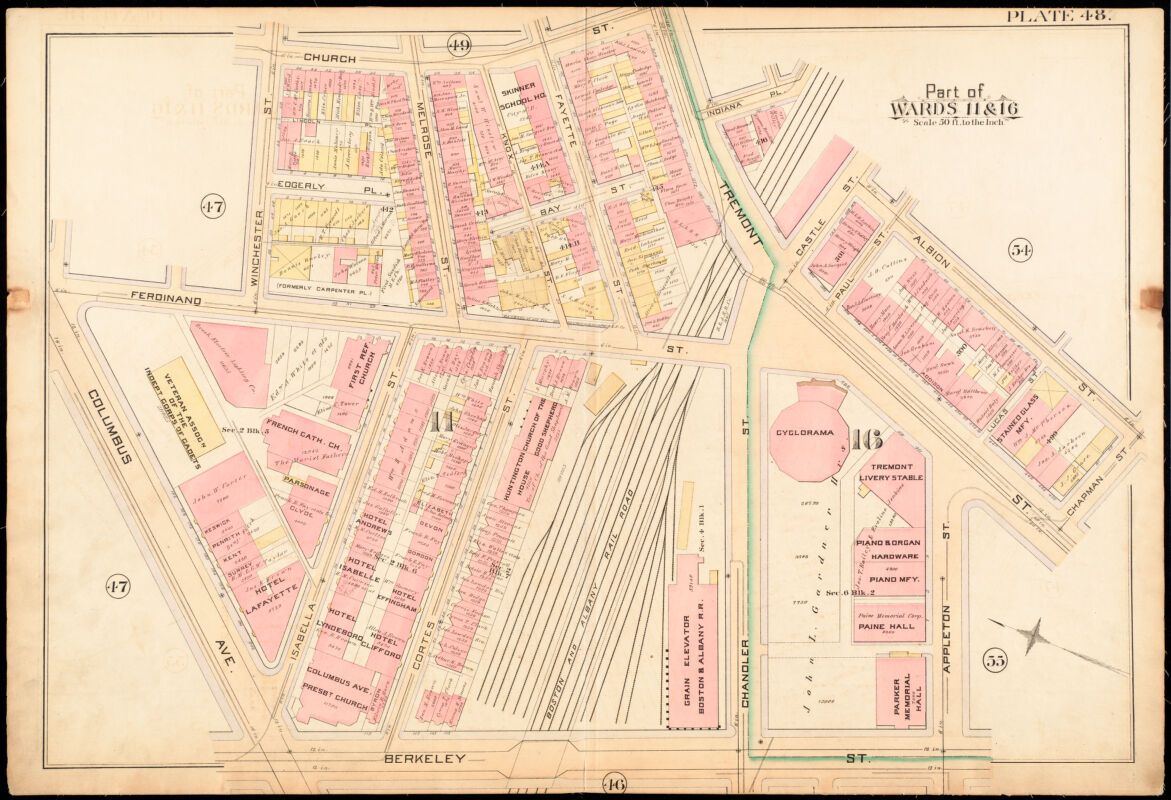
CYCLORAMA ARCHITECTURE
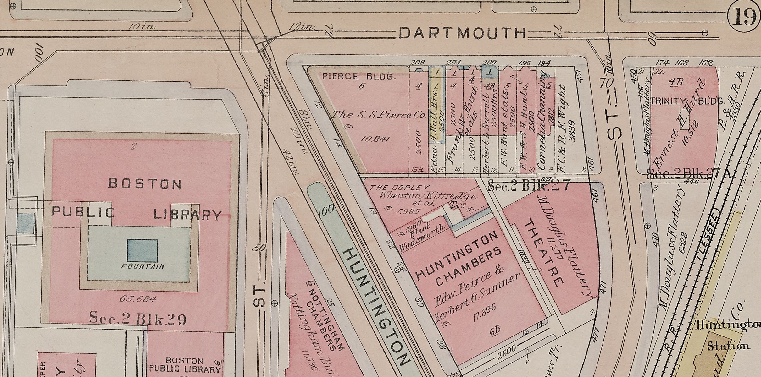
The 1885 Sanborn atlas provides details about the Gettysburg cyclorama building that place it firmly in the nineteenth century: it was heated by a boiler in the basement and the ceiling was iron and glass.
Atlas of the City of Boston, City Proper, Plate 48
G.W. Bromley & Co
1885
Leventhal Map & Education Center
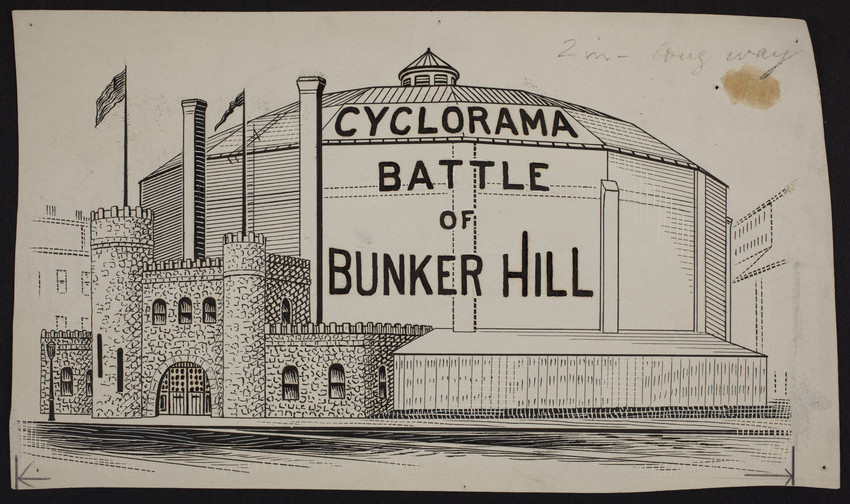
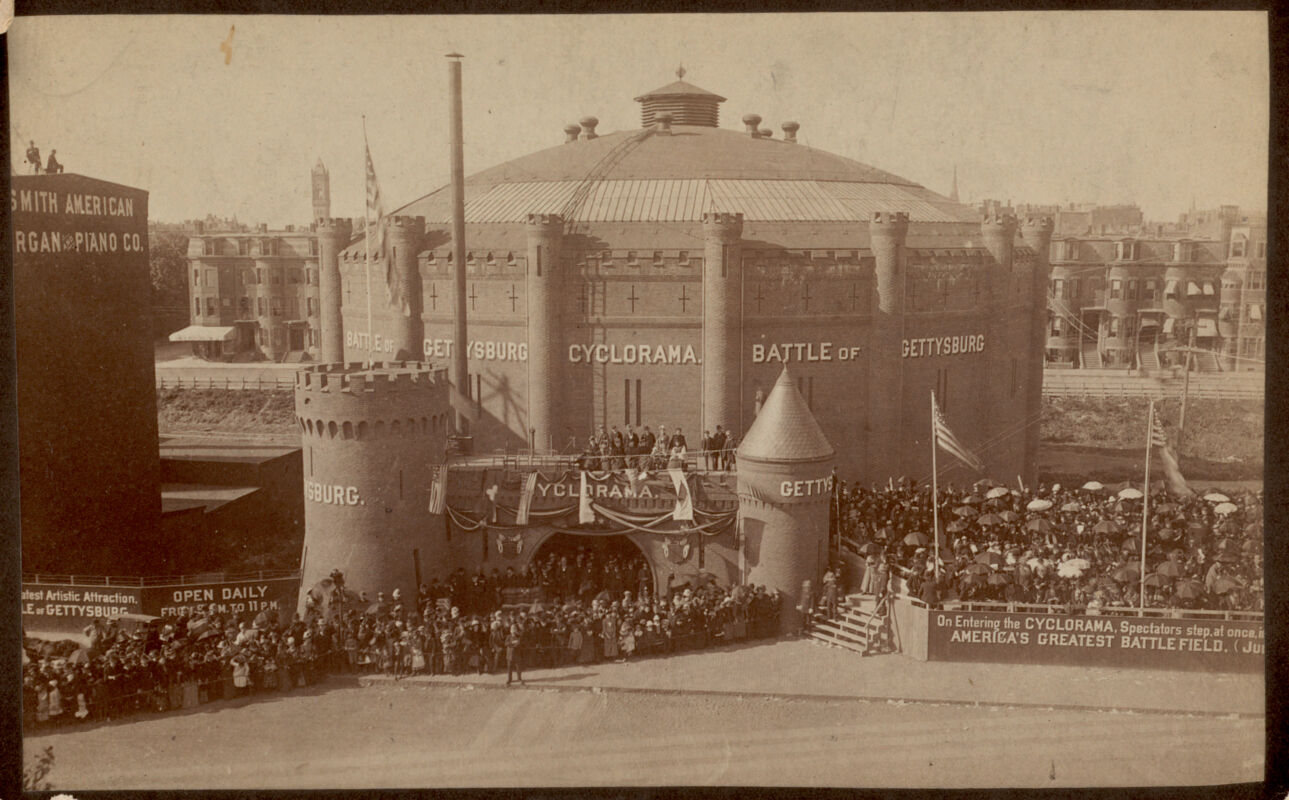
While urban atlases didn’t concern themselves with the styles of buildings’ facades, promotional material shows that the exteriors of both cyclorama buildings in the South End had the appearance of a medieval arena. The drawing shows columns on each of the sixteen sides. Was there so much difference between a medieval joust and a cyclorama? Both immersed viewers in scenes of battle and war.
Cyclorama, Battle of Bunker Hill, Tremont Street, Boston, Mass., 1888-1899
[1888–1899]
Historic New England
Cyclorama building. Battle of Gettysburg. Tremont Street
[ca. 1855–1895]
Boston Public Library Arts Department
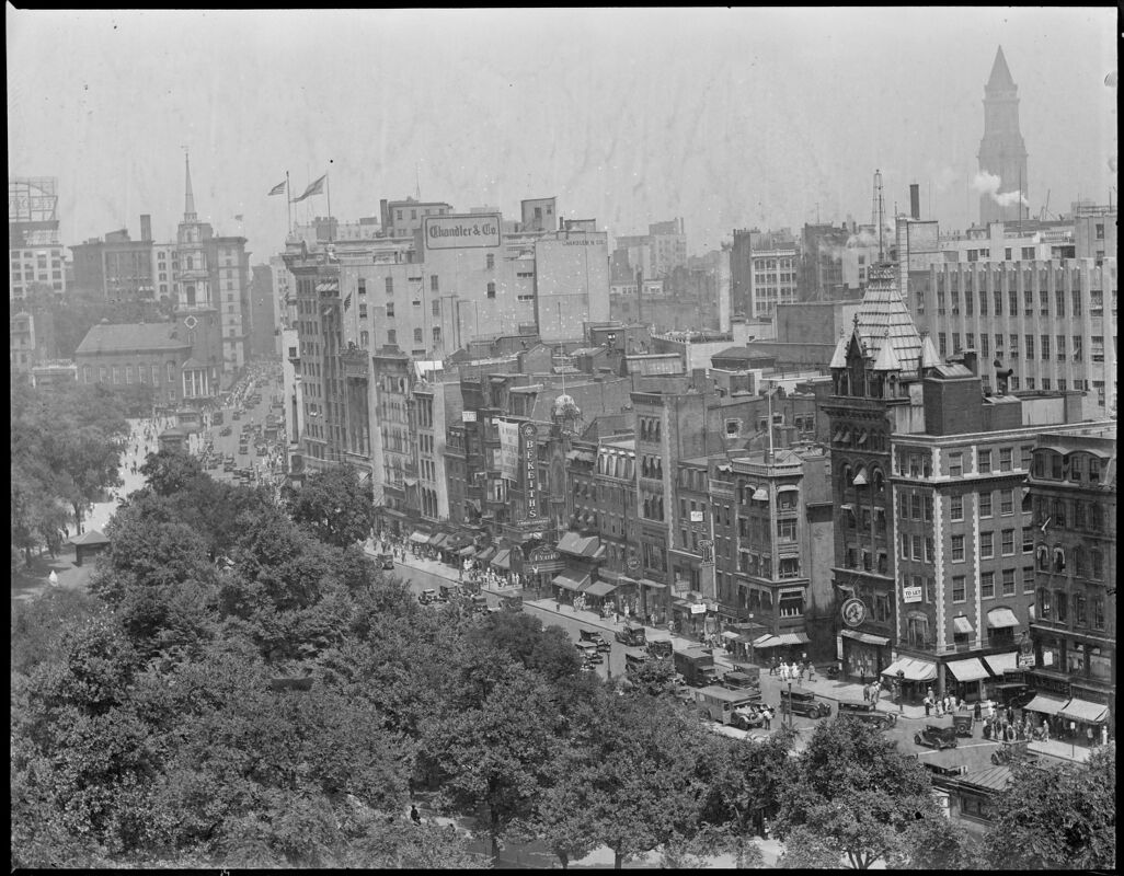
THE SCENE ON TREMONT STREET
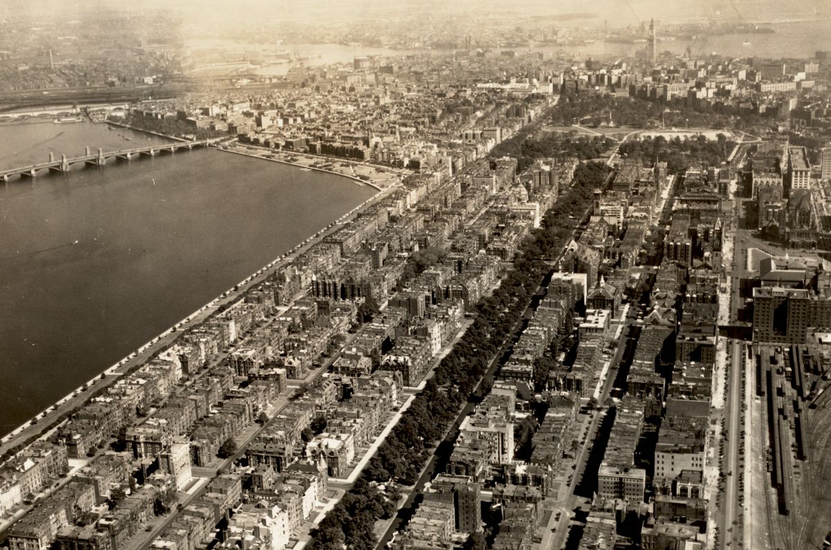
In 1931, when Boston Globe photographer Leslie Jones took this aerial shot of Tremont Street, the film industry was transitioning from the era of silent moving pictures to the combination of spoken dialogue and film we’re familiar with today.
Detail of Aerial, Tremont St.
Leslie Jones
[ca. 1917–1934]
Boston Public Library Arts Department
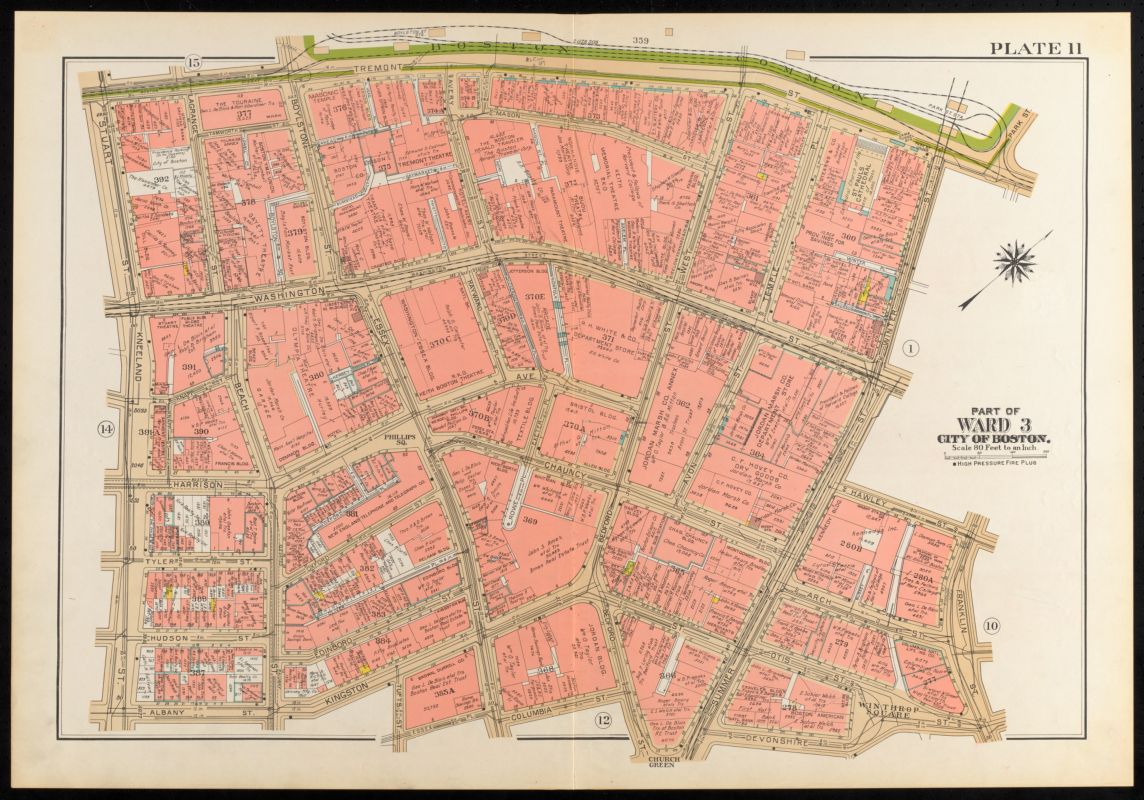
The 1938 Bromley view of Tremont Street presents a tidier image of a busy, messy scene bursting with recreation.
Detail of Atlas of the city of Boston, Boston proper and Back Bay, plate 11
G. W. Bromley & Co.
1938
Leventhal Map & Education Center
For urban atlases concerned with fire insurance, the theatrics of live performances and film projection posed no shortage of risk. The 1882 Sanborn image here uses thick written descriptions to note the precautionary systems in place. It gives a good inventory of the building technologies used in theaters, with details on stages, lighting, and the fly system for hoisting scenery.
Detail of Insurance maps of Boston, volume one, plate 19
D. A. Sanborn
1882
Leventhal Map & Education Center
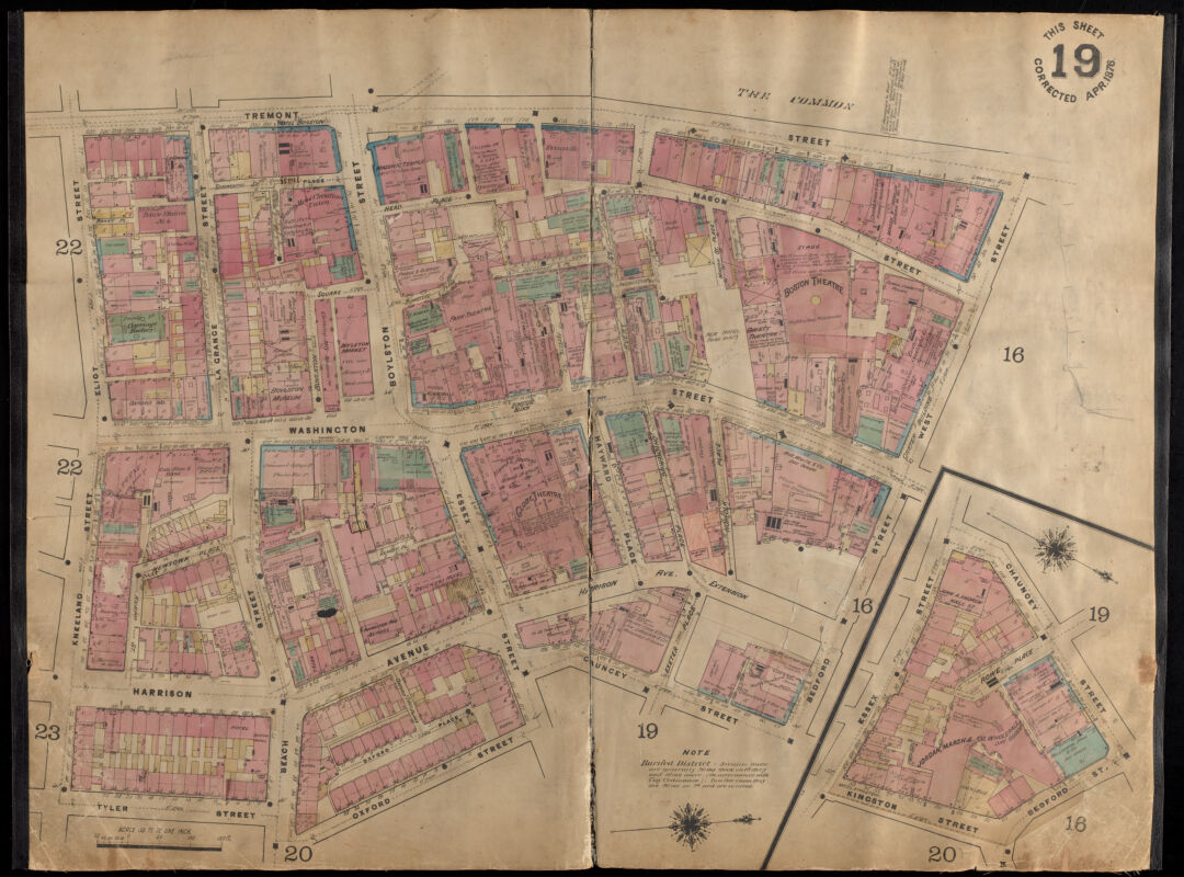
The earlier development of the Washington Theater district is visible at the top of this Pinney plate.
Plan of the city of Boston, plate 14
C. Pinney
1861
Leventhal Map & Education Center
During that time, films depicted what were considered risky themes, including homosexual and interracial relationships. The photograph includes a special view of (C BF Keith Theater), located in the Washington Street Theater District. Live performance halls and moving pictures cinemas both gave the area a sensational character. Keith’s theater got its start as a family-friendly vaudeville house called Gaiety Theater. In the photograph, the film on view is slightly more mature: it is titled “A Woman of Experience” featuring the film-actress Helen Twelvetrees. A man updates the marquee, and Tremont Street seems alive.
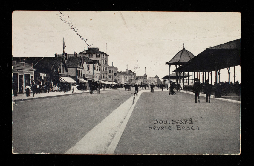
LANDSCAPE OF MARVELS: REVERE BEACH
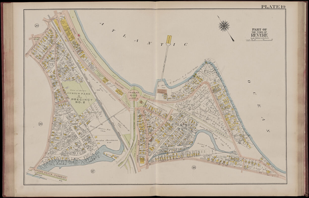
Railroads and coastlines make these (59) (60) two Bromley plates from 1914 pleasing to look at. Although the plates are printed on consecutive pages in the bound atlas, the slender north arrows confirm that they are oriented differently. But don’t let the fragmented atlas plates distract from the fact that the recreational prospects of the three-mile stretch of coastline actually hinged on a view of the “long sweep of open beach,” in the words of Charles Eliot, the landscape architect who designed this picturesque beachfront promenade in 1896. Eliot’s work with the Metropolitan Parks Commission preserved the coastal view, framed it with a boulevard, and defined space for commercial development in a strip across the boulevard, which filled in with attractions and hotels.
Atlas of the city of Chelsea and the towns of Revere & Winthrop, Massachusetts, plate 19
G.W. Bromley & Co.
1914
Leventhal Map & Education Center
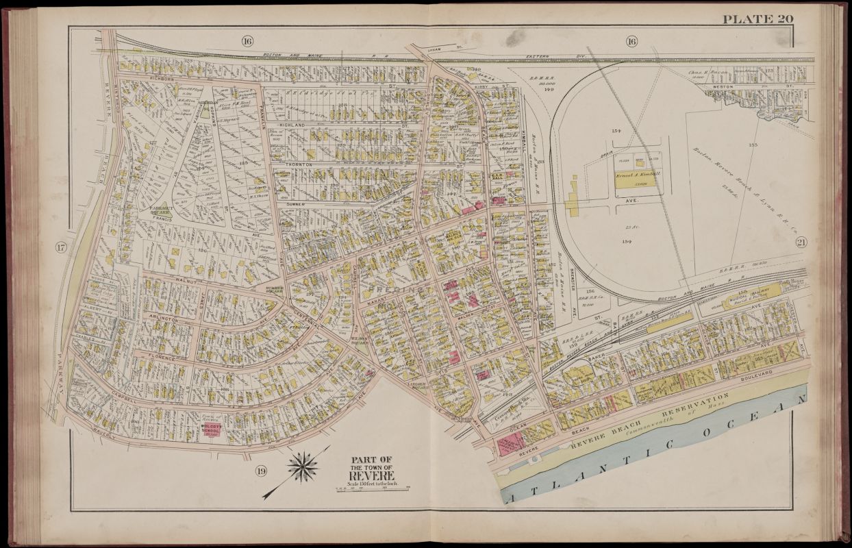
Atlas of the city of Chelsea and the towns of Revere & Winthrop, Massachusetts, plate 20
G.W. Bromley & Co.
1914
Leventhal Map & Education Center
To picture this landscape of leisure, follow the labels and dashed lines of the scene in a close-up view.
Detail of Atlas of the city of Chelsea and the towns of Revere & Winthrop, Massachusetts, plate 19
G.W. Bromley & Co.
1914
Leventhal Map & Education Center
Detail of Atlas of the city of Chelsea and the towns of Revere & Winthrop, Massachusetts, plate 20
G.W. Bromley & Co.
1914
Leventhal Map & Education Center
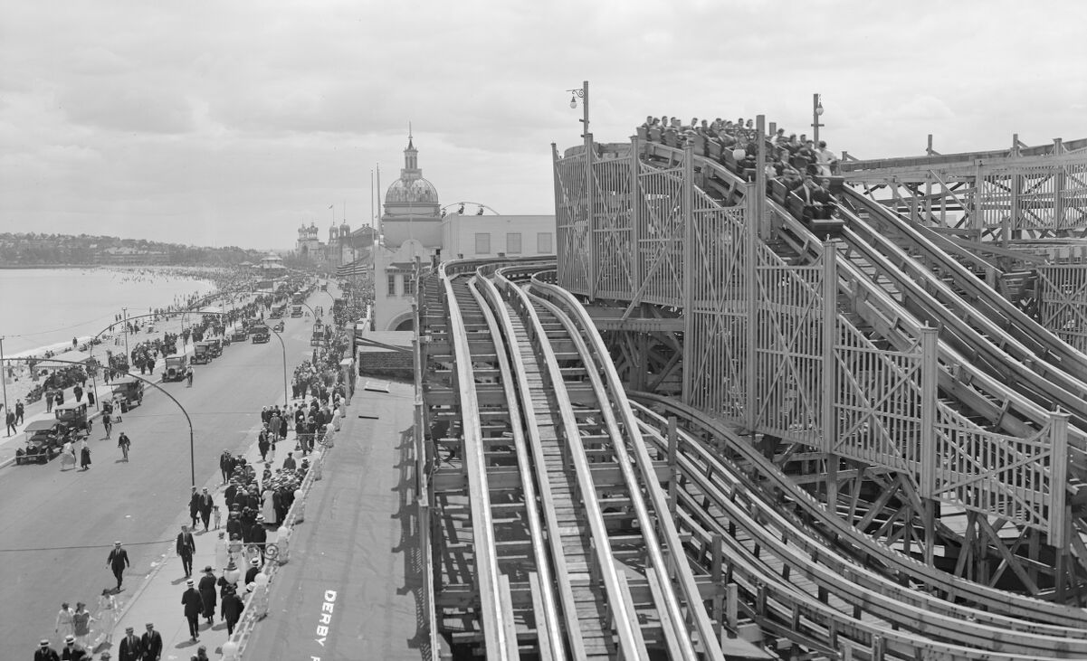
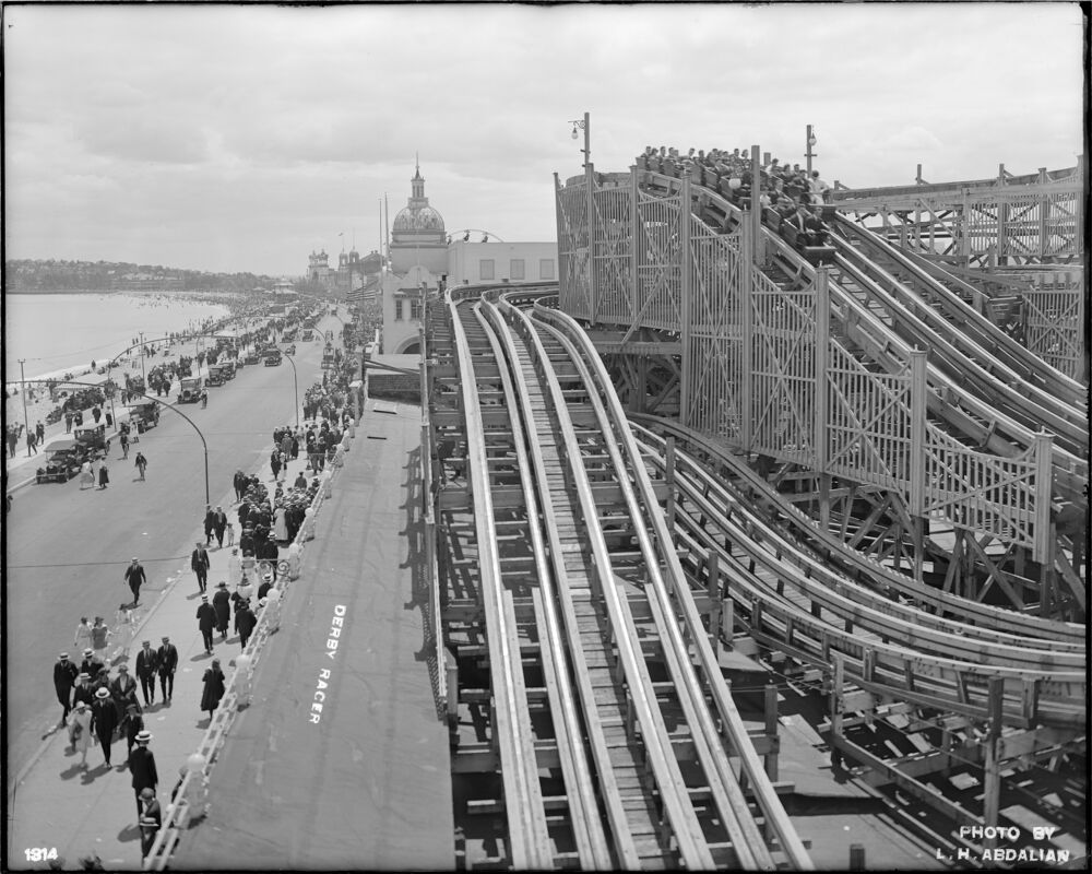
The Bromley atlas records the names of landmarks like “Derby Racer” and “Giant Safety Thriller” alongside dashed-line plans of twisting geometries.
Roller coaster, derby racer, Revere Beach
Leon H. Abdalian
1920
Boston Public Library Arts Department
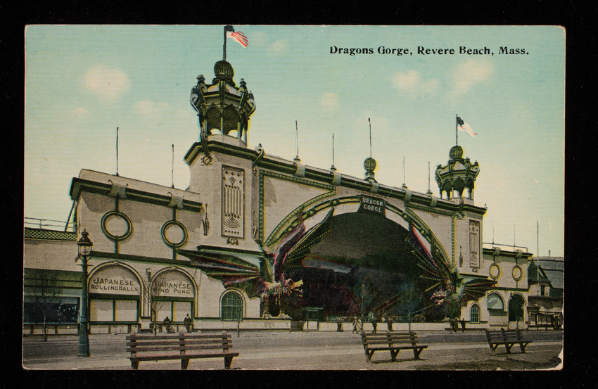
Hell Gate - Wonderland - Revere Beach, Mass.
Tichnor Bros., Inc.
1907
Historic New England
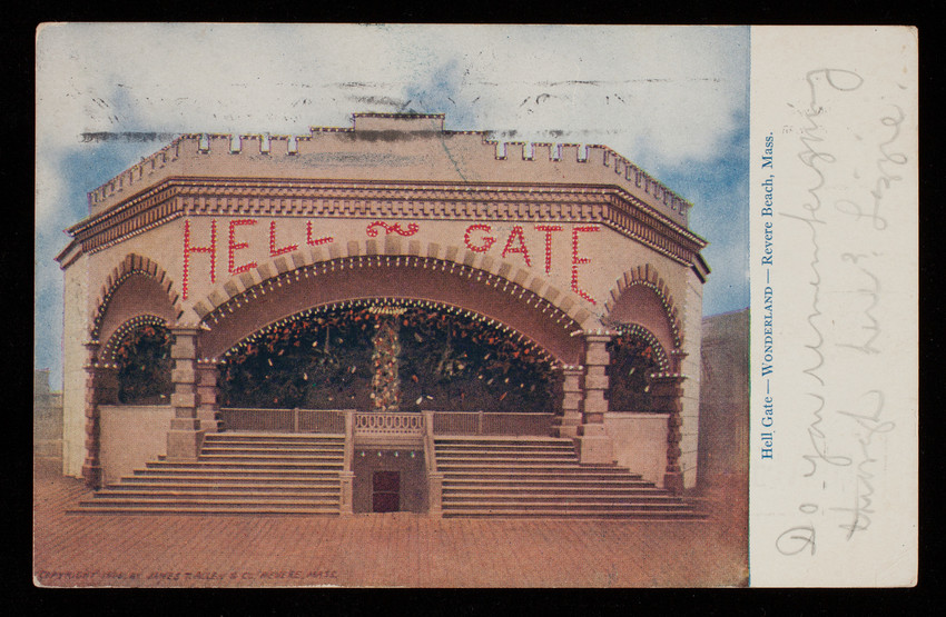
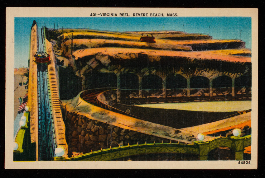
Mechanical amusement park rides ran on electricity, slides required pumping water, and roller coasters were feats of construction.
You can probably tell that these are “rides”—structures meant for tossing around thrill-seekers. All of them invited risk and encapsulated the thrill of a new and transcendent material reality.
Florida's Story
Florida’s social life was intertwined with that of other upper-class Black families in Boston. Several Black publications from the early twentieth century frequently mentioned who and where Florida was visiting, as well as the kinds of receptions and concerts she was attending and hosting at her own home.
As part of her leadership for the League of Women for Community Service, Florida was committed to celebrating and raising awareness about Black artists, and sponsored performances of amateur theater, chorales, and classical performances from Black colleges, as well as art exhibitions. Her exhibitions include one hosted at the Boston Public Library in 1922. Her own brother George Ruffin was an accomplished singer and performed around Massachusetts.
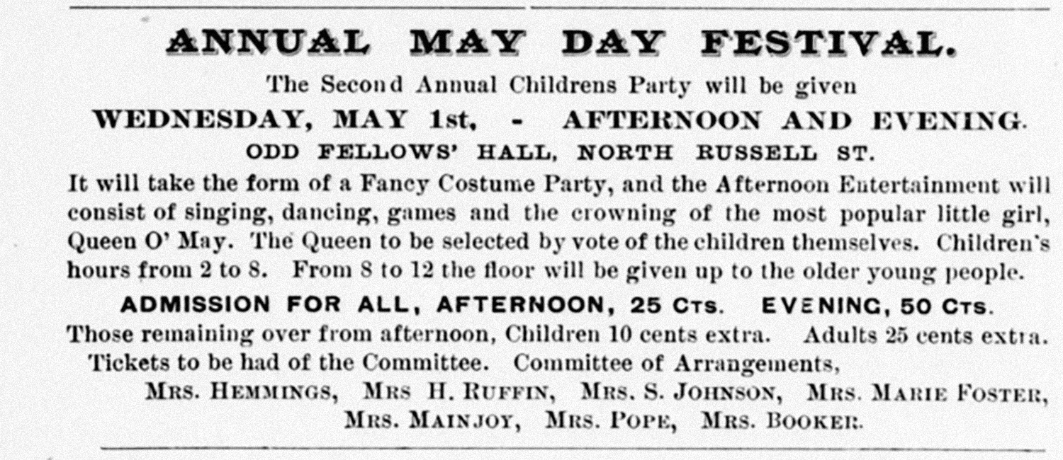
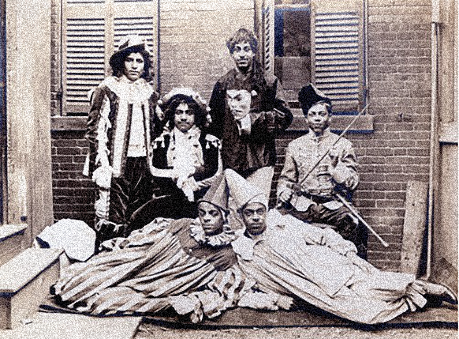
As a young child, and then as a mother with children of her own, Florida might have participated in a May Day celebration like this one (pictured) organized by many of the women she knew and advertised in the Woman’s Era magazine in 1895.
The Harriet Tubman House in the South End, a settlement house founded by six Black women to provide housing for recently arrived southern Black women, hosted a series of “Musicales” organized by Florida and the League of Women for Community Service in 1919.