
October 6, 2025

Pierre Duval, Les tables de geographie, reduites en un jeu de cartes (1669)

Playing and Learning World Geography in the Seventeenth Century
In a new digital essay, Geoffrey Phelippot examines seventeenth-century card games as a medium for geographical exploration. Phelipott’s essay explores the work of the cartographer and game maker Pierre Duval and his eight geographical games. Read the full article for more on Duval's professional trajectory, the rationale behind the creation of these card games, and an interactive view into how these games were actually played. This work is supported by the the Leventhal Center’s Small Grants for Early Career Digital Publications program.
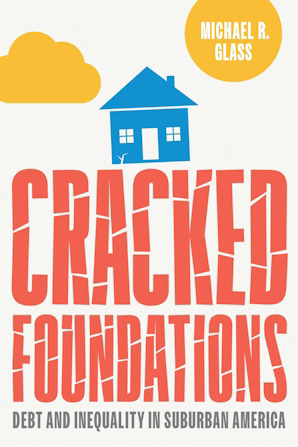
In Person: Michael Glass on Debt and Inequality in Suburban America · Oct 15, 12:30 pm ET
Join Boston College historian Michael Glass for a conversation about his new book, Cracked Foundations: Debt and Inequality in Suburban America. The book explores how home mortgages and municipal bonds helped build postwar suburbs while also making them financially fragile, and how these tools entrenched disparities that still shape American life today. Glass will be in conversation with Harvard’s Lizabeth Cohen.
Lunch will be served and registration is required to attend.
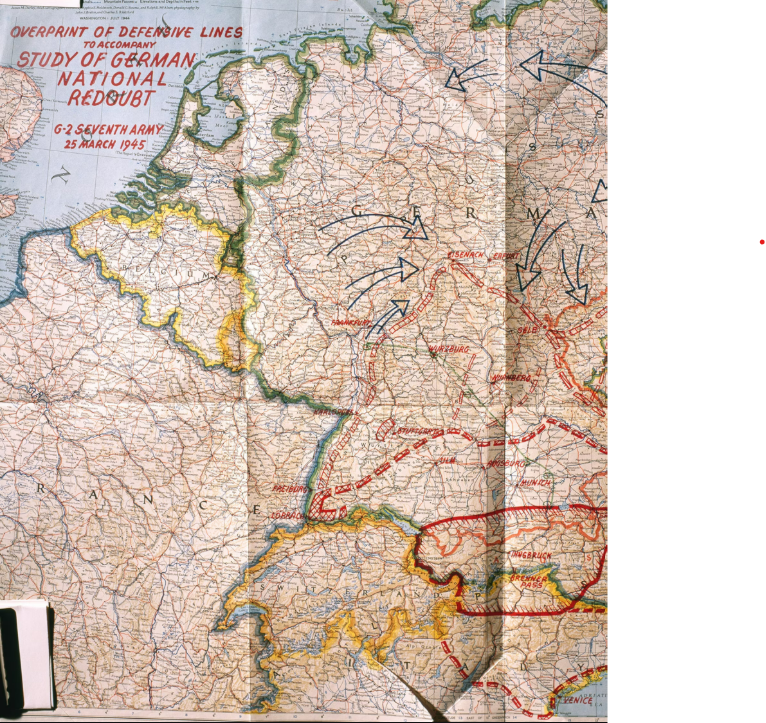
Did you see us in National Geographic?
A recent National Geographic article which digs into the history and significance of the National Geographic Society’s map department during World War II features a quote from the Leventhal Center’s President & Head Curator, Garrett Dash Nelson. In the article (“How WWI got Nat Geo into the map business”), Nelson comments on the state of American mapmaking in the middle of the twentieth century.

In Case You Missed It: Molly Nebiolo on Urban Space, Water, and Health in Colonial Charleston
We recently hosted Dr. Molly Nebiolo for a virtual seminar on the colonial geography of Charleston with a focus on tidal creeks and other waterbodies—both those marked on maps of this period as well as those hidden in the cartographic record. This program is part of the American Revolutionary Geographies Online (ARGO) project. Molly’s recorded talk and discussion is now available to view.

The upcoming transformation of the McKim building
The Boston Public Library’s McKim Building—one half of the Central Library and home to the Leventhal Center—was just featured in the Boston Globe. The Globe article details the ongoing work to transform the historic building, which currently has many sections closed to the public. Planning for the restoration of the McKim Building aims to ensure these spaces are reopened to the public and reimagined for the twenty-first century.

Virtual Teacher Workshop: What Can a Map Do? Teaching Maps for Elementary School Students · October 8, 6:30 pm ET
Maps can foster curiosity and help young learners make sense of the world around them. In this workshop, we’ll explore how to use both historic maps and hands-on mapping activities to build spatial thinking and support cross-curricular learning in elementary classrooms.

From the Vault: Maps in Disaster (In-Person) · October 10, 2 pm ET
Maps are not just snapshots of a geographic location in time, but a culmination of data collected over years. As such, many disasters were not explicitly shown in the maps themselves, so what was being depicted on each map? How were these places changed after significant catastrophe? What was lost from each area post-destruction and what was left behind?
Explore these themes with us during this From the Vault as we delve into cities, neighborhoods and regions just before and after major disasters.

Newsletter Trivia: Map Projections
The Mercator projection is very commonly used in Western education to teach geography, but it significantly distorts the size of certain landmasses. For example, on a map that uses the Mercator projection, Greenland and Africa look to be roughly of similar size; in reality, Africa is significantly bigger. How much larger is Africa compared to Greenland?
8 times
14 times
25 times
3 times
The answer to last newsletter’s question about the 5,000 acres of Boston's made land being how many times larger than the pre-Colonial Shawmut Peninsula is 6 times.
Correct answers will be included in a random draw—the winner will receive the next three Map of the Month club postcards for free. Congratulations to our last winner, Joe! In order to enter, make sure you follow us on Bluesky, Instagram or Facebook and direct message or email us the answer to the question. We’ll accept answers until October 14 at 9 am ET.
The Leventhal Map & Education Center is an independent nonprofit. We rely on the contributions of donors like you to support our mission of preserving the past and advancing the future of maps and geography.
View this email in your browser
Leventhal Map & Education Center at the Boston Public Library
617.859.2387 · info@leventhalmap.org
{{SenderInfoLine}}