
August 4, 2025

Virtual: Urban Space, Water, and Health in Colonial Charleston · Sep 16, 6 pm ET
Join us this fall for a conversation in the Brown Seminar on the Historical Geography of the American Revolutionary Era with historian Molly Nebiolo. Professor Nebiolo will explore the colonial geography of Charleston with a focus on tidal creeks and other waterbodies—both those marked on maps of this period as well as those hidden in the cartographic record. These maps open up a new perspective on the history of health and environment in the eighteenth century colonial American city.
This program is part of the American Revolutionary Geographies Online (ARGO) initiative.
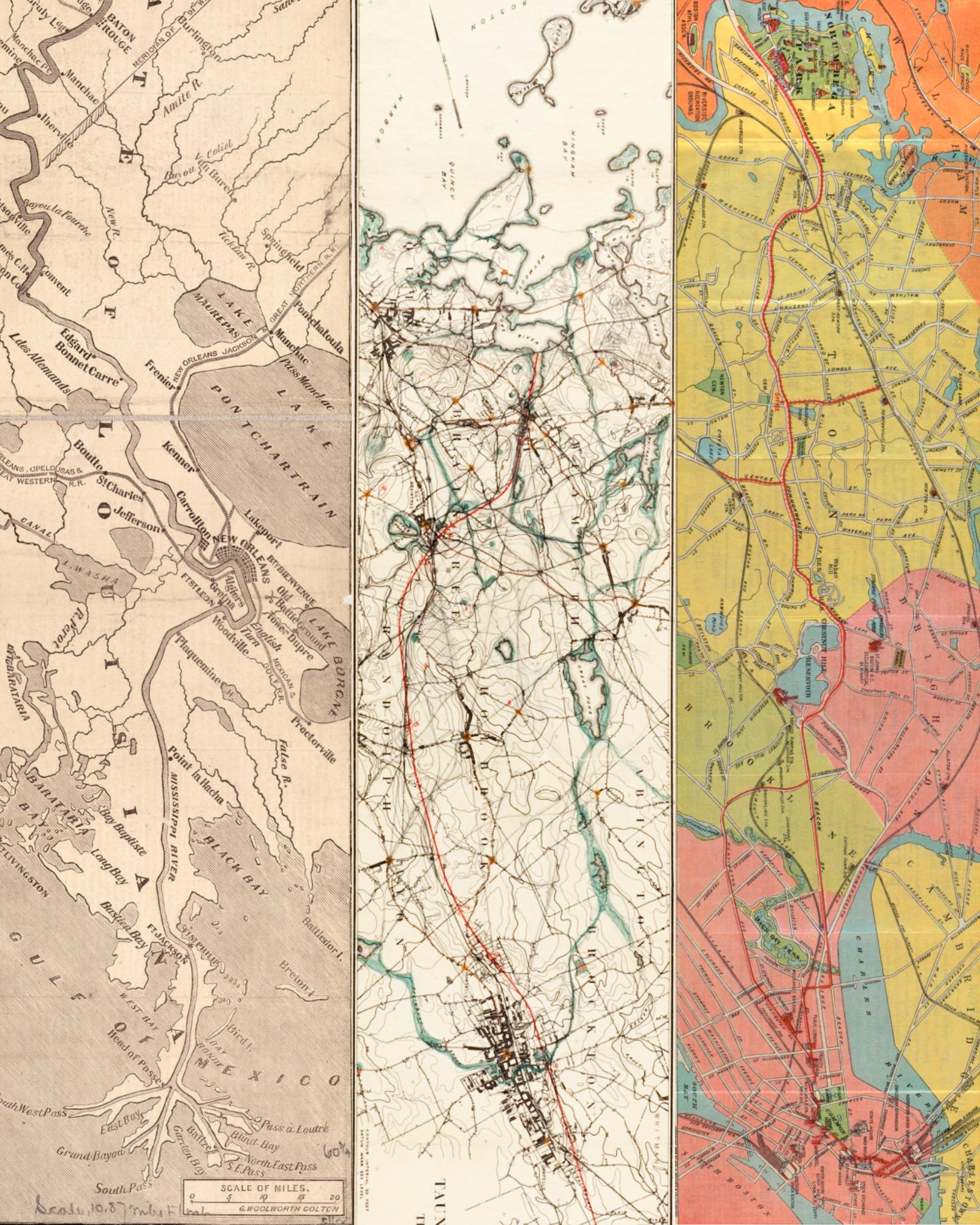
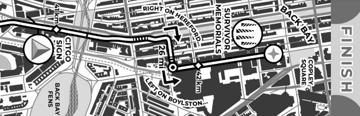
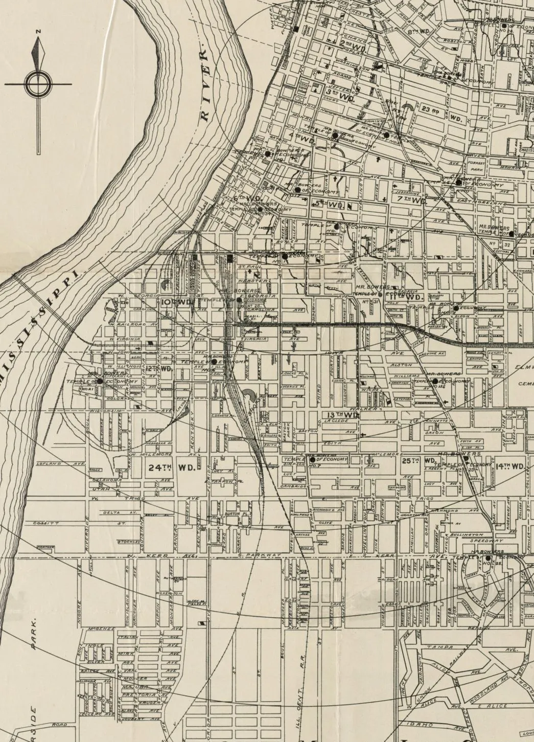
In-Person: Cartography at Length: The Longest Maps in the Library · August 8, 2 pm ET
If we organized maps by their printed length, would we see patterns emerge? Could we learn something about geography and history from looking at the longest maps in a library? It turns out the answer is “yes.”
In this From The Vault, we dive into some of the longest and tallest maps in the Leventhal Center collections. From rivers to railroads, green parks to gold rushes, these maps document how cartographers have fixated on long landscapes—including one 12-foot long map of the Boston Marathon, printed on a receipt!

Fall Teacher Professional Development
We don’t want to rush summer but we do love the start of a new school year. Our Education team is pleased to welcome K-12 educators—near and far—to the next year of upcoming teacher workshops.
We will be hosting both virtual and in-person sessions where educators can explore a range of topics, from teaching map basics in a non-basic way, to engaging with complicated conversations around the naming and claiming of space. Sign up today to ensure a spot in an upcoming program!

From the Vault map collections showing: July Roundup
This past July, we hosted two From the Vault map collections showing events.
We Are One: Mapping America’s Road from Revolution to Independence brought back the best elements of one of our most popular exhibitions, We Are One, to celebrate this Independence Day and explore the tumultuous events that led thirteen colonies to join and forge a new nation. In Historic Currents: Charting the Evolution of Boston’s Ferry Routes, we partnered with A Better City, the Seaport Transportation Management Association, and the Lower Mystic Transportation Management Association to learn about how transportation hubs, industries, and the destinations characterizing Greater Boston communities led the way for a variety of successful ferry routes.
We welcome other community and interest groups to collaborate with us on future map collections showings. Please contact Julia Williams, Gallery & Communications Coordinator, at jwilliams@leventhalmap.org, if you would like to propose a co-curated program.
Check out the maps from each of the events in the roundup articles linked below.
Newsletter Trivia: Urban Rivers
The River Seine in Paris has reopened publicly to swimmers after a century-long ban. Which of the following American cities also actively encourages public swimming in its adjacent river?
- Boston - Charles River
- Philadelphia - Delaware River
- Chicago - Chicago River
- Memphis - Mississippi River
The answer to last newsletter’s question about what park used to be a brick-producing clay pit, a landfill, and dump site before it was converted into a park space is Danehy Park.
Correct answers will be included in a random draw—the winner will receive the next three Map of the Month club postcards for free. Congratulations to our last winner, Danielle! In order to enter, make sure you follow us on Bluesky, Instagram or Facebook and direct message or email us the answer to the following question. We’ll accept answers until August 11 at 9 am ET.

A Summer Treat for the Gift Store
For all of our newsletter subscribers, we would like to thank you so much for your support of the Leventhal Map & Education Center. For a small mid-year treat, we’re adding three new maps to the gift store and that’s not even the best part! Use the code SUMMERTREAT for free shipping.
The Leventhal Map & Education Center is an independent nonprofit. We rely on the contributions of donors like you to support our mission of preserving the past and advancing the future of maps and geography.
View this email in your browser
Leventhal Map & Education Center at the Boston Public Library
617.859.2387 · info@leventhalmap.org
{{SenderInfoLine}}