
July 7, 2025


Summertime Teacher Professional Development
Educators! Join your fellow teachers from across the country for virtual teacher workshops with the Leventhal Center Education team this summer. We will be focused on the American Revolution as we gear up for the semiquincentennial. Each session will provide both primary sources and tools to use with K-12 students to encourage them to think critically about how where the Revolution happened impacted what happened.
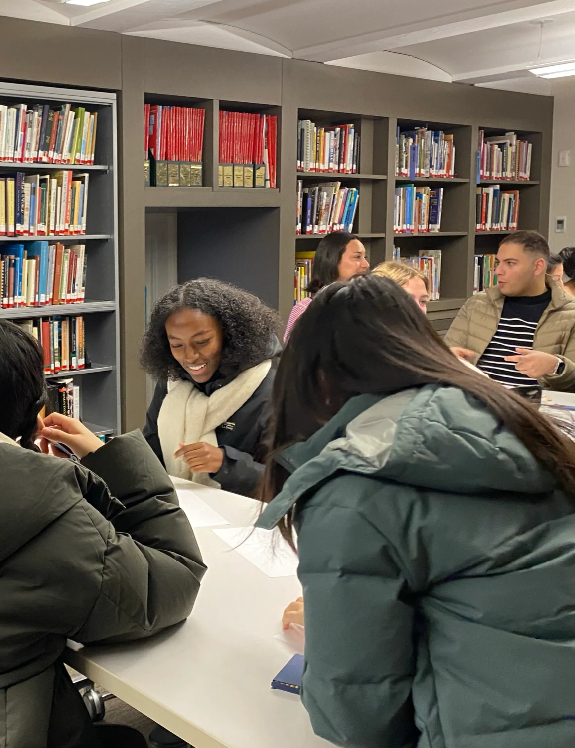
University Visits for the Fall
It’s time to book your Fall university visits to the LMEC!
We welcome university classes to visit our collections and exhibition, either through an in-person trip to the Central Library in Copley Square or via a remote visit. We offer broad overview lessons on historical geography, critical cartography, Boston history, and research in the map collections, as well as thematically-focused discussions of specific groups of objects or exhibition topics. We also offer instruction in digital methods for geography and cartography.
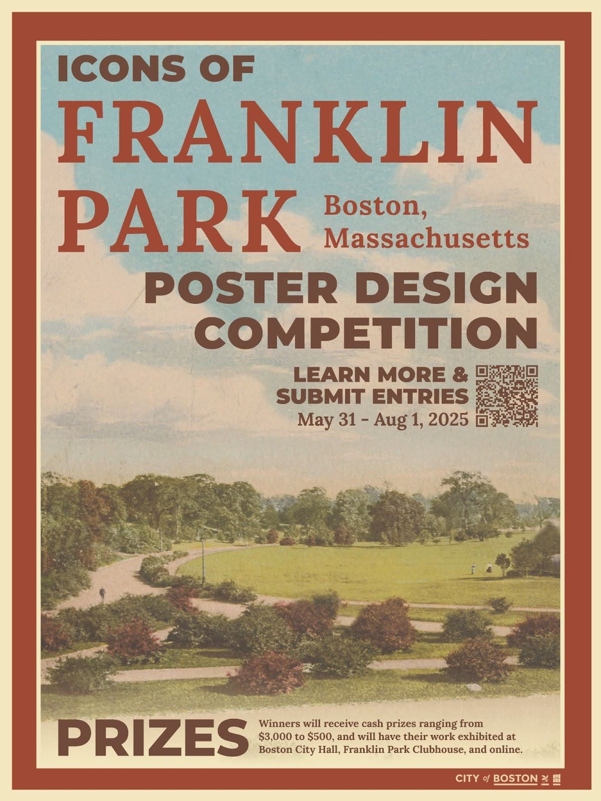
"Icons of Franklin Park" Poster Competition
Mayor Michelle Wu, the Parks and Recreation Department, the Boston Society of Landscape Architects (BSLA), the Planning Department, and the Franklin Park Coalition invite artists of all ages to participate in the Icons of Franklin Park Poster Design Competition, a citywide art competition to celebrate the rich history, contemporary culture, and landmarks of Franklin Park through original poster designs.
Submissions are open now through August 1, 2025, with categories for professional and emerging artists. Winners will receive prizes and have their work exhibited at Boston City Hall, Franklin Park Clubhouse, and online.

From the Vault: June Roundup
This past June, we hosted two From the Vault events.
Cartography in the Classroom used a display of maps, globes, games, atlases and related objects to explore the evolution of geographic education, examine the visual aids were used by teachers in the classroom, and marvel at unique student-produced geography projects from the late eighteenth to the twentieth centuries. In That Doesn’t Look Quite Right…, we explored how maps can portray physical features in a misleading manner because of choices made by mapmakers.
Check out the maps from each of the events in the roundup articles linked below.

Newsletter Trivia: Harvard Square MBTA
A disused MBTA Red Line tunnel that runs under Harvard Square in Cambridge is being considered for conversion into a music venue. Which of the following was not a former station name for a Red Line stop in the Harvard Square area?
- Harvard/Brattle
- Stadium
- Harvard/Kennedy
- Harvard/Holyoke
The answer to last newsletter’s question about the name of the original baseball grounds for the Red Sox is Huntington Avenue Baseball Grounds.
Correct answers will be included in a random draw—the winner will receive the next three Map of the Month club postcards for free. Congratulations to our last winner, James! In order to enter, make sure you follow us on Bluesky, Instagram or Facebook and direct message or email us the answer to the following question. We’ll accept answers until July 14 at 9 am ET.

Celebrate the Fourth with Revolutionary Maps!
With a great selection Revolutionary War-era maps recently added to our online shop— including some from our current show Terrains of Independence—there’s something for everyone! For everything from postcards and exhibition catalogs to map reproductions, use the code TERRAINS throughout the month of July for 15% off your total order.
The Leventhal Map & Education Center is an independent nonprofit. We rely on the contributions of donors like you to support our mission of preserving the past and advancing the future of maps and geography.
View this email in your browser
Leventhal Map & Education Center at the Boston Public Library
617.859.2387 · info@leventhalmap.org
{{SenderInfoLine}}