
April 14, 2025
First Days of Terrains of Independence
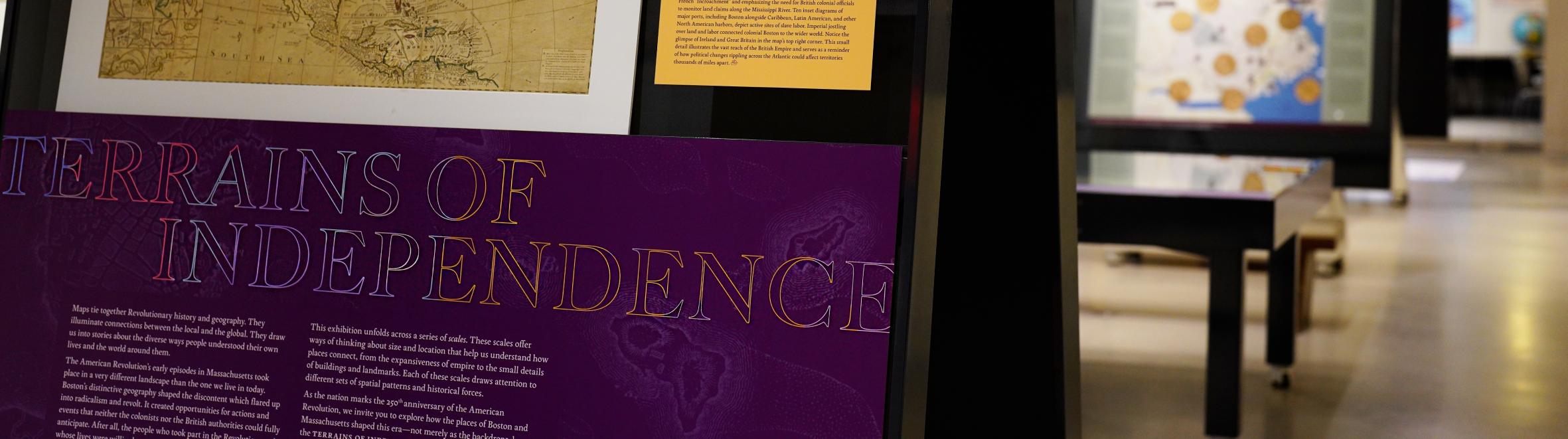
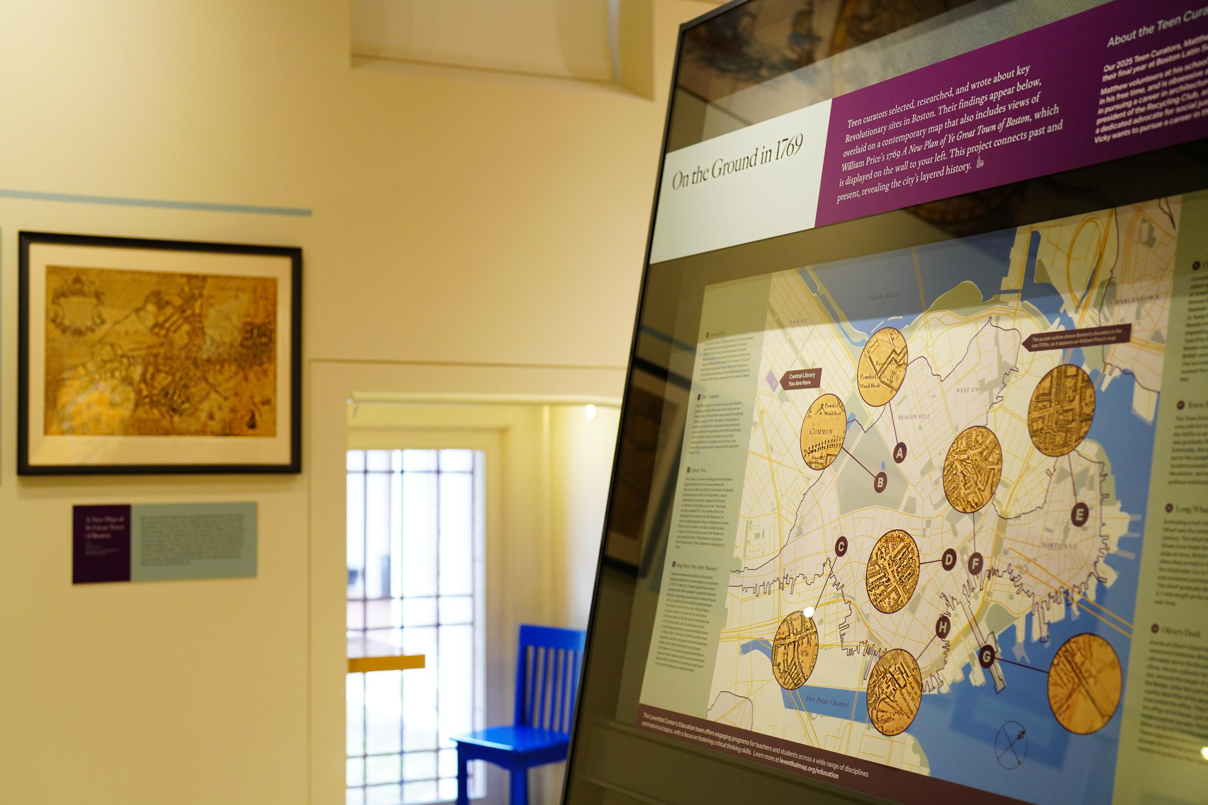
Terrains of Independence is here! In the past two weeks, we’ve begun to welcome visitors to our newest exhibition, which uses maps and geography to explore Boston’s role in the American Revolution. Designed to prompt the question “Why here?,” Terrains of Independence offers all visitors—from American Revolution buffs to elementary school students—a new perspective on the importance of place and locality in understanding how the United States became an independent nation.

In-Person · Special Collections Open House: American Revolution in Boston · April 19 and 22
In honor of the 250th anniversary of the Battles of Lexington and Concord, the Leventhal Map & Education Center and BPL’s Special Collections Department are collaborating on an open house highlighting items from our collections relating to the opening salvo of the war, as well as other major events of the American Revolution in Boston.
Stop by the Center’s gallery to see our new exhibition and then head into our classroom to see related items from Special Collections across a variety of formats. This open house will take place on both Saturday, April 19 and Tuesday, April 22 from 11 am–4 pm with staff members available to answer questions. The same items will be on display at both open houses.

Article · Planting the Seeds of Rebellion
What motivated early American colonists to challenge the British Empire? As we approach the 250th anniversary of the Battles of Lexington and Concord on April 19, this question is still relevant.
In this article for American Revolutionary Geographies Online (ARGO), Richard Brown and Nina Nazionale argue that a remarkable sequence of battles at Lake George, New York in 1755 planted seeds of rebellion and independence in the American psyche that subsequently blossomed at Lexington and Concord.

Virtual · April 24, 6 pm ET · “Maps & America”: Arthur Holzheimer Lecture
Emily Bowe, Assistant Director of the Leventhal Map and Education Center at the Boston Public Library, and Ian Spangler, Assistant Curator of Digital & Participatory Geography at the Leventhal Map & Education Center, present the 2025 “Maps & America” Arthur Holzheimer Lecture on Thursday, April 24, 2025 at 6 p.m.
Their talk, “Processing Place: How Computers and Cartographers Redrew Our World,” explores the how the computer technologies developed in the twentieth century drove changes in land management, law and policy, national defense, and more. Taking a historical approach to digital mapping by comparing maps made with computers to those that came before, the talk will invite us to reevaluate the relationships between maps, technology, and society.
Registration is required for this hybrid event.
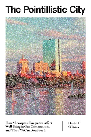
In Person · May 29, 12 pm ET · Author Talk: Dan O'Brien on The Pointilistic City
Sit down with Dan O’Brien and Nigel Jacob for a conversation on O’Brien’s latest book project, The Pointillistic City. This talk is free, open to the public, and will be held in person at the Central Library in Copley Square. Lunch will be served and registration is required to attend.
Dr. Dan O’Brien is Professor of Public Policy and Urban Affairs and Criminology and Criminal Justice at Northeastern University and Director of the Boston Area Research Initiative (BARI). His research focuses on equity in urban neighborhoods, including crime, environmental justice, and more. His three books, including The Pointillistic City (MIT Press; 2024), demonstrate the value of integrating data-driven science with community-oriented policy and practice.

Newsletter Trivia: Revere's Ride
Paul Revere’s midnight ride saw him pass through Boston, across the Charles River to Charlestown, and then on through Medford, present-day Arlington, and Lexington before being apprehended by the British. What was Arlington’s name at this time, before it became “Arlington” in 1867?
- Menotomy
- Dana
- Enfield
- New Providence
The answer to last newsletter’s question about the ratio of British soldiers to Bostonian men was 1 in 3.
Correct answers will be included in a random draw—the winner will receive the next three Map of the Month club postcards for free. Congratulations to our last winner, Priyanka! In order to enter, make sure you follow us on Bluesky, Instagram or Facebook and direct message or email us the answer to the following question. We’ll accept answers until April 21 at 9 am ET.
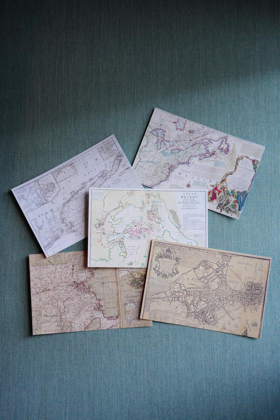
New Postcards in the Gift Store
With the opening of our new exhibition, Terrains of Independence, we’ve introduced a new series of postcards to our online store. Each postcard spotlights maps from the various geographic “scales” of the show and the maps help illustrate Boston’s history as a dynamic port city.
Get free shipping from the gift store with the code PORTBOSTON—exclusive to newsletter subscribers.
The Leventhal Map & Education Center is an independent nonprofit. We rely on the contributions of donors like you to support our mission of preserving the past and advancing the future of maps and geography.
View this email in your browser
Leventhal Map & Education Center at the Boston Public Library
617.859.2387 · info@leventhalmap.org
{{SenderInfoLine}}