Principles of Park Making
Is it doubtful that it does men good to come together in this way in pure air and under the light of heaven, or that it must have an influence directly counteractive to that of the ordinary hard, hustling working hours of town life?
— Frederick Law Olmsted, “Public Parks and the Enlargement of Towns” (1870)
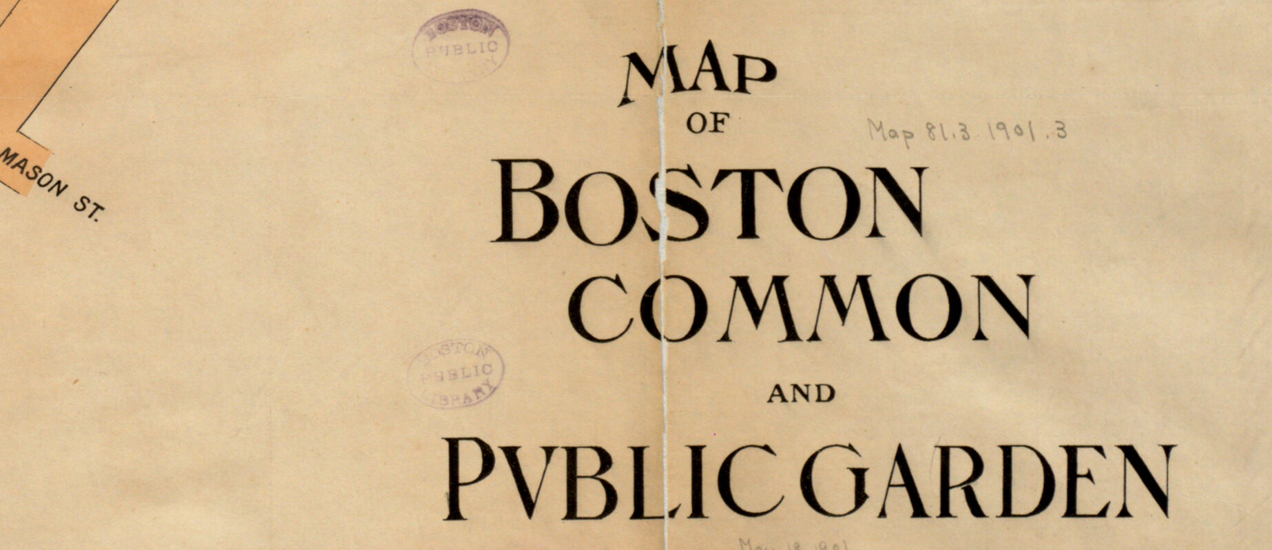
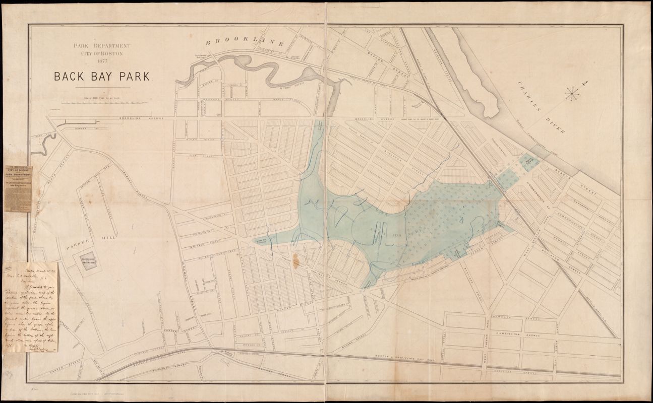
One of the most beautiful and widely-praised landscapes in Boston is the Emerald Necklace system of parks that snakes from the Charles River to Franklin Park. Although the parks of the Emerald Necklace seem like “natural” spaces set aside from the highly engineered city that surrounds them, they actually represent the legacy of social, cultural, and political ideas about how to refashion this landscape. This 1877 map shows an early plan for Back Bay Park. The blue lines trace out the winding routes of the Muddy River’s former delta. The attached newspaper advertisement notes an 1878 competition “for the best Plan for laying out the Back Bay Park.” The winning entry was simply a plan for a formal flower garden, which the Parks Department discarded, calling instead on the skills of the visionary landscape architect Frederick Law Olmsted. Olmsted’s eventual design for the park system called for a naturalistic style that echoed Romantic era ideals of bringing the countryside into the city.
Back Bay Park
Boston Park Commissioners
1877
Leventhal Map & Education Center
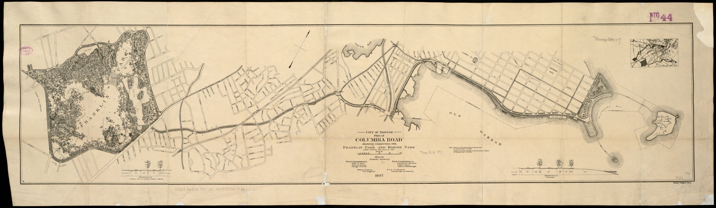
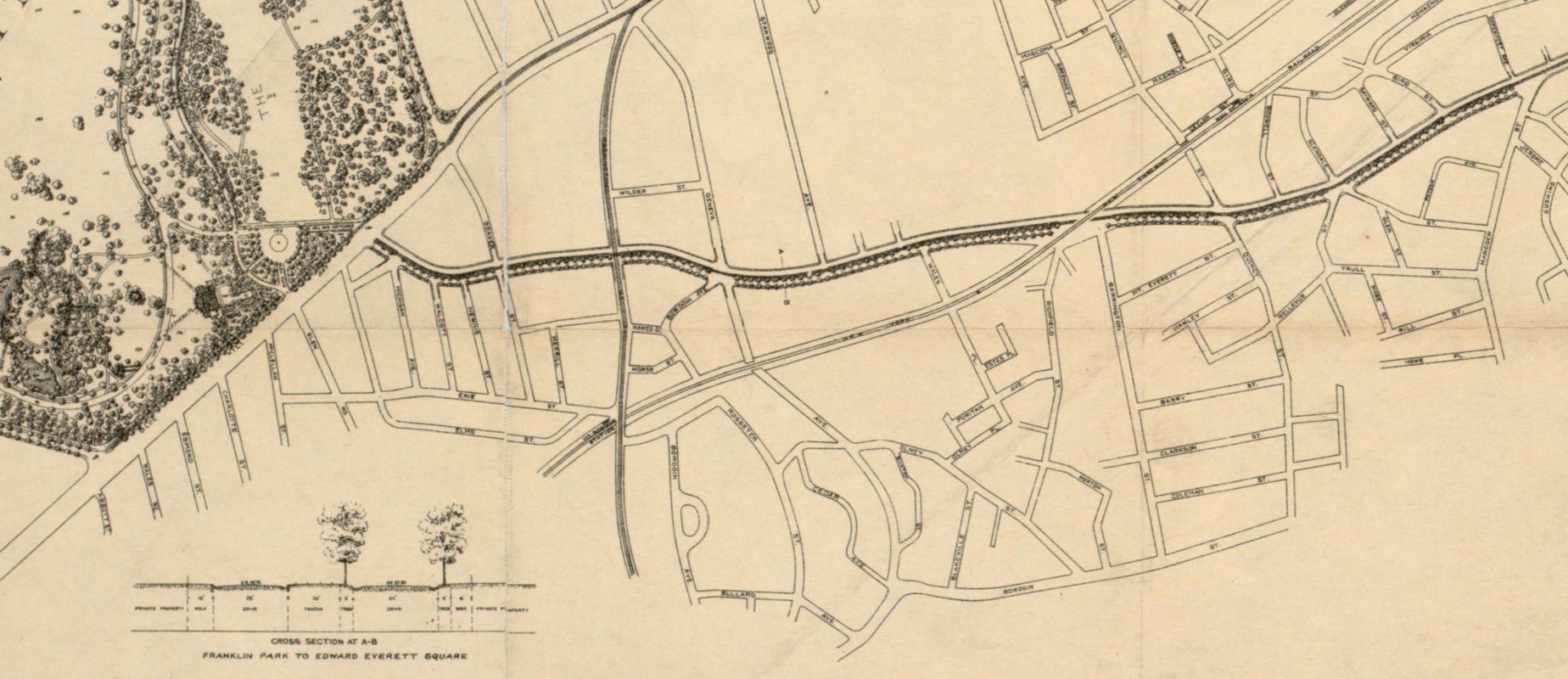
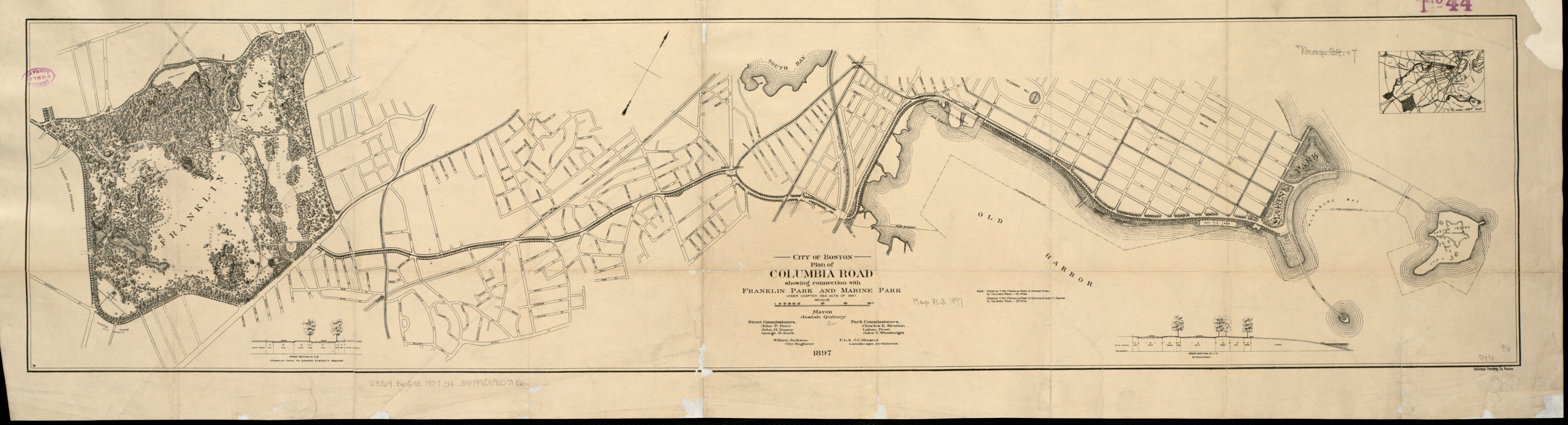
One of Olmsted’s most innovative ideas as a landscape architect was his insistence that parklands were not just beautiful attractions, but also served as democratic spaces, owned in common by the people. His original plan for the Emerald Necklace foresaw a continuous chain of parks running from the Charles River to Dorchester Bay; this 1897 plan shows how Franklin Park and Marine Park (Castle Island) would be connected by a boulevard running down Columbia Road. However, this section of the “necklace” was never realized, blocked in part by property owners and speculators who had already developed the land along this route. Today, neighborhoods like Brookline and Jamaica Plain near the completed sections of the Emerald Necklace are far more affluent than the diverse part of the city traversed by Columbia Road. Environmental justice advocates see this corridor as an opportunity to invest in urban design that serves the needs of the surrounding community.
City of Boston Plan of Columbia Road, Showing Connection with Franklin Park and Marine Park
Frederick Law Olmsted; John Charles Olmsted; City of Boston
1897
Leventhal Map & Education Center