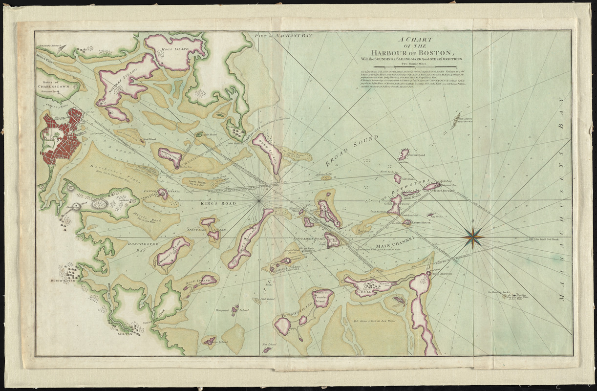
A chart of the Harbour of Boston, with the soundings, sailing-marks, and other directions
This map is also available in American Revolutionary Geographies Online (ARGO), a collections portal especially built for material relating to the American Revolutionary War Era. Visit ARGO to learn more about this item and explore the historical geography of North America in the late eighteenth century.
Item Information
- Title:
- A chart of the Harbour of Boston, with the soundings, sailing-marks, and other directions
- Contributor:
- Robert Sayer and John Bennett (Firm)
- Date:
-
[1776]
- Format:
-
Maps/Atlases
- Location:
- George Washington's Mount Vernon
- Collection (local):
-
Richard H. Brown Revolutionary War Map Collection at Mount Vernon
- Subjects:
-
Nautical charts--Massachusetts--Boston Harbor--Early works to 1800
Boston Harbor (Mass.)--Maps--Early works to 1800
- Places:
-
Boston Harbor
- Extent:
- 1 chart : col. ; 53 x 88 cm.
- Terms of Use:
-
No known copyright restrictions.
This work is licensed for use under a Creative Commons Attribution Non-Commercial Share Alike License (CC BY-NC-SA).

- Publisher:
-
London :
R. Sayer and J. Bennett
- Scale:
-
Scale [ca. 1:28,000]
- Language:
-
English
- Catalog Record:
-
MVLA record
- Notes:
-
Depth shown by soundings. Relief shown by hachures.
Shows fortifications and settlements.
Appears in the North American Pilot for New England, New York ... London: R. Sayer & J. Bennett, 1776.
- Notes (date):
-
This date is inferred.
- Identifier:
-
06_01_009523


