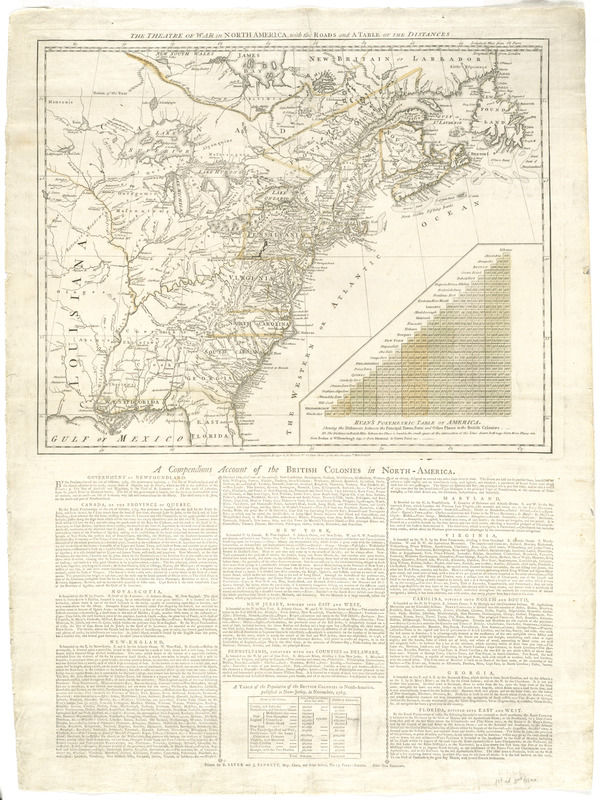
The theatre of war in North America, with the roads and a table of the distances
This map is also available in American Revolutionary Geographies Online (ARGO), a collections portal especially built for material relating to the American Revolutionary War Era. Visit ARGO to learn more about this item and explore the historical geography of North America in the late eighteenth century.
Item Information
- Title:
- The theatre of war in North America, with the roads and a table of the distances
- Contributor:
- Robert Sayer and John Bennett (Firm)
- Date:
-
1776
- Format:
-
Maps/Atlases
- Location:
- George Washington's Mount Vernon
- Collection (local):
-
Richard H. Brown Revolutionary War Map Collection at Mount Vernon
- Subjects:
-
North America--History--Revolution, 1775-1783--Maps
United States--History--Revolution, 1775-1783--Maps
- Places:
-
North America (area)
- Extent:
- 1 map : hand col. ; 39 x 49 cm., on sheet 78 x 57 cm.
- Terms of Use:
-
No known copyright restrictions.
This work is licensed for use under a Creative Commons Attribution Non-Commercial Share Alike License (CC BY-NC-SA).

- Publisher:
-
London :
Rt. Sayer & Jno. Bennett
- Scale:
-
Scale [ca. 1:7,500,000]
- Language:
-
English
- Catalog Record:
-
MVLA record
- Notes:
-
Relief shown pictorially.
Includes Evan's polymetric table of America.
Letterpress below map: A compendious account of the British colonies in North-America.
First edition, state 3, as distinguished by size and spacing of type.
- Identifier:
-
06_01_008242


