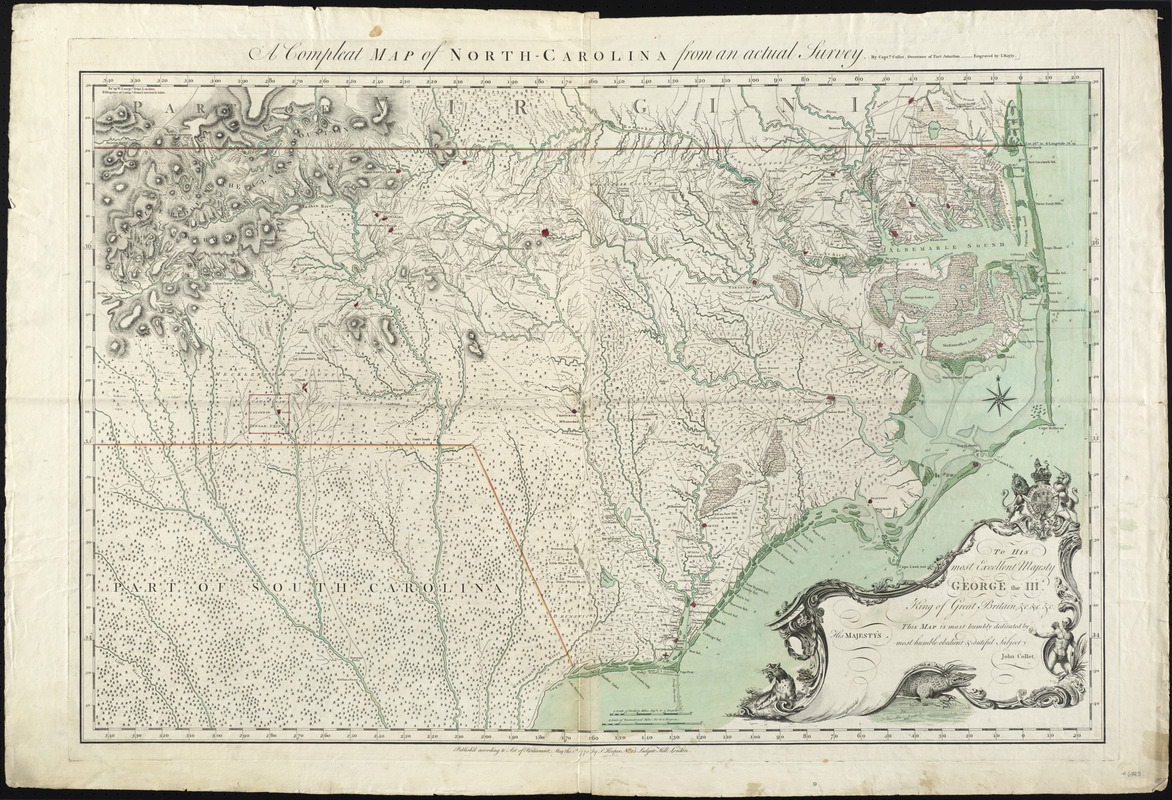
A compleat map of North-Carolina from an actual survey
This map is also available in American Revolutionary Geographies Online (ARGO), a collections portal especially built for material relating to the American Revolutionary War Era. Visit ARGO to learn more about this item and explore the historical geography of North America in the late eighteenth century.
Item Information
- Title:
- A compleat map of North-Carolina from an actual survey
- Creator:
- Collet, John
- Engraver:
- Bayly, J.
- Publisher:
- Hooper, S. (Samuel)
- Name on Item:
-
by Capt'n Collet, Governor of Fort Johnston ; engraved by I. Bayly.
- Date:
-
1770
- Format:
-
Maps/Atlases
- Location:
- George Washington's Mount Vernon
- Collection (local):
-
Richard H. Brown Revolutionary War Map Collection at Mount Vernon
- Subjects:
-
Real property--North Carolina--Maps--Early works to 1800
North Carolina--Maps--Early works to 1800
- Places:
-
North Carolina
- Extent:
- 1 map : hand col. ; 70 x 107 cm.
- Terms of Use:
-
No known copyright restrictions.
This work is licensed for use under a Creative Commons Attribution Non-Commercial Share Alike License (CC BY-NC-SA).

- Publisher:
-
London :
S. Hooper
- Scale:
-
Scale [ca. 1:550,000]
- Language:
-
English
- Catalog Record:
-
MVLA record
- Notes:
-
Relief shown by hachures. Depths shown by soundings.
Shows rural householders' names.
"Publish'd according to Act of Parliament, May the 1st, 1770, by S. Hooper, No. 25 Ludgate Hill, London."
Decorative dedication cartouche includes royal coat of arms, a native, and animals.
"To His most Excellent Majesty George the IIId ... this map is most humbly dedicated by ... John Collet."
- Identifier:
-
06_01_008135


