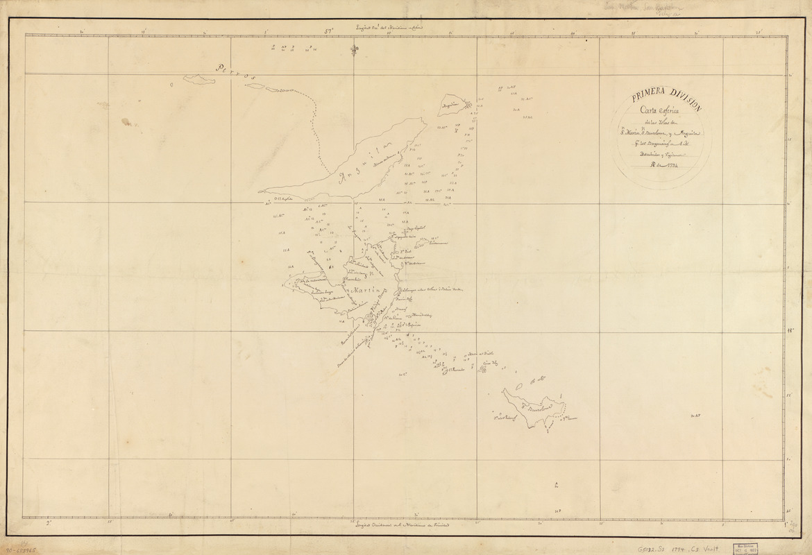
Carta esférica de las yslas de Sn. Martin, Sn. Bartolome y Anguila
This map is also available in American Revolutionary Geographies Online (ARGO), a collections portal especially built for material relating to the American Revolutionary War Era. Visit ARGO to learn more about this item and explore the historical geography of North America in the late eighteenth century.
Item Information
- Title:
- Carta esférica de las yslas de Sn. Martin, Sn. Bartolome y Anguila
- Name on Item:
-
pr. los Bergantines de S.M. Descubridor y Vigilante, ao. de 1794
- Date:
-
[1794]
- Format:
-
Maps/Atlases
Manuscripts
- Location:
- Library of Congress Geography and Map Division
- Collection (local):
-
Library of Congress Collection
- Subjects:
-
Saint Martin (West Indies)--Maps, Manuscript--Early works to 1800
Saint-Barthélemy--Maps, Manuscript--Early works to 1800
Anguilla--Maps, Manuscript--Early works to 1800
- Places:
-
Saint Barthélemy (dependency)
St. Martin (island)Leeward Islands (area)
Anguilla (territory)
- Extent:
- 1 map : ms. ; 50 x 79 cm.
- Terms of Use:
-
No known copyright restrictions.
This work is licensed for use under a Creative Commons Attribution Non-Commercial Share Alike License (CC BY-NC-SA).

- Scale:
-
Scale [ca. 1:142,000]
- Language:
-
Spanish
- Catalog Record:
-
https://lccn.loc.gov/90683965
- Notes:
-
Depths shown by soundings.
At head of title: Primera División.
Prime meridians: Cádiz and Trinidad.
Pen-and-ink.
Mounted on cloth backing.
Maggs number annotated in pencil in lower right corner: 290.
- Notes (date):
-
This date is inferred.
- Notes (citation):
-
LC Luso-Hispanic World, 40
- Identifier:
-
lh000040


