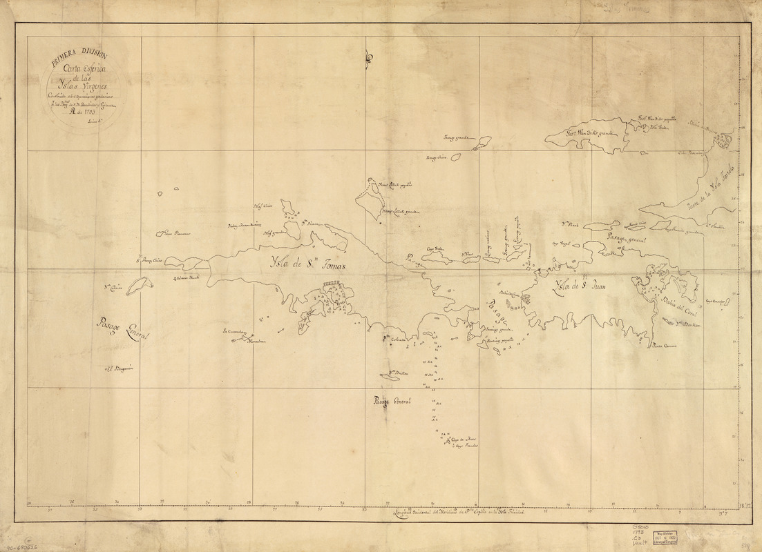
Carta esférica de las Yslas Virgenes
This map is also available in American Revolutionary Geographies Online (ARGO), a collections portal especially built for material relating to the American Revolutionary War Era. Visit ARGO to learn more about this item and explore the historical geography of North America in the late eighteenth century.
Item Information
- Title:
- Carta esférica de las Yslas Virgenes
- Name on Item:
-
construida sobre operaciones geodésicas pr. los Bergnes. de S.M. Descubridor y Vigilante, ao. de 1793
- Date:
-
[1793]
- Format:
-
Maps/Atlases
Manuscripts
- Location:
- Library of Congress Geography and Map Division
- Collection (local):
-
Library of Congress Collection
- Subjects:
-
United States Virgin Islands--Maps--Early works to 1800
British Virgin Islands--Maps--Early works to 1800
- Places:
-
British Virgin Islands (territory)
Virgin Islands of the United States (territory)
- Extent:
- 1 map : ms. ; 50 x 75 cm.
- Terms of Use:
-
No known copyright restrictions.
This work is licensed for use under a Creative Commons Attribution Non-Commercial Share Alike License (CC BY-NC-SA).

- Scale:
-
Scale [ca. 1:74,200]
- Language:
-
Spanish
- Catalog Record:
-
https://lccn.loc.gov/90680626
- Notes:
-
Covers St. Thomas Island, St. John Island, and western Tortola Island with adjacent islands.
Depths shown by soundings.
At head of title: Primera División.
Prime meridian: Port of Spain.
Pen-and-ink.
Mounted on cloth backing.
"Lámina 3a."
Maggs number annotated in pencil in lower right margin: 329.
- Notes (date):
-
This date is inferred.
- Notes (citation):
-
LC Luso-Hispanic World, 978
- Identifier:
-
lh000978


