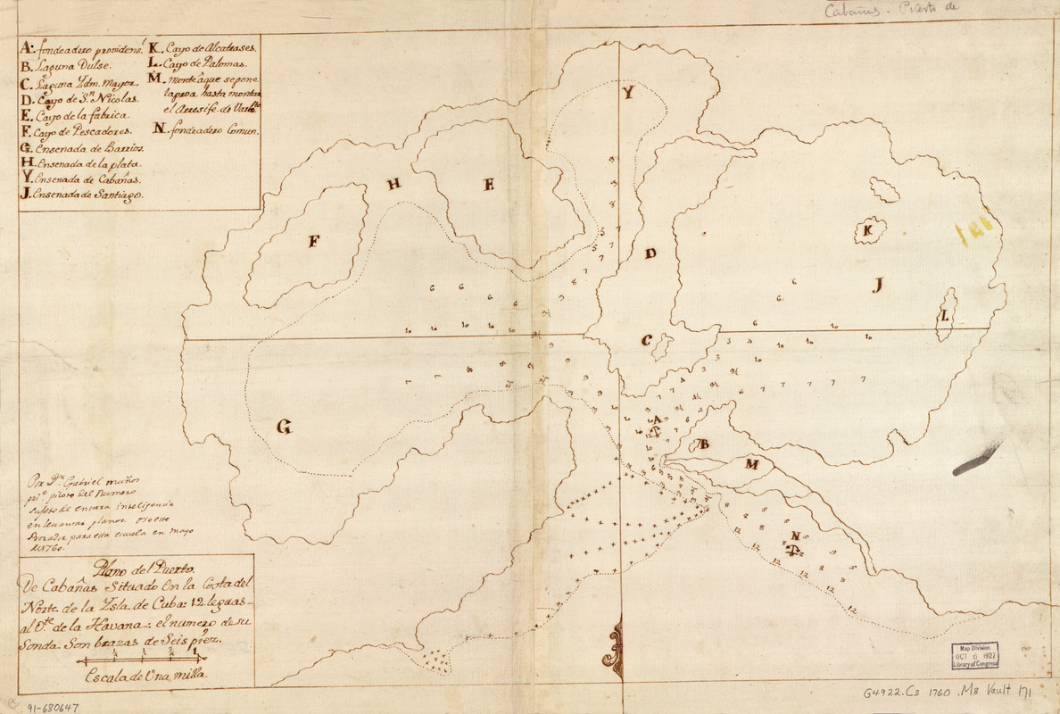
Plano del Puerto de Cabañas situado en la costa del norte de la ysla de Cuba, 12 leguas al ote. de la Havana
This map is also available in American Revolutionary Geographies Online (ARGO), a collections portal especially built for material relating to the American Revolutionary War Era. Visit ARGO to learn more about this item and explore the historical geography of North America in the late eighteenth century.
Item Information
- Title:
- Plano del Puerto de Cabañas situado en la costa del norte de la ysla de Cuba, 12 leguas al ote. de la Havana
- Creator:
- Muñoz, Gabriel
- Name on Item:
-
por Dn. Gabriel Muñoz, prio. piloto del numero sujeto de entara ... para ella escuela en mayo de 1760
- Date:
-
[1760]
- Format:
-
Maps/Atlases
Manuscripts
- Location:
- Library of Congress Geography and Map Division
- Collection (local):
-
Library of Congress Collection
- Subjects:
-
Cabañas Bay (Cuba)--Maps, Manuscript--Early works to 1800
Coasts--Cuba--Cabañas Bay--Maps--Early works to 1800
Manuscript maps--Early works to 1800
- Places:
-
Bahía de Cabañas
- Extent:
- 1 map : ms. ; 36 x 56 cm.
- Terms of Use:
-
No known copyright restrictions.
This work is licensed for use under a Creative Commons Attribution Non-Commercial Share Alike License (CC BY-NC-SA).

- Scale:
-
Scale [ca. 1:26,500]
- Language:
-
Spanish
- Catalog Record:
-
https://lccn.loc.gov/91680647
- Notes:
-
Depths shown by soundings.
Oriented with north to the bottom.
Watermarks: French imitation of Genoese watermark [?]; FIN in the left side; cross in the upper circle; unidentifiable characters in the right side; and, unidentifiable letterings.
Brown ink.
Mounted on cloth backing.
Indexed.
Maggs number annotated in pencil in lower right margin: 171.
- Notes (date):
-
This date is inferred.
- Notes (citation):
-
LC Luso-Hispanic World, 325
- Identifier:
-
lh000325


