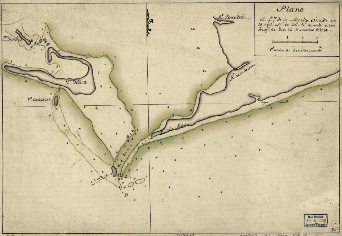
Plano del Pto. de la Movila situado en la latd. N. de 30⁰ 10ʹ tomado á los Ings., el día 14 de marzo de 1780
This map is also available in American Revolutionary Geographies Online (ARGO), a collections portal especially built for material relating to the American Revolutionary War Era. Visit ARGO to learn more about this item and explore the historical geography of North America in the late eighteenth century.
Item Information
- Title:
- Plano del Pto. de la Movila situado en la latd. N. de 30⁰ 10ʹ tomado á los Ings., el día 14 de marzo de 1780
- Date:
-
[1780?]
- Format:
-
Maps/Atlases
Manuscripts
- Location:
- Library of Congress Geography and Map Division
- Collection (local):
-
Library of Congress Collection
- Subjects:
-
Mobile Bay (Ala.)--Maps, Manuscript--Early works to 1800
Coasts--Alabama--Mobile Bay--Early works to 1800
Gulf Coast (Ala.)--Maps, Manuscript--Early works to 1800
- Places:
-
AlabamaMobile Bay
- Extent:
- 1 manuscript map : hand color 25 x 37 cm.
- Terms of Use:
-
No known copyright restrictions.
This work is licensed for use under a Creative Commons Attribution Non-Commercial Share Alike License (CC BY-NC-SA).

- Scale:
-
Scale ca. 1:100,000
- Language:
-
Spanish
- Catalog Record:
-
https://lccn.loc.gov/73691552
- Notes:
-
Manuscript, pen-and-ink and watercolor.
Watermark: Zoonen.
Soundings shown in fathoms.
Shows the entrance to Mobile Bay.
Mounted on cloth backing.
Maggs number annotated in pencil in lower right corner: 95.
Order number annotated in pencil in lower margin: 367887/27.
- Notes (citation):
-
LC Maps of North America, 1750-1789, 1669
LC Luso-Hispanic World, 862
- Identifier:
-
ar166900


