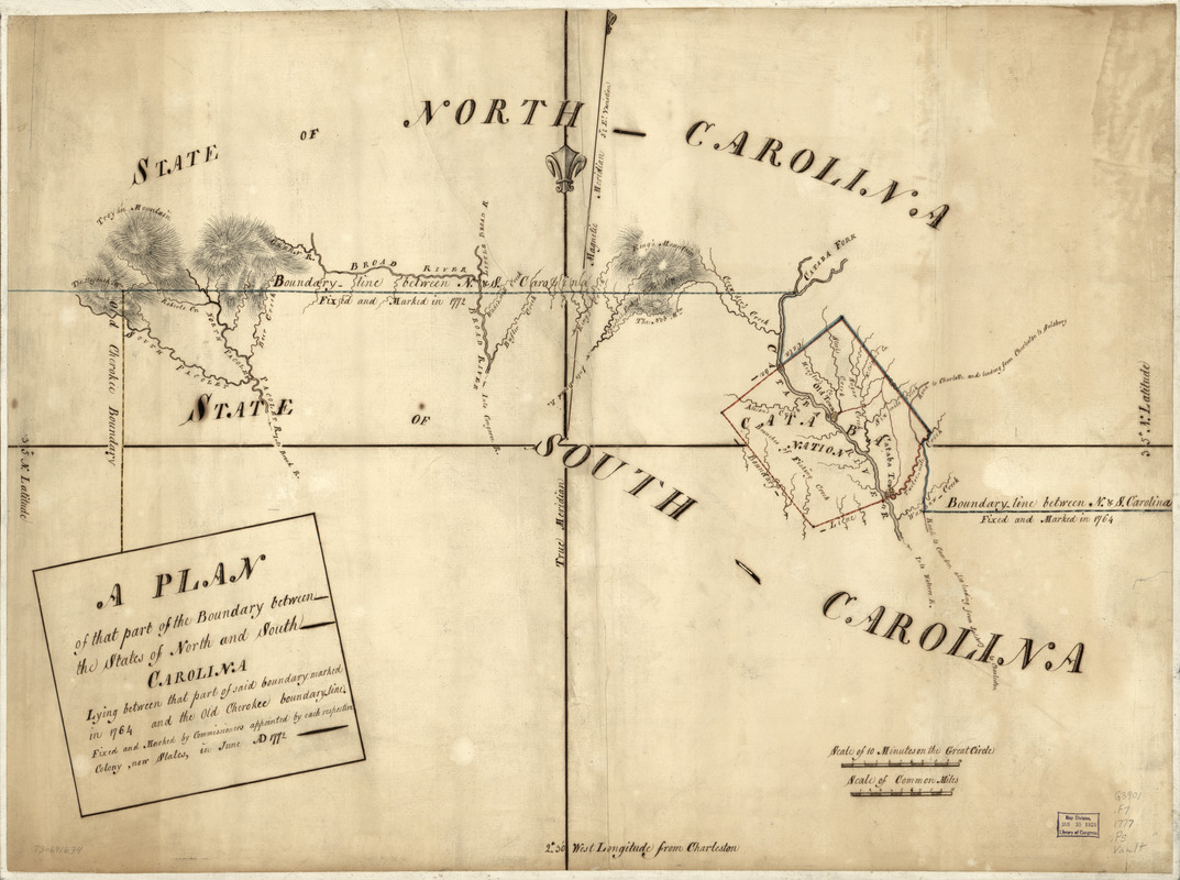
A Plan of that part of the boundary between the states of North and South Carolina : lying between that part of said boundary marked in 1764 and the old Cherokee boundary line. Fixed and marked by commissioners appointed by each respective colony, now states, in June A.D. 1772
This map is also available in American Revolutionary Geographies Online (ARGO), a collections portal especially built for material relating to the American Revolutionary War Era. Visit ARGO to learn more about this item and explore the historical geography of North America in the late eighteenth century.
Item Information
- Title:
- A Plan of that part of the boundary between the states of North and South Carolina : lying between that part of said boundary marked in 1764 and the old Cherokee boundary line. Fixed and marked by commissioners appointed by each respective colony, now states, in June A.D. 1772
- Date:
-
[1777?]
- Format:
-
Maps/Atlases
Manuscripts
- Location:
- Library of Congress Geography and Map Division
- Collection (local):
-
Library of Congress Collection
- Subjects:
-
North Carolina--Boundaries--South Carolina--Maps, Manuscript--Early works to 1800
South Carolina--Boundaries--North Carolina--Maps, Manuscript--Early works to 1800
- Places:
-
South Carolina
North Carolina
- Extent:
- 1 manuscript map : hand color 53 x 72 cm.
- Terms of Use:
-
No known copyright restrictions.
This work is licensed for use under a Creative Commons Attribution Non-Commercial Share Alike License (CC BY-NC-SA).

- Scale:
-
Scale ca. 1:260,000
- Language:
-
English
- Catalog Record:
-
https://lccn.loc.gov/73691634
- Notes:
-
Manuscript, pen-and-ink and watercolor.
Prime meridian: Charleston.
Relief shown pictorially.
Shows "Old Cherokee Boundary" which was changed in 1777.
- Notes (citation):
-
LC Maps of North America, 1750-1789, 1397
- Identifier:
-
ar139700


