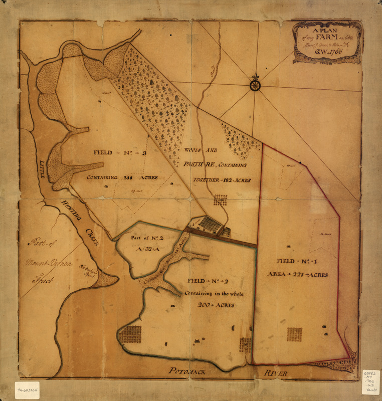
A plan of my farm on Little Huntg. Creek & Potomk. R
This map is also available in American Revolutionary Geographies Online (ARGO), a collections portal especially built for material relating to the American Revolutionary War Era. Visit ARGO to learn more about this item and explore the historical geography of North America in the late eighteenth century.
Item Information
- Title:
- A plan of my farm on Little Huntg. Creek & Potomk. R
- Creator:
- Washington, George, 1732-1799
- Name on Item:
-
G. W.
- Date:
-
1766
- Format:
-
Maps/Atlases
Manuscripts
- Location:
- Library of Congress Geography and Map Division
- Collection (local):
-
Library of Congress Collection
- Subjects:
-
Mount Vernon (Va. : Estate)--Maps, Manuscript--Early works to 1800
- Places:
-
Fairfax (county)Mount Vernon (historic site)
- Extent:
- 1 manuscript map : hand color 46 x 44 cm.
- Terms of Use:
-
No known copyright restrictions.
This work is licensed for use under a Creative Commons Attribution Non-Commercial Share Alike License (CC BY-NC-SA).

- Scale:
-
Scale not given
- Language:
-
English
- Catalog Record:
-
https://lccn.loc.gov/74693204
- Notes:
-
Manuscript, pen-and-ink and watercolor.
Mounted on linen covered cardboard.
Accompanied by 2 manuscript notes.
- Notes (citation):
-
LC Maps of North America, 1750-1789, 1447
- Identifier:
-
ct000085z


