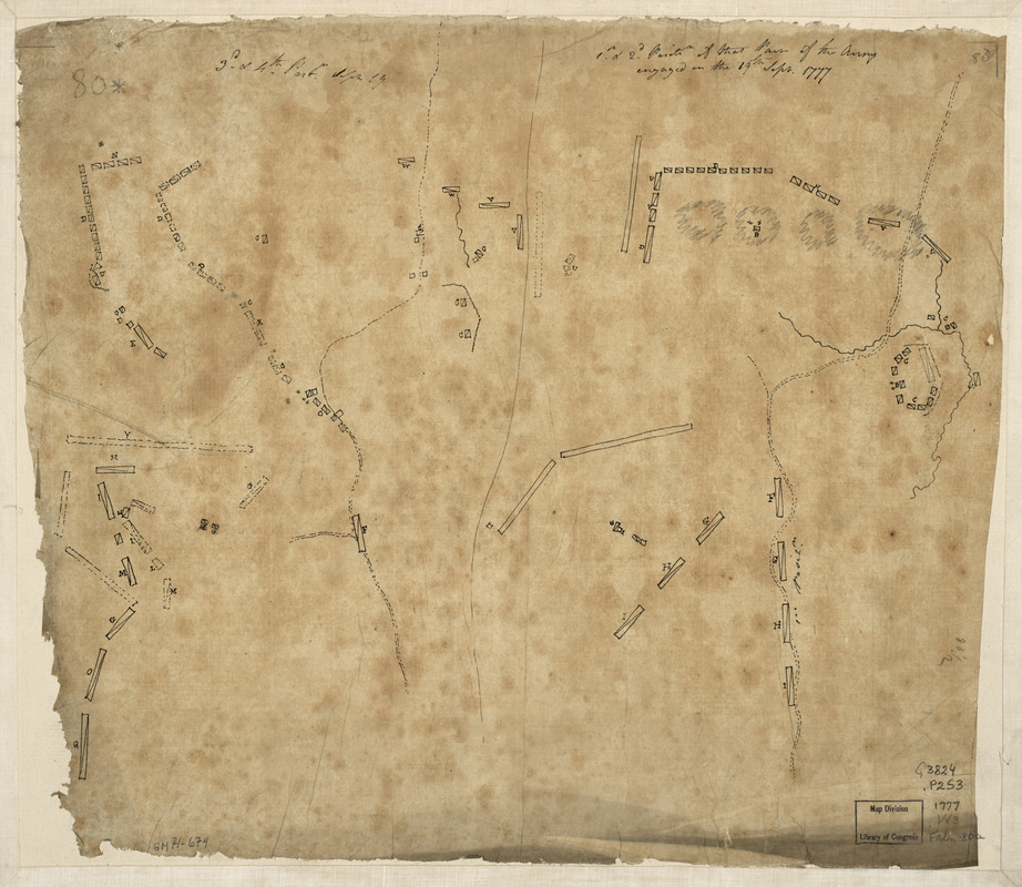
1st. & 2d. position of that part of the army engaged on the 19th Sept. 1777 : 3d & 4th postn. Sept. 19
This map is also available in American Revolutionary Geographies Online (ARGO), a collections portal especially built for material relating to the American Revolutionary War Era. Visit ARGO to learn more about this item and explore the historical geography of North America in the late eighteenth century.
Item Information
- Title:
- 1st. & 2d. position of that part of the army engaged on the 19th Sept. 1777 : 3d & 4th postn. Sept. 19
- Creator:
- Wangenheim, Friedrich Adam Julius von
- Date:
-
[1777]
- Format:
-
Maps/Atlases
Manuscripts
- Location:
- Library of Congress Geography and Map Division
- Collection (local):
-
Library of Congress Collection
- Subjects:
-
Saratoga Campaign, N.Y., 1777--Maps--Early works to 1800
Saratoga Springs Region (N.Y.)--Maps--Early works to 1800
- Places:
-
Saratoga (county)
- Extent:
- 2 maps on sheet 34 x 40 cm.
- Terms of Use:
-
No known copyright restrictions.
This work is licensed for use under a Creative Commons Attribution Non-Commercial Share Alike License (CC BY-NC-SA).

- Scale:
-
Scale not given
- Language:
-
English
- Catalog Record:
-
https://lccn.loc.gov/gm71000674
- Notes:
-
Manuscript, pen-and-ink and lead-pencil on tracing paper.
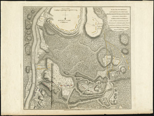
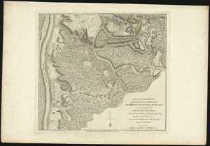
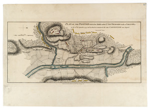
The maps show the Battle of Freeman's Farm on 19 September 1777--an action undertaken during the Saratoga Campaign (N.Y.).
Map sheet mounted on cloth backing.
Includes notes in ink handwriting at upper edge.
- Notes (date):
-
This date is inferred.
- Notes (citation):
-
LC Maps of North America, 1750-1789, 1343
- Identifier:
-
ar134300

![[Plan of the battles of Saratoga]](https://bpldcassets.blob.core.windows.net/derivatives/images/commonwealth:z603vw07d/image_thumbnail_300.jpg)