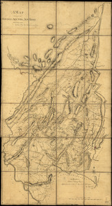
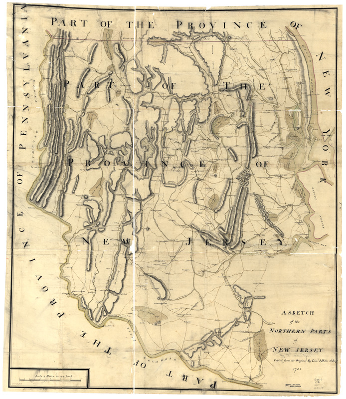
A sketch of the northern parts of New Jersey
This map is also available in American Revolutionary Geographies Online (ARGO), a collections portal especially built for material relating to the American Revolutionary War Era. Visit ARGO to learn more about this item and explore the historical geography of North America in the late eighteenth century.
Item Information
- Title:
- A sketch of the northern parts of New Jersey
- Creator:
- Hills, John, (Surveyor)
- Contributor:
- Morgan, Benjamin, (Draftsman)
- Contributor:
- Millidge, Thomas
- Name on Item:
-
Copied from the original by Lieut. I. Hills, 23d Regt., 1781
- Date:
-
[1781]
- Format:
-
Maps/Atlases
Manuscripts
- Location:
- Library of Congress Geography and Map Division
- Collection (local):
-
Library of Congress Collection
- Subjects:
-
New Jersey--Maps, Manuscript--Early works to 1800
- Places:
-
New Jersey
- Extent:
- 1 manuscript map : hand color; 97 x 83 cm.
- Terms of Use:
-
No known copyright restrictions.
This work is licensed for use under a Creative Commons Attribution Non-Commercial Share Alike License (CC BY-NC-SA).

- Scale:
-
Scale 1:126,720
- Language:
-
English
- Catalog Record:
-
https://lccn.loc.gov/gm72003605
- Notes:
-
Manuscript, pen-and-ink and watercolor.
Has watermarks.
Relief shown by hachures.
Original attributed to B. Morgan and T. Milliadge through table of contents of the collection.
- Notes (date):
-
This date is inferred.
- Notes (citation):
-
LC Maps of North America, 1750-1789, 1251
- Identifier:
-
ar125100z