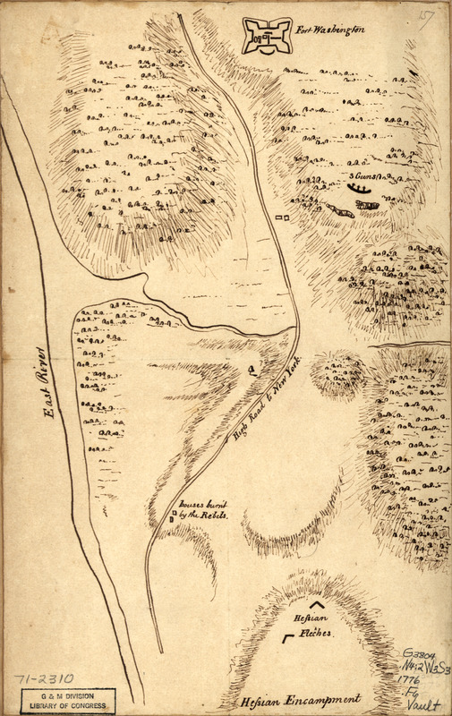
Fort Washington & vicinity
This map is also available in American Revolutionary Geographies Online (ARGO), a collections portal especially built for material relating to the American Revolutionary War Era. Visit ARGO to learn more about this item and explore the historical geography of North America in the late eighteenth century.
Item Information
- Title:
- Fort Washington & vicinity
- Date:
-
[1776?]
- Format:
-
Maps/Atlases
Manuscripts
- Location:
- Library of Congress Geography and Map Division
- Collection (local):
-
Library of Congress Collection
- Subjects:
-
Fort Washington (New York, N.Y.)--Capture, 1776--Maps, Manuscript--Early works to 1800
- Places:
-
Fort Washington (historical)
- Extent:
- 1 manuscript map, on sheet 32 x 20 cm.
- Terms of Use:
-
No known copyright restrictions.
This work is licensed for use under a Creative Commons Attribution Non-Commercial Share Alike License (CC BY-NC-SA).

- Scale:
-
Scale not given
- Language:
-
English
- Catalog Record:
-
https://lccn.loc.gov/gm71002310
- Notes:
-
Title from manuscript catalog of Peter Force map collection.
Manuscript, pen-and-ink.
Relief shown by hachures.
Shows Fort Washington with the position of Hessian encampment at the time of the capture.
- Notes (citation):
-
LC Maps of North America, 1750-1789, 1157
- Identifier:
-
ar115700

![Sketth [sic] of the Hessian attack on Fort Washington under General Knypehausen on the 16th November 1776](https://bpldcassets.blob.core.windows.net/derivatives/images/commonwealth:q524n878n/image_thumbnail_300.jpg)


