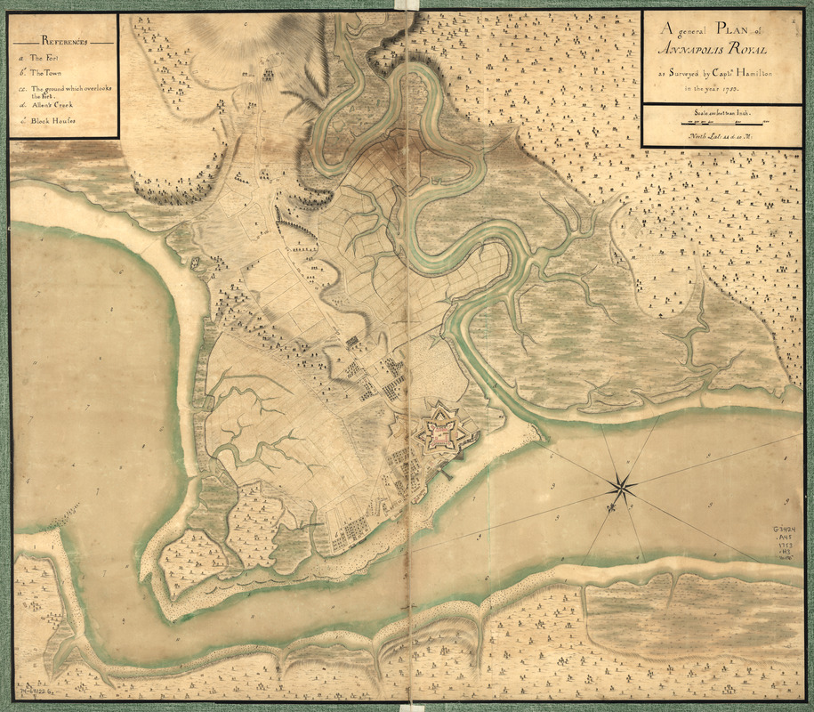
A general plan of Annapolis Royal
This map is also available in American Revolutionary Geographies Online (ARGO), a collections portal especially built for material relating to the American Revolutionary War Era. Visit ARGO to learn more about this item and explore the historical geography of North America in the late eighteenth century.
Item Information
- Title:
- A general plan of Annapolis Royal
- Creator:
- Hamilton, Captn.
- Name on Item:
-
as surveyed by Captn: Hamilton in the year 1753
- Date:
-
[1753]
- Format:
-
Maps/Atlases
Manuscripts
- Location:
- Library of Congress Geography and Map Division
- Collection (local):
-
Library of Congress Collection
- Subjects:
-
Annapolis Royal (N.S.)--Maps, Manuscript--Early works to 1800
- Places:
-
CanadaAnnapolis Royal
- Extent:
- 1 manuscript map : hand color ; 65 x 74 cm.
- Terms of Use:
-
No known copyright restrictions.
This work is licensed for use under a Creative Commons Attribution Non-Commercial Share Alike License (CC BY-NC-SA).

- Scale:
-
Scale 1:4,800
- Language:
-
English
- Catalog Record:
-
https://lccn.loc.gov/74691226
- Notes:
-
Manuscript, pen-and-ink and watercolor.
Relief shown by hachures. Depths shown by soundings.
Oriented with north toward the lower left.
Has watermark.
Indexed for points of interest.
- Notes (date):
-
This date is inferred.
- Notes (citation):
-
LC Maps of North America, 1750-1789, 540
- Identifier:
-
ar054000z


