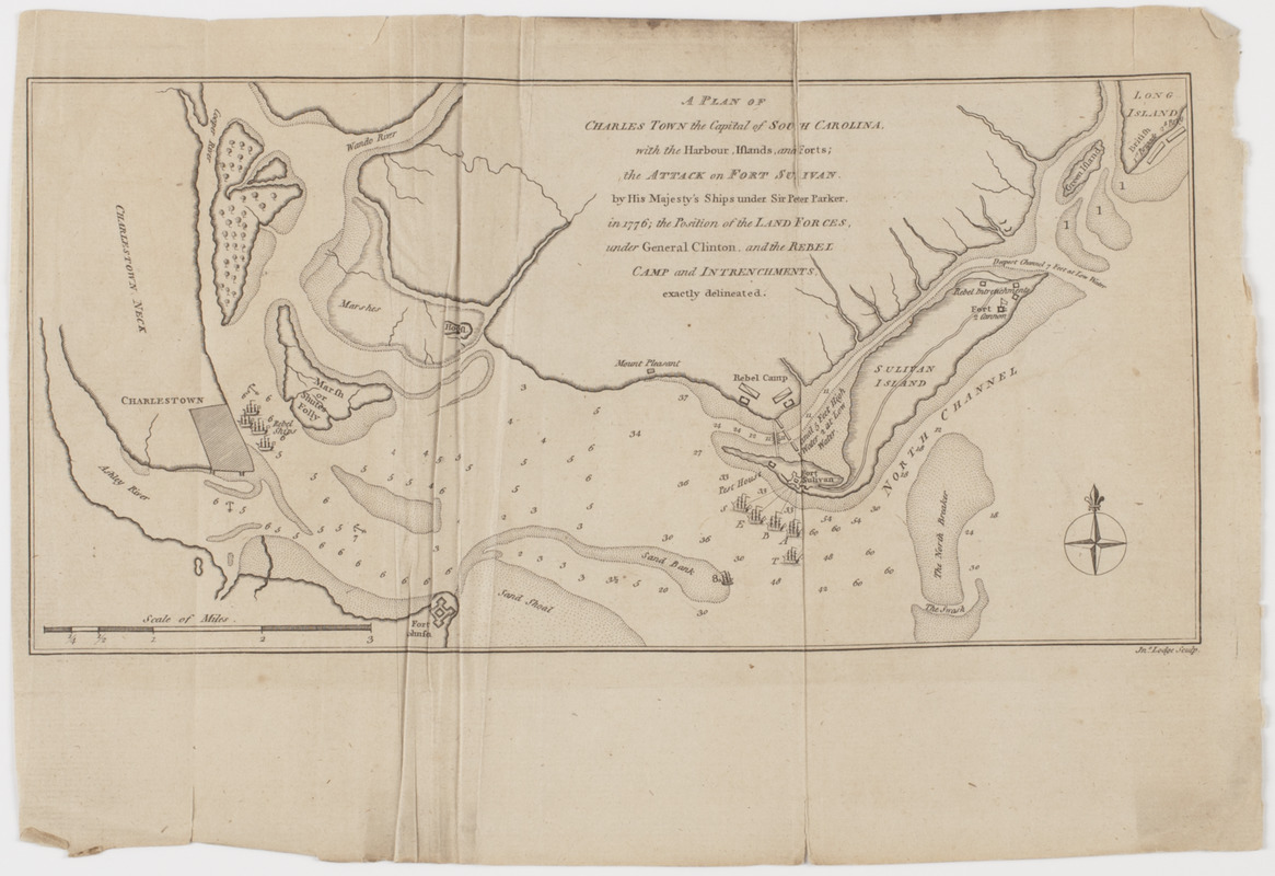
A Plan of Charles Town the capitol of South Carolina, : with the harbour, islands, and forts; the attack on Fort Sulivan, by His Majesty's ships under Sir Peter Parker, in 1776; the position of the land forces, under General Clinton, and the rebel camp and intrenchments, exactly delineated
This map is also available in American Revolutionary Geographies Online (ARGO), a collections portal especially built for material relating to the American Revolutionary War Era. Visit ARGO to learn more about this item and explore the historical geography of North America in the late eighteenth century.
Item Information
- Title:
- A Plan of Charles Town the capitol of South Carolina, : with the harbour, islands, and forts; the attack on Fort Sulivan, by His Majesty's ships under Sir Peter Parker, in 1776; the position of the land forces, under General Clinton, and the rebel camp and intrenchments, exactly delineated
- Title (uniform):
-
Political magazine (London, England)
- Description:
-
Subject: Plan of the coastal areas surrounding Charleston, South Carolina, showing ships stationed near Charleston and Fort Moultrie on Sullivan Island.
- Name on Item:
-
Jno. Lodge sculp.
- Date:
-
[1780]
- Format:
-
Maps/Atlases
- Location:
- American Antiquarian Society
- Collection (local):
-
American Antiquarian Society Collection
- Subjects:
-
Fort Moultrie, Battle of, S.C., 1776
Charleston (S.C.)--Maps
United States--History--Revolution, 1775-1783--Maps
- Places:
-
Charleston (county)Charleston
- Extent:
- 1 map : engraving ; 14 x 28 cm., on sheet 21 x 30 cm.
- Terms of Use:
-
Public Domain/No known restrictions on use. Contact host institution to download image.
Contact host institution for more information.
- Publisher:
-
London :
[s.n.]
- Scale:
-
Scale [ca. 1:63,360]
- Language:
-
English
- Catalog Record:
-
http://catalog.mwa.org/vwebv/holdingsInfo?bibId=488808
- Notes:
-
Depths shown by soundings.
From Political magazine, London, February, 1780.
- Notes (date):
-
This date is inferred.


