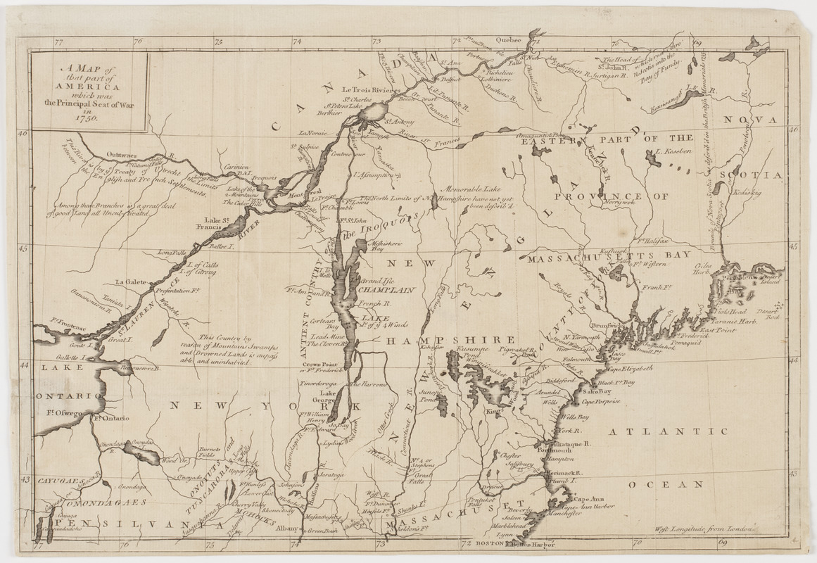
A Map of that part of America which was the principal seat of war in 1756
This map is also available in American Revolutionary Geographies Online (ARGO), a collections portal especially built for material relating to the American Revolutionary War Era. Visit ARGO to learn more about this item and explore the historical geography of North America in the late eighteenth century.
Item Information
- Title:
- A Map of that part of America which was the principal seat of war in 1756
- Title (uniform):
-
Gentleman's magazine (London, England)
- Description:
-
Subject: Map of northern New England, New York and part of Canada during the French and Indian War. Shows land divisions from the Treaty of Utrecht and the British Memorials of 1755. Also shows the forts at Lake Ontario, Lake Champlain and throughout the region.
- Donor:
- Farwell, John Whittemore, 1843-1929
- Date:
-
[1757]
- Format:
-
Maps/Atlases
- Location:
- American Antiquarian Society
- Collection (local):
-
American Antiquarian Society Collection
- Subjects:
-
United States--History--French and Indian War, 1754-1763--Maps
New England--Maps
New York (State)--Maps
Canada--Maps
- Places:
-
United States
New York
New England (area)
Canada
- Extent:
- 1 map : engraving ; 22 x 34 cm., on sheet 24 x 34 cm.
- Terms of Use:
-
Public Domain/No known restrictions on use. Contact host institution to download image.
Contact host institution for more information.
- Publisher:
-
London :
[s.n.]
- Scale:
-
Scale not given
- Language:
-
English
- Catalog Record:
-
http://catalog.mwa.org/vwebv/holdingsInfo?bibId=489657
- Notes:
-
Appears in the Gentleman's magazine, London, ca. 1757.
- Notes (date):
-
This date is inferred.


