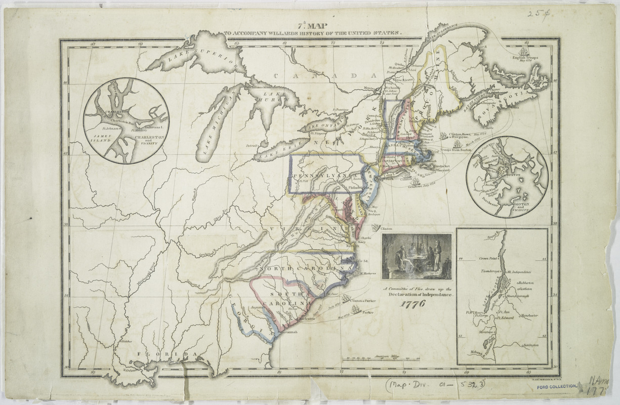
7th map to accompany Willards History of the United States
This map is also available in American Revolutionary Geographies Online (ARGO), a collections portal especially built for material relating to the American Revolutionary War Era. Visit ARGO to learn more about this item and explore the historical geography of North America in the late eighteenth century.
Item Information
- Title:
- 7th map to accompany Willards History of the United States
- Title (alt.):
-
Seventh map to accompany Willard's History of the United States
- Creator:
- Willard, Emma, 1787-1870
- Contributor:
- Maverick, Samuel, 1789-1845
- Name on Item:
-
Saml. Maverick, sc., N.Y.
- Date:
-
[1828?]
- Format:
-
Maps/Atlases
- Location:
- New York Public Library
- Collection (local):
-
Maps of North America
- Subjects:
-
United States--Historical geography--Maps
- Places:
-
- Extent:
- 1 map : hand col. ; 26 x 35 cm.
- Terms of Use:
-
No known copyright restrictions.
This work is licensed for use under a Creative Commons Attribution Non-Commercial Share Alike License (CC BY-NC-SA).

- Publisher:
-
New-York? :
White, Gallaher, & White?
- Scale:
-
Scale [ca. 1:9,000,000]
- Language:
-
English
- Catalog Record:
-
https://digitalcollections.nypl.org/items/510d47da-ee84-a3d9-e040-e00a18064a99
- Notes:
-
Relief shown by hachures.
Covers North America from Maine and Nova Scotia south to Florida and west to the Mississippi Valley.
Shows colonies, and routes of ships in 1776.
Appears in Emma Willard's History of the United States, or Republic of America. 1828 ed.
Includes ill.
Inset maps: Charleston and vicinity -- Boston and vicinity --[Lake George and vicinity].


