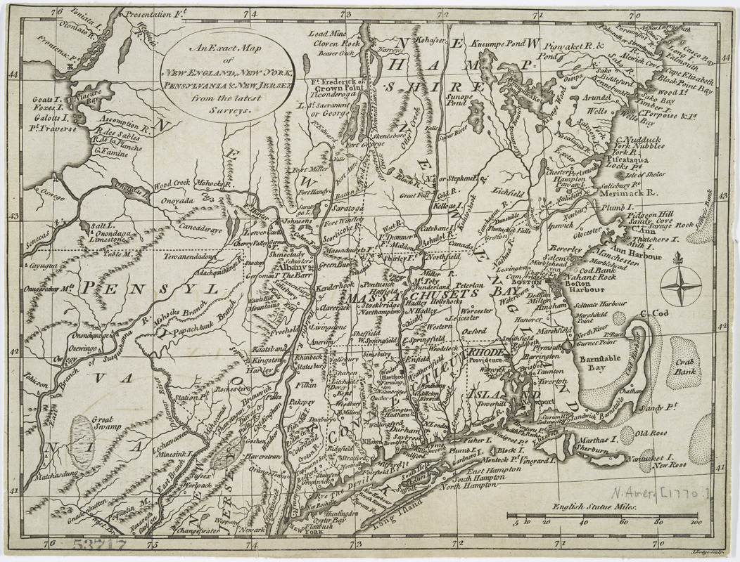
An exact map of New England, New York, Pensylvania & New Jersey, from the latest surveys
This map is also available in American Revolutionary Geographies Online (ARGO), a collections portal especially built for material relating to the American Revolutionary War Era. Visit ARGO to learn more about this item and explore the historical geography of North America in the late eighteenth century.
Item Information
- Title:
- An exact map of New England, New York, Pensylvania & New Jersey, from the latest surveys
- Creator:
- Lodge, John, -1796
- Name on Item:
-
J. Lodge, sculp.
- Date:
-
[1778?]
- Format:
-
Maps/Atlases
- Location:
- New York Public Library
- Collection (local):
-
Maps of North America
- Subjects:
-
New England--Maps--Early works to 1800
Middle Atlantic States--Maps--Early works to 1800
- Places:
-
New England (area)
Middle Atlantic (area)
- Extent:
- 1 map ; 19 x 25 cm.
- Terms of Use:
-
No known copyright restrictions.
This work is licensed for use under a Creative Commons Attribution Non-Commercial Share Alike License (CC BY-NC-SA).

- Publisher:
-
London? :
Fielding and Walker?
- Scale:
-
Scale [ca. 1:2,400,000]
- Language:
-
English
- Catalog Record:
-
https://digitalcollections.nypl.org/items/510d47db-afe3-a3d9-e040-e00a18064a99
- Notes:
-
Appears in William Russell's The history of America. London, 1778.


