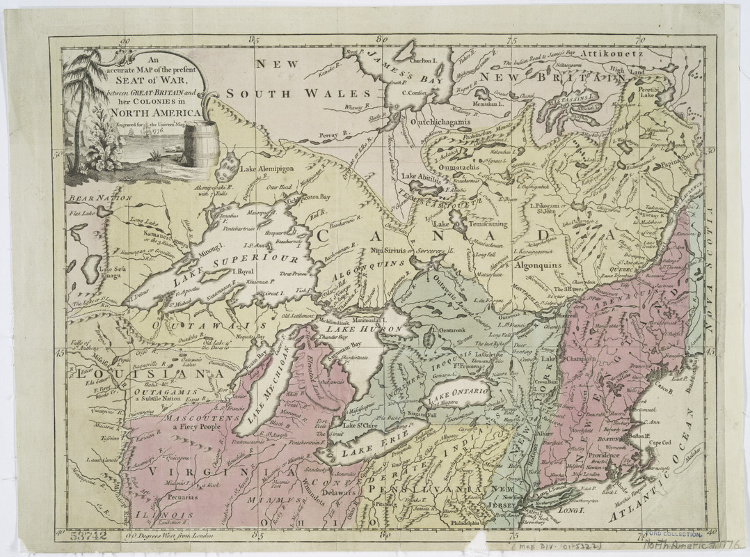
An Accurate map of the present seat of war between Great-Britain and her colonies in North America
This map is also available in American Revolutionary Geographies Online (ARGO), a collections portal especially built for material relating to the American Revolutionary War Era. Visit ARGO to learn more about this item and explore the historical geography of North America in the late eighteenth century.
Item Information
- Title:
- An Accurate map of the present seat of war between Great-Britain and her colonies in North America
- Title (alt.):
-
Seat of war between Great-Britain and her colonies in North America
- Title (uniform):
-
Universal magazine of knowledge and pleasure
- Contributor:
- Hinton, John, -1781
- Name on Item:
-
Engraved for the Universal Mage.
- Date:
-
1776
- Format:
-
Maps/Atlases
- Location:
- New York Public Library
- Collection (local):
-
Maps of North America
- Subjects:
-
North America--Maps--Early works to 1800
Great Britain--Colonies--America--Maps--Early works to 1800
- Places:
-
North America (area)
- Extent:
- col. map 27 x 35 cm.
- Terms of Use:
-
No known copyright restrictions.
This work is licensed for use under a Creative Commons Attribution Non-Commercial Share Alike License (CC BY-NC-SA).

- Scale:
-
Scale ca. 1:5,600,000
- Language:
-
English
- Catalog Record:
-
https://digitalcollections.nypl.org/items/510d47da-f0e7-a3d9-e040-e00a18064a99
- Notes:
-
Hand colored.
From Universal magazine, v. 59, Oct. 1776.
"Engraved for the Universal mage."
Prime meridian: London.
Relief shown pictorially.
Area extends from James Bay to Philadelphia and from the Great Lakes to Penobscot Bay.
- LCCN:
-
gm 71005459


