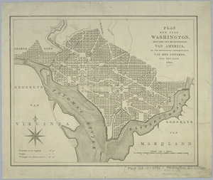
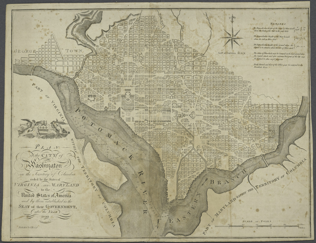
Plan of the city of Washington in the territory of Columbia : ceded by the states of Virginia and Maryland to the United States of America and by them established as the seat of their government, after the year 1800
This map is also available in American Revolutionary Geographies Online (ARGO), a collections portal especially built for material relating to the American Revolutionary War Era. Visit ARGO to learn more about this item and explore the historical geography of North America in the late eighteenth century.
Item Information
- Title:
- Plan of the city of Washington in the territory of Columbia : ceded by the states of Virginia and Maryland to the United States of America and by them established as the seat of their government, after the year 1800
- Creator:
- Reid, John, publisher
- Contributor:
- Rollinson, William, 1762-1842
- Name on Item:
-
Rollinson sculp't N. York.
- Date:
-
[1795?]
- Format:
-
Maps/Atlases
- Location:
- New York Public Library
- Collection (local):
-
Maps of North America
- Subjects:
-
Washington (D.C.)--Maps--Early works to 1800
Georgetown (Washington, D.C.)--Maps--Early works to 1800
- Places:
-
WashingtonGeorgetown
- Extent:
- 1 map ; 40 x 52 cm.
- Terms of Use:
-
No known copyright restrictions.
This work is licensed for use under a Creative Commons Attribution Non-Commercial Share Alike License (CC BY-NC-SA).

- Publisher:
-
[New York] :
Publish'd by I. Reid
- Scale:
-
Scale [ca. 1:20,750]
- Language:
-
English
- Catalog Record:
-
https://digitalcollections.nypl.org/items/510d47da-ef95-a3d9-e040-e00a18064a99
- Notes:
-
Shows block numbers and proposed government buildings.
Also covers Georgetown.
Relief shown by hachures. Depths shown by soundings.
"L. Wayland and C. Smith 1795" deleted from publisher's statement.
Includes "Remarks" and coat-of-arms.
- LCCN:
-
88694116