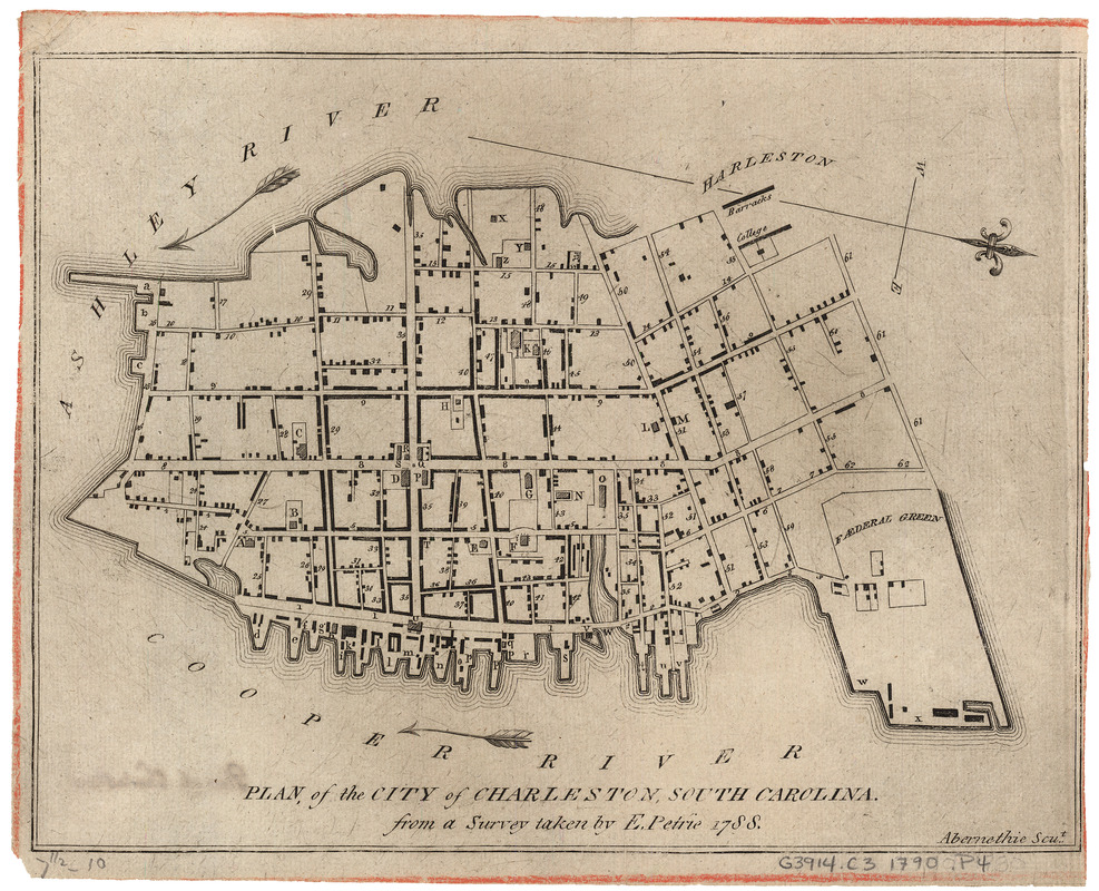
Plan of the city of Charleston, South Carolina
This map is also available in American Revolutionary Geographies Online (ARGO), a collections portal especially built for material relating to the American Revolutionary War Era. Visit ARGO to learn more about this item and explore the historical geography of North America in the late eighteenth century.
Item Information
- Title:
- Plan of the city of Charleston, South Carolina
- Creator:
- Petrie, E. (Edmund)
- Contributor:
- Abernethie
- Contributor:
- Bowen, Thomas Bartholomew, 1742?-1805
- Name on Item:
-
from a survey taken by E. Petrie, 1788 ; Abernethie scu.t.
- Date:
-
[1790]
- Format:
-
Maps/Atlases
- Location:
- Harvard Library
- Collection (local):
-
Harvard Map Collection
- Subjects:
-
Charleston (S.C.)--Maps--Early works to 1800
- Places:
-
Charleston (county)Charleston
- Extent:
- 1 map ; 19 x 25 cm. + 1 index.
- Terms of Use:
-
No known copyright restrictions.
This work is licensed for use under a Creative Commons Attribution Non-Commercial Share Alike License (CC BY-NC-SA).

- Publisher:
-
Charleston, S.C :
J. Milligan.
- Scale:
-
Scale not given
- Language:
-
English
- Catalog Record:
-
http://id.lib.harvard.edu/aleph/010131465/catalog
- Notes:
-
Shows layout of Charleston, including streets, buildings, wharves and surrounding rivers.
Appears in: The Charleston directory and revenue system. Charleston : Printed by T.B. Bowen no, . 42 Bay. Sold by J. Milligan, at the Intelligence Office, [1790].
North oriented to right.
Keyed to index on separate sheet.
- Notes (date):
-
This date is inferred.


