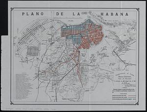
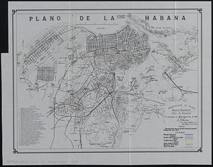
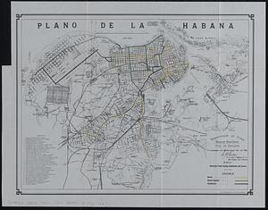
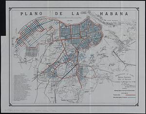
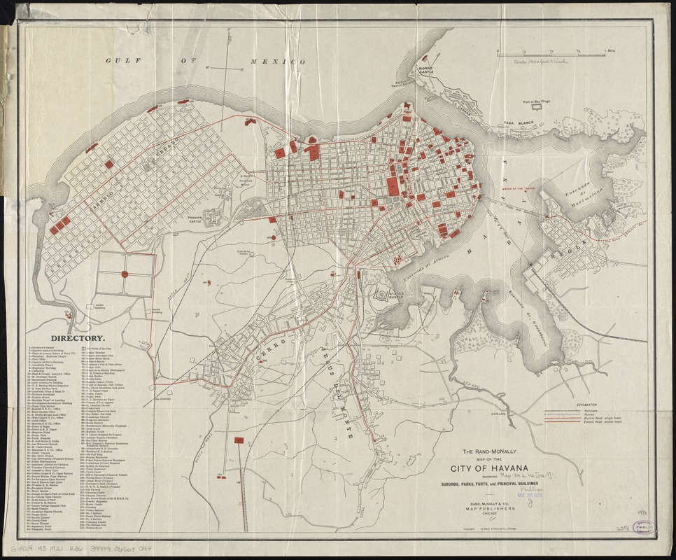
The Rand-McNally map of the city of Havana showing suburbs, parks, forts, and principal buildings
Item Information
- Title:
- The Rand-McNally map of the city of Havana showing suburbs, parks, forts, and principal buildings
- Title (alt.):
-
Map of the city of Havana
Rand McNally pocket map of Havana
- Creator:
- Rand McNally and Company
- Date:
-
1921
- Format:
-
Maps/Atlases
- Location:
-
Boston Public Library
Norman B. Leventhal Map Center - Collection (local):
-
Norman B. Leventhal Map Center Collection
- Subjects:
-
Streets--Cuba--Havana--Maps
Buildings--Cuba--Havana--Maps
Railroads--Cuba--Havana--Maps
Spanish-American War, 1898--Cuba--Havana--Maps
Havana (Cuba)--Maps
- Places:
-
Havana (province)Havana
- Extent:
- 1 map : color ; 49 x 60 cm, folded in cover 17 x 11 cm
- Terms of Use:
-
No known copyright restrictions.
No known restrictions on use.
- Publisher:
-
Chicago :
Rand, McNally & Co.,
- Scale:
-
Scale approximately 1:15,500
- Language:
-
English
- Notes:
-
Date of publication taken from date of acquisition.
Relief shown by hachures.
Shows site of the wreck of the USS Maine in Havana Harbor in 1898; street names, select buildings, military facilities and fortifications, railroads, "electric roads," ferries, cemeteries, and points of interest.
Includes directory.
- Identifier:
-
06_01_011898
- Call #:
-
G4924.H3 1921 .R36
- Barcode:
-
39999065690164