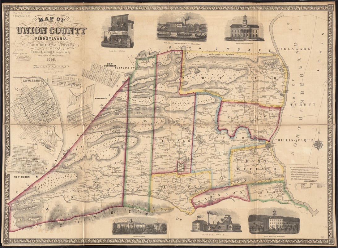
Map of Union County, Pennsylvania : entirely from original surveys
Item Information
- Title:
- Map of Union County, Pennsylvania : entirely from original surveys
- Creator:
- Paschall, Thomas H.
- Name on Item:
-
by Thomas H. Paschall & James Keily ; engraved & printed by Th. Leonhardt & J.H. Camp.
- Date:
-
1856
- Format:
-
Maps/Atlases
- Location:
-
Boston Public Library
Norman B. Leventhal Map Center - Collection (local):
-
Norman B. Leventhal Map Center Collection
- Subjects:
-
Landowners--Pennsylvania--Union County--Maps
Real property--Pennsylvania--Union County--Maps
Union County (Pa.)--Maps
Lewisburg (Pa.)--Maps
Hartleton (Pa.)--Maps
New Columbia (Pa.)--Maps
Mifflinburg (Pa.)--Maps
New Berlin (Pa.)--Maps
- Places:
-
Union (county)New Berlin
Union (county)Lewisburg
Union (county)Hartleton
Union (county)New Columbia
Union (county)Mifflinburg
- Extent:
- 1 map : hand col. ; 70 x 100 cm.
- Terms of Use:
-
No known copyright restrictions.
No known restrictions on use.
- Publisher:
-
Philadelphia :
Th. Leonhardt & J. H. Camp
- Scale:
-
Scale [ca. 1:52,000]
- Language:
-
English
- Notes:
-
General-content county map also showing rural houses/buildings with householders' names.
Relief shown by hachures.
Shows road distances in perches.
Hand col. to emphasize township boundaries.
Includes note, key to abbreviations, and ill.
Borough/village insets showing lot lines, lot numbers, and buildings: Lewisburg -- Hartleton -- New Columbia -- Mifflinburg -- New Berlin.
- Identifier:
-
06_01_011477
- Call #:
-
G3823.U5 1856 .P37
- Barcode:
-
39999065685339
- LCCN:
-
2012592213


