Map of Clinton County
Item Information
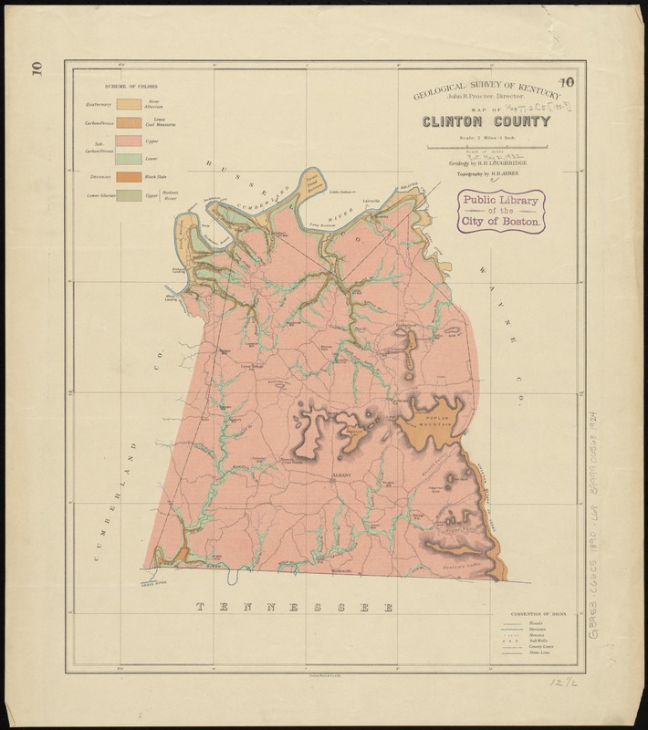
- Title:
- Map of Clinton County
- Title (alt.):
-
Report on the geology of Clinton County
- Creator:
- Loughridge, R. H. (Robert Hills), 1843-1917
- Name on Item:
-
geology by R.H. Loughridge ; topography by H.R. Ayres.
- Date:
-
[1890]
- Format:
-
Maps/Atlases
- Location:
-
Boston Public Library
Norman B. Leventhal Map Center - Collection (local):
-
Norman B. Leventhal Map Center Collection
- Subjects:
-
Geology--Kentucky--Clinton County--Maps
Clinton County (Ky.)--Maps
- Places:
-
Clinton (county)
- Extent:
- 1 map : col. ; 38 x 32 cm.
- Terms of Use:
-
No known copyright restrictions.
No known restrictions on use.
- Publisher:
-
[Frankfort, Ky.] :
Geological Survey of Kentucky
- Scale:
-
Scale [1:126,720]. 2 miles = 1 in.
- Language:
-
English
- Notes:
-
Also shows houses and salt wells.
Detached from: Report on the geology of Clinton County : with map / by R.H. Loughridge. Frankfort, Ky.: Geological Survey of Kentucky, [1890]. (Miscellaneous geological reports (Kentucky Geological Survey) ; Ser. 2, v. 13).
Relief shown by hachures.
Prime meridian: Washington.
"Julius Bien & Co., Lith."
- Notes (date):
-
This date is inferred.
- Identifier:
-
06_01_011040
- Call #:
-
G3953.C66C5 1890 .L68
- Barcode:
-
39999065681924


