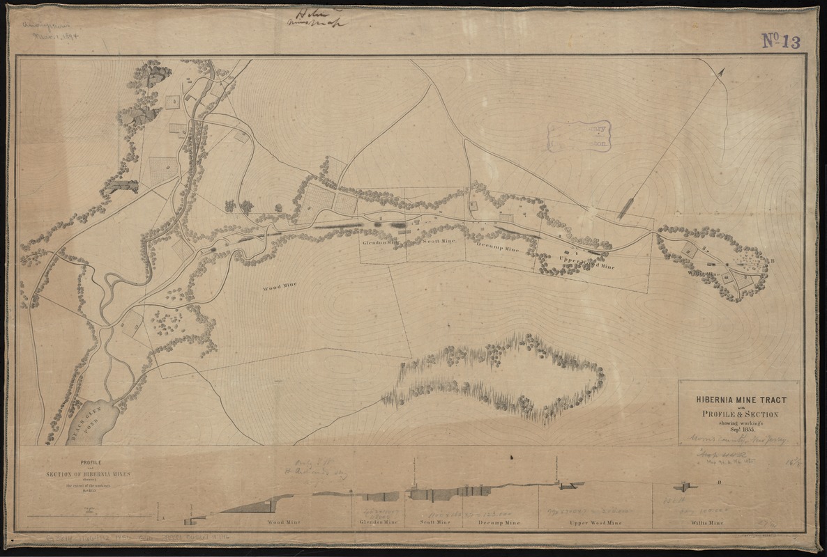
Hibernia mine tract : with profile & section showing working's Sept. 1855
Item Information
- Title:
- Hibernia mine tract : with profile & section showing working's Sept. 1855
- Creator:
- Geological Survey of New Jersey
- Date:
-
[1856]
- Format:
-
Maps/Atlases
- Location:
-
Boston Public Library
Norman B. Leventhal Map Center - Collection (local):
-
Norman B. Leventhal Map Center Collection
- Subjects:
-
Hibernia Iron Works (Hibernia, N.J.)--Maps
Iron mines and mining--New Jersey--Hibernia--Maps
Geology--New Jersey--Hibernia--Maps
Hibernia (N.J.)--Maps
- Places:
-
Morris (county)Hibernia
- Extent:
- 1 map ; 43 x 71 cm.
- Terms of Use:
-
No known copyright restrictions.
No known restrictions on use.
- Publisher:
-
Trenton, N.J :
Geological Survey of the State of New Jersey
- Scale:
-
Scale [ca. 1:2,600]
- Language:
-
English
- Notes:
-
Relief shown by form lines.
Includes inset, "Profile and section of Hibernia mines showing the extent of workings, Oct. 1855."
From: Annual report of the Geological Survey of the State of New Jersey. 2nd (1855). Trenton, 1856.
- Notes (date):
-
This date is inferred.
- Identifier:
-
06_01_010897
- Call #:
-
G3814.H664H2 1856 .G46
- Barcode:
-
39999065679746


