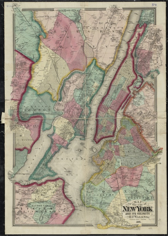
Map of the city of New York and its vicinity
Item Information
- Title:
- Map of the city of New York and its vicinity
- Creator:
- Walling, Henry Francis, 1825-1888
- Name on Item:
-
by H.F. Walling.
- Date:
-
1866
- Format:
-
Maps/Atlases
- Location:
-
Boston Public Library
Norman B. Leventhal Map Center - Collection (local):
-
Norman B. Leventhal Map Center Collection
- Subjects:
-
New York (N.Y.)--Maps
- Places:
-
New York
- Extent:
- 1 map : hand col. ; 124 x 88 cm.
- Terms of Use:
-
No known copyright restrictions.
No known restrictions on use.
- Publisher:
-
New York :
H.F. Walling
- Scale:
-
Scale 1:30,000
- Language:
-
English
- Notes:
-
Covers Manhattan and parts of Brooklyn, Staten Island, and New Jersey.
Relief shown by hachures. Depths shown by isolines.
- Identifier:
-
06_01_010799
- Call #:
-
G3804.N4 1866 .W35
- Barcode:
-
39999065678953


