New York City map
Item Information
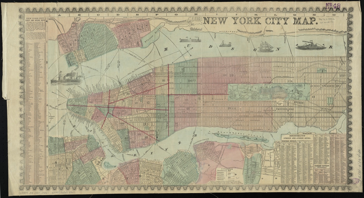
- Title:
- New York City map
- Creator:
- Phelps, Humphrey, active 19th century
- Date:
-
1857
- Format:
-
Maps/Atlases
- Location:
-
Boston Public Library
Norman B. Leventhal Map Center - Collection (local):
-
Norman B. Leventhal Map Center Collection
- Subjects:
-
Railroads--New York (State)--New York--Maps
Fire protection districts--New York (State)--New York--Maps
Ferries--New York (State)--New York--Maps
Piers--New York (State)--New York--Maps
New York (N.Y.)--Administrative and political divisions--Maps
Manhattan (New York, N.Y.)--Maps
Brooklyn (New York, N.Y.)--Maps
Jersey City (N.J.)--Maps
Hoboken (N.J.)--Maps
- Places:
-
New YorkBrooklyn
Hudson (county)Hoboken
Hudson (county)Jersey City
New YorkManhattan
- Extent:
- 1 map : col. ; 38 x 68 cm.
- Terms of Use:
-
No known copyright restrictions.
No known restrictions on use.
- Publisher:
-
New York :
Humphrey Phelps
- Scale:
-
Scale [ca. 1:19,500]
- Language:
-
English
- Notes:
-
Covers Manhattan below 132nd Street, Brooklyn north of Union Street and west of Fifth or Union Avenues, and part of western Queens, all in New York (N.Y.); also covers Jersey City and Hoboken in New Jersey.
"Entered, according to Act of Congress, in the year 1857, by Humphrey Phelps ..."
Includes street indexes for Manhattan and Brooklyn.
Shows wards, fire districts, and railroads.
- Identifier:
-
06_01_010788
- Call #:
-
G3804.N4 1857 .P441
- Barcode:
-
39999065678847


