Map of the State of New-York : showing its water and rail road lines, Jany. 1854
Item Information
- Title:
- Map of the State of New-York : showing its water and rail road lines, Jany. 1854
- Description:
-
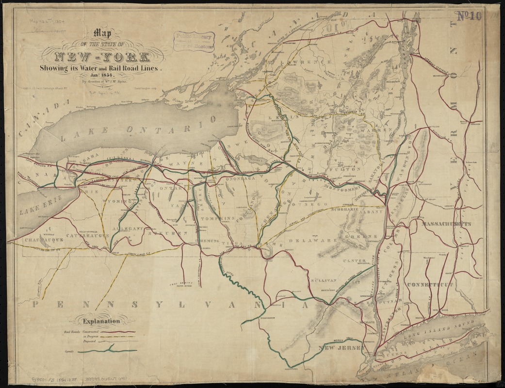
Map of New York and parts of adjacent states showing drainage, county boundaries, cities and towns. Different colors indicate canals and railroads in operation, in progress, and proposed.
- Creator:
- Vaughan, David, active 1849-1864
- Name on Item:
-
by direction of Wm. J. McAlpine ; David Vaughan scrip.
- Date:
-
1854
- Format:
-
Maps/Atlases
- Location:
-
Boston Public Library
Norman B. Leventhal Map Center - Collection (local):
-
Norman B. Leventhal Map Center Collection
- Subjects:
-
Railroads--New York (State)--Maps
Canals--New York (State)--Maps
New York (State)--Maps
- Places:
-
New York
- Extent:
- 1 map : hand col. ; 51 x 65 cm.
- Terms of Use:
-
No known copyright restrictions.
No known restrictions on use.
- Publisher:
-
Albany, N.Y :
Lith. of J.E. Gavit Exchange
- Scale:
-
Scale [ca. 1:1,000,000]
- Language:
-
English
- Notes:
-
Relief shown by hachures.
- Identifier:
-
06_01_010726
- Call #:
-
G3801.P3 1854 .V38
- Barcode:
-
39999065676411


