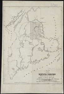
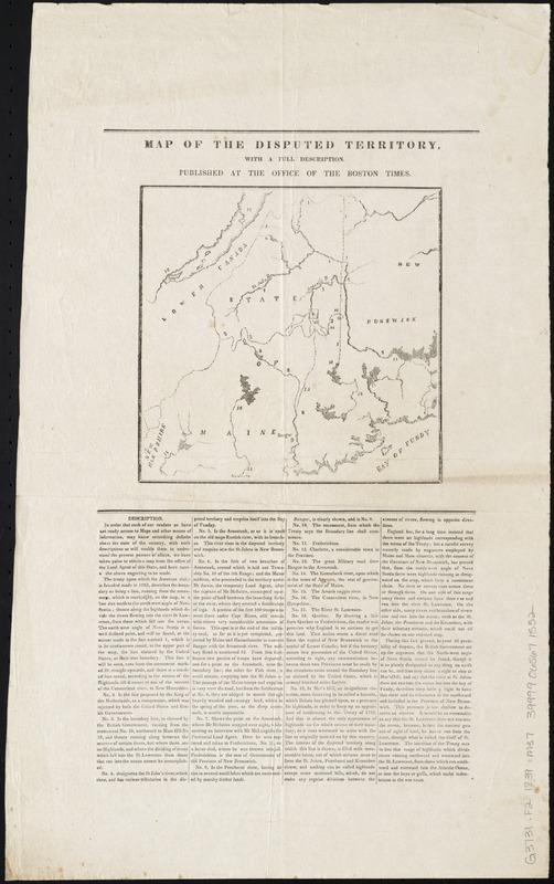
Map of the disputed territory,with a full description
Item Information
- Title:
- Map of the disputed territory,with a full description
- Date:
-
[1839]
- Format:
-
Maps/Atlases
- Location:
-
Boston Public Library
Norman B. Leventhal Map Center - Collection (local):
-
Norman B. Leventhal Map Center Collection
- Subjects:
-
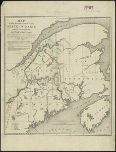
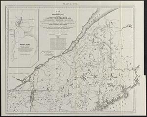
Aroostook War, 1839--Maps
Northeast boundary of the United States--Maps
Maine--Boundaries--New Brunswick--Maps
New Brunswick--Boundaries--Maine--Maps
United States--Boundaries--Canada--Maps
Canada--Boundaries--United States--Maps
- Places:
-
Maine
CanadaProvince of New Brunswick (province)
- Extent:
- 1 map ; 18 x 19 cm. on sheet 51x 32 cm.
- Terms of Use:
-
No known copyright restrictions.
No known restrictions on use.
- Publisher:
-
[Boston] :
Boston Times
- Scale:
-
Scale [ca. 1:250,000]
- Language:
-
English
- Notes:
-
Includes description of boundaries.
- Notes (date):
-
This date is inferred.
- Identifier:
-
06_01_010393
- Call #:
-
G3731.F2 1839 .M37
- Barcode:
-
39999065671552