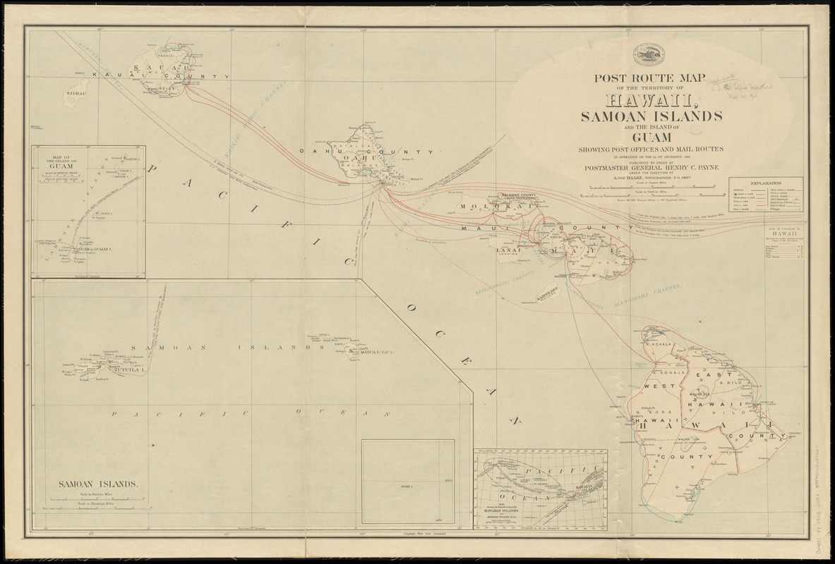
Post route map of the territory of Hawaii, Samoan Islands and the island of Guam showing post offices in operation on the 1st of December, 1903
Item Information
- Title:
- Post route map of the territory of Hawaii, Samoan Islands and the island of Guam showing post offices in operation on the 1st of December, 1903
- Creator:
- United States. Post Office Dept
- Name on Item:
-
published by order of Postmaster General Henry C. Payne under the direction of A. von Haake, topographer P.O. Dept.
- Date:
-
1903
- Format:
-
Maps/Atlases
- Location:
-
Boston Public Library
Norman B. Leventhal Map Center - Collection (local):
-
Norman B. Leventhal Map Center Collection
- Subjects:
-
Counties--Hawaii--Maps
Postal service--Guam--Maps
Postal service--Hawaii--Maps
Postal service--Samoan Islands--Maps
Railroads--Hawaii--Maps
Guam--Maps
Hawaii--Maps
Samoan Islands--Maps
- Places:
-
Hawaii
Guam (territory)
Samoa Islands (area)
- Extent:
- 1 map : col. ; 68 x 105 cm.
- Terms of Use:
-
No known copyright restrictions.
No known restrictions on use.
- Publisher:
-
[Washington] :
Post Office Dept.
- Scale:
-
Scale [ca. 1:576,000]
- Language:
-
English
- Notes:
-
Also shows railroads, counties, and submarine cables.
Relief shown by hachures.
Insets: Map of the island of Guam -- Samoan Islands -- Map showing the extended group of the Hawaiian Islands and Midway Island P. O.
Includes index to counties.
- Identifier:
-
06_01_009128
- Call #:
-
G4381.P8 1903 .U55x
- Barcode:
-
39999065659227