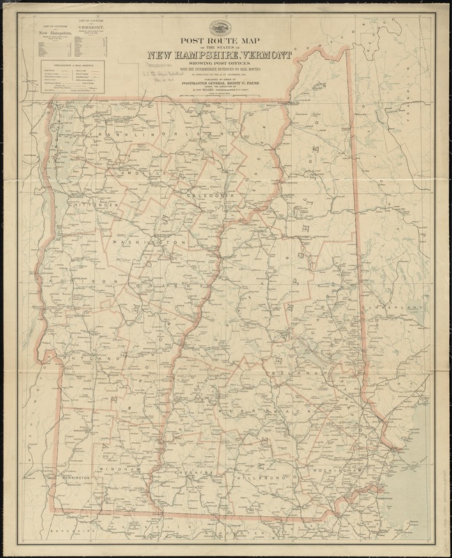
Post route map of the states of New Hampshire, Vermont showing post offices with the intermediate distances on mail routes in operation on the 1st of December, 1903
Item Information
- Title:
- Post route map of the states of New Hampshire, Vermont showing post offices with the intermediate distances on mail routes in operation on the 1st of December, 1903
- Creator:
- United States. Post Office Dept
- Name on Item:
-
published by order of Postmaster General Henry C. Payne under the direction of A. von Haake, topographer P. O. Dept.
- Date:
-
1903
- Format:
-
Maps/Atlases
- Location:
-
Boston Public Library
Norman B. Leventhal Map Center - Collection (local):
-
Norman B. Leventhal Map Center Collection
- Subjects:
-
Counties--New Hampshire--Maps
Counties--Vermont--Maps
Postal service--New Hampshire--Maps
Postal service--Vermont--Maps
Railroads--New Hampshire--Maps
Railroads--Vermont--Maps
New Hampshire--Maps
Vermont--Maps
- Places:
-
Vermont
New Hampshire
- Extent:
- 1 map : col. ; 101 x 80 cm.
- Terms of Use:
-
No known copyright restrictions.
No known restrictions on use.
- Publisher:
-
[Washington, D.C.] :
U.S. Post Office Dept.
- Scale:
-
Scale [ca. 1:316,000]
- Language:
-
English
- Notes:
-
Also shows counties and railroads.
Includes lists of counties showing relative position.
- Identifier:
-
06_01_009107
- Call #:
-
G3741.P8 1903 .U55x
- Barcode:
-
39999065659359


![Map showing the relative distances of Porsmouth [i.e. Portsmouth] and Boston from Concord & Manchester, N.H](https://bpldcassets.blob.core.windows.net/derivatives/images/commonwealth:7h14b104z/image_thumbnail_300.jpg)

