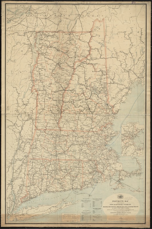
Post route map of the states of New Hampshire, Vermont, Massachusetts, Rhode Island, Connecticut and parts of New York and Maine : showing post offices with the intermediate distances and mail routes in operation on the 1st of September, 1895
Item Information
- Title:
- Post route map of the states of New Hampshire, Vermont, Massachusetts, Rhode Island, Connecticut and parts of New York and Maine : showing post offices with the intermediate distances and mail routes in operation on the 1st of September, 1895
- Creator:
- United States. Post Office Dept
- Name on Item:
-
published by order of Postmaster General William L. Wilson under the direction of A. von Haake, topographer P.O. Dept.
- Date:
-
1895
- Format:
-
Maps/Atlases
- Location:
-
Boston Public Library
Norman B. Leventhal Map Center - Collection (local):
-
Norman B. Leventhal Map Center Collection
- Subjects:
-
Counties--New England--Maps
Postal service--New England--Maps
Railroads--New England--Maps
New England--Maps
- Places:
-
New England (area)
- Extent:
- 1 map on 2 sheets : col., assembled ; 147 x 94 cm.
- Terms of Use:
-
No known copyright restrictions.
No known restrictions on use.
- Publisher:
-
[Washington, D.C.] :
U.S. Post Office Dept.
- Scale:
-
Scale [1:380,160]. 6 miles to 1 in.
- Language:
-
English
- Notes:
-
Prime meridians: Washington, D. C. and Greenwich.
Also shows counties and railroads.
Inset: Environs of Boston.
Includes lists of counties showing the relative positions.
"The service on this diagram brought up to date of Sept. 1st. 1895."
- Identifier:
-
06_01_009012
- Call #:
-
G3721.P8 1895 .U55x
- Barcode:
-
39999065658104


