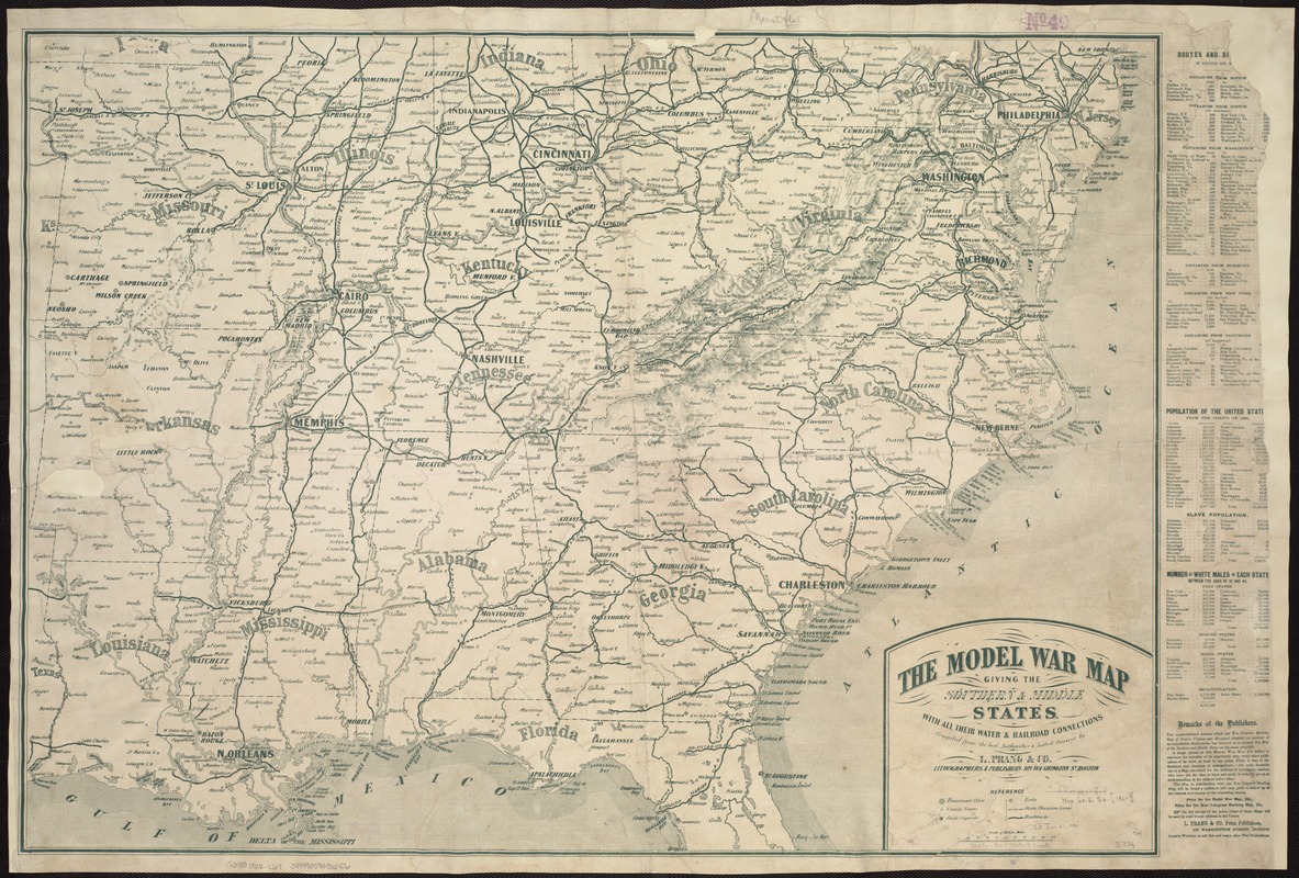
The model war map giving the southern & middle states, with all their water & railroad connections
Item Information
- Title:
- The model war map giving the southern & middle states, with all their water & railroad connections
- Creator:
- Louis Prang and Company
- Name on Item:
-
Compiled from the best authorities & latest surveys by L. Prang & Co., lithographers & publishers.
- Date:
-
[1862?]
- Format:
-
Maps/Atlases
- Location:
-
Boston Public Library
Norman B. Leventhal Map Center - Collection (local):
-
Norman B. Leventhal Map Center Collection
- Subjects:
-
Confederate States of America--History--Maps
Middle Atlantic States--History--Civil War, 1861-1865--Maps
United States--History--Civil War, 1861-1865--Maps
- Places:
-
Confederate States of America (area)
Middle Atlantic (area)
- Extent:
- 1 map ; 62 x 93 cm.
- Terms of Use:
-
No known copyright restrictions.
No known restrictions on use.
- Publisher:
-
Boston :
L. Prang & Co.
- Scale:
-
Scale 1:2,217,600.
- Language:
-
English
- Notes:
-
General map printed in green ink.
Includes tables giving "routes and distances," "population of the United States from the Census of 1860," and "Number of white males in each state between the ages of 18 and 45."
"This map, in combination with our War-Telegram Marking Map [published in 1862] will be found a sufficient and easy guide to follow up all the various movements of the contesting armies."
Description derived from published bibliography.
- Identifier:
-
06_01_007462
- Call #:
-
G3700 1862 .L67
- Barcode:
-
39999059031656
- LCCN:
-
99447093


