The new war map of Virginia, Maryland & Pennsylvania
Item Information
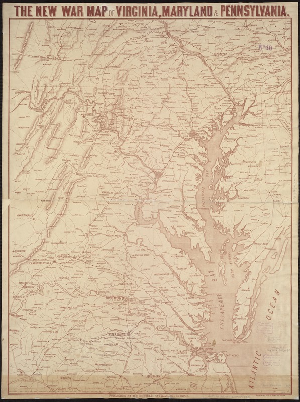
- Title:
- The new war map of Virginia, Maryland & Pennsylvania
- Title (alt.):
-
New war map of Virginia, Maryland and Pennsylvania
- Creator:
- Russell, B. B. (Benjamin B.)
- Date:
-
[1860–1869]
- Format:
-
Maps/Atlases
- Location:
-
Boston Public Library
Norman B. Leventhal Map Center - Collection (local):
-
Norman B. Leventhal Map Center Collection
- Subjects:
-
Middle Atlantic States--Maps
Virginia--Maps
Maryland--Maps
Pennsylvania--Maps
Chesapeake Bay Region (Md. and Va.)--Maps
- Places:
-
Pennsylvania
Chesapeake Bay
Virginia
Maryland
- Extent:
- 1 map ; 89 x 67 cm.
- Terms of Use:
-
No known copyright restrictions.
No known restrictions on use.
- Publisher:
-
Boston :
B.B. Russell
- Language:
-
English
- Notes:
-
General map of the Middle Atlantic and Chesapeake Bay regions showing railroads, highways, and selected forts in eastern Virginia. Does not show Civil War battle locations or troop positions.
Relief shown by hachures.
Printed in brown.
- Notes (date):
-
This date is inferred.
- Identifier:
-
06_01_007451
- Call #:
-
G3791.S5 1860 .R87
- Barcode:
-
39999059031532
- LCCN:
-
91686263


