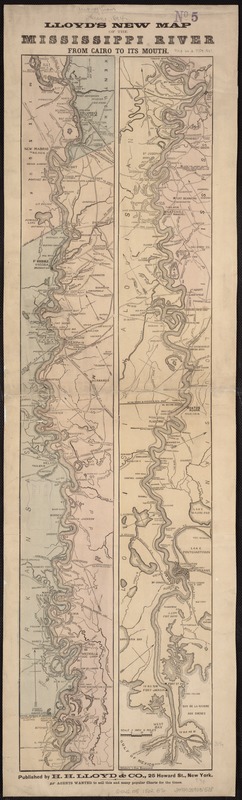
Lloyd's new map of the Mississippi River from Cairo to its mouth
Item Information
- Title:
- Lloyd's new map of the Mississippi River from Cairo to its mouth
- Creator:
- Brooks, F. W.
- Name on Item:
-
F.W. Brooks, delr. Waters & son, engravers.
- Date:
-
[1863?]
- Format:
-
Maps/Atlases
- Location:
-
Boston Public Library
Norman B. Leventhal Map Center - Collection (local):
-
Norman B. Leventhal Map Center Collection
- Subjects:
-
Mississippi River--Maps
- Places:
-
Mississippi River
- Extent:
- 2 maps on 1 sheet ; col. ; each 80 x 11 cm. on sheet 89 x 26 cm.
- Terms of Use:
-
No known copyright restrictions.
No known restrictions on use.
- Publisher:
-
New York :
H.H. Lloyd & Co.
- Scale:
-
Scale 1:696,960.
- Language:
-
English
- Notes:
-
General map of the river indicating the location of a few forts.
Description derived from published bibliography.
- Identifier:
-
06_01_007448
- Call #:
-
G4042.M5 1862 .B76
- Barcode:
-
39999059031508
- LCCN:
-
99447107


