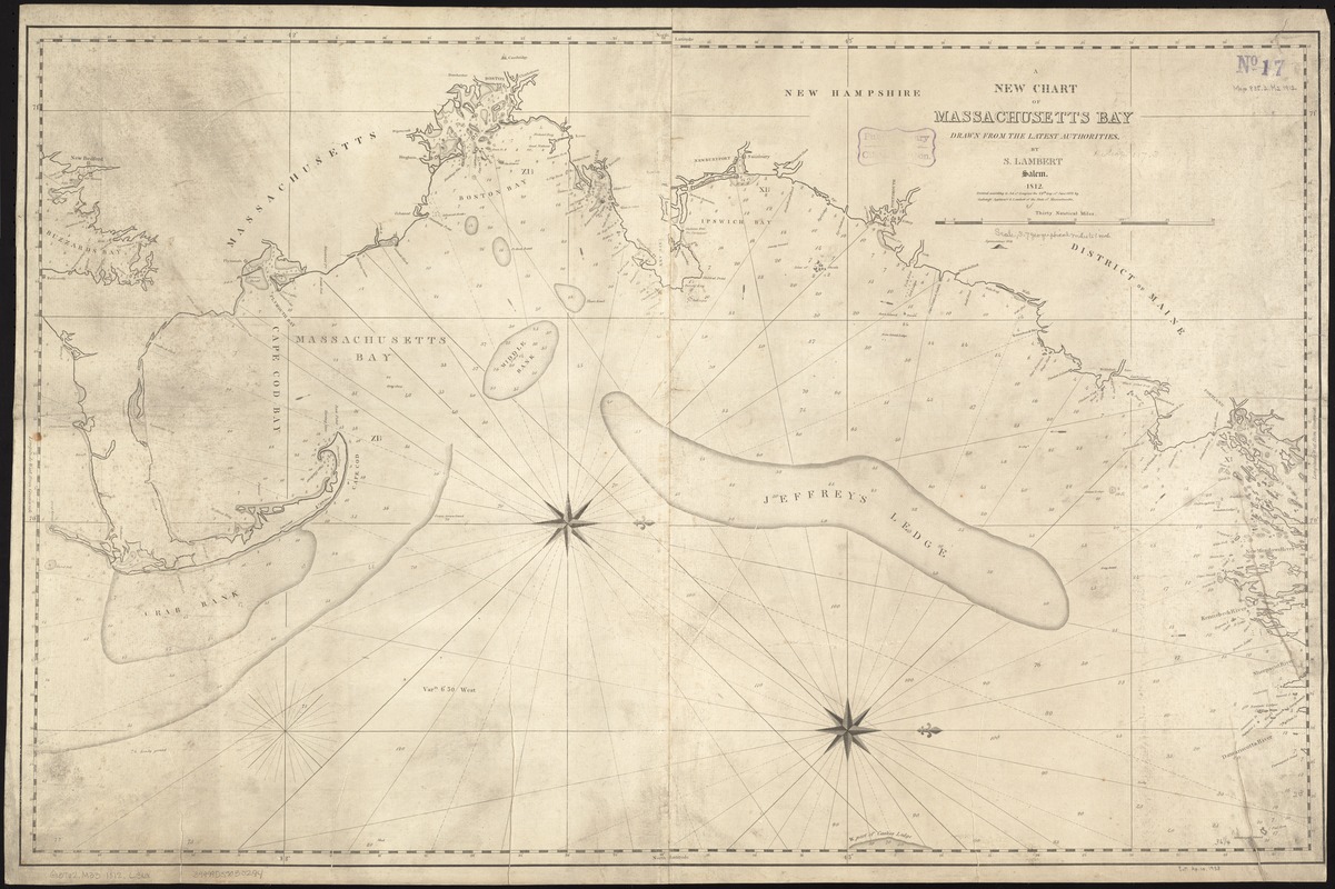
A new chart of Massachusetts Bay drawn from the latest authorities
Item Information
- Title:
- A new chart of Massachusetts Bay drawn from the latest authorities
- Creator:
- Lambert, Samuel, 1768-1832
- Name on Item:
-
by S. Lambert.
- Date:
-
1812
- Format:
-
Maps/Atlases
- Location:
-
Boston Public Library
Norman B. Leventhal Map Center - Collection (local):
-
Norman B. Leventhal Map Center Collection
- Subjects:
-
Nautical charts--Massachusetts--Massachusetts Bay
Massachusetts Bay (Mass.)--Maps
- Places:
-
Massachusetts Bay
- Extent:
- 1 chart ; 59 x 94 cm.
- Terms of Use:
-
No known copyright restrictions.
No known restrictions on use.
- Publisher:
-
Salem [Mass.] :
S. Lambert
- Scale:
-
Scale ca. 1:235,000.
- Language:
-
English
- Notes:
-
Depths shown by soundings.
Oriented with north to the right.
Cataloging, conservation, and digitization made possible in part by The National Endowment for the Humanities: Exploring the human endeavor.
- Identifier:
-
06_01_007245
- Call #:
-
G3762.M33 1812 .L36x
- Barcode:
-
39999059030294