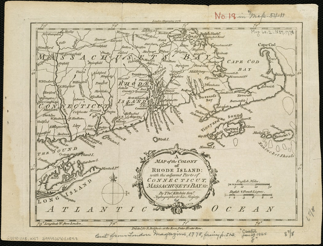
A map of the colony of Rhode Island : with the adjacent parts of Connecticut, Massachusetts Bay, &c
This map is also available in American Revolutionary Geographies Online (ARGO), a collections portal especially built for material relating to the American Revolutionary War Era. Visit ARGO to learn more about this item and explore the historical geography of North America in the late eighteenth century.
Item Information
- Title:
- A map of the colony of Rhode Island : with the adjacent parts of Connecticut, Massachusetts Bay, &c
- Description:
-
Includes Connecticut as far west as Branford and Farmington; Massachusetts extending west to the Connecticut River Valley and north to Boston, including Cape Cod, Martha's Vineyard, and Nantucket; and the eastern end of Long Island.
- Creator:
- Kitchin, Thomas, d. 1784
- Name on Item:
-
by Thos. Kitchin Senr.
- Date:
-
1778
- Format:
-
Maps/Atlases
- Location:
-
Boston Public Library
Norman B. Leventhal Map Center - Collection (local):
-
Norman B. Leventhal Map Center Collection
- Subjects:
-
New England--Maps--Early works to 1800
Rhode Island--Maps--Early works to 1800
Connecticut--Maps--Early works to 1800
Massachusetts--Maps--Early works to 1800
- Places:
-
Massachusetts
New England (area)
Rhode Island
Connecticut
- Extent:
- 1 map ; 17 x 23 cm.
- Terms of Use:
-
No known copyright restrictions.
No known restrictions on use.
- Publisher:
-
[London] :
Printed for R. Baldwin at the Rose, Pater Noster Row
- Scale:
-
Scale 1:1,300,000
- Language:
-
English
- Notes:
-
London Magazine 1778--Upper margin.
- Identifier:
-
06_01_006265
- Call #:
-
G3770 1778 .K57
- Barcode:
-
39999059021897


