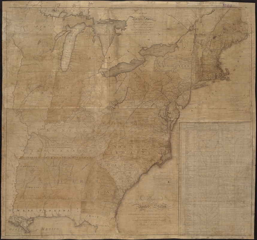
Map of the United States exhibiting the post-roads, the situations, connections & distances of the post-offices, stage roads, counties, ports of entry and delivery for foreign vessels, and the principal rivers
This map is also available in American Revolutionary Geographies Online (ARGO), a collections portal especially built for material relating to the American Revolutionary War Era. Visit ARGO to learn more about this item and explore the historical geography of North America in the late eighteenth century.
Item Information
- Title:
- Map of the United States exhibiting the post-roads, the situations, connections & distances of the post-offices, stage roads, counties, ports of entry and delivery for foreign vessels, and the principal rivers
- Additional title :
- Map of the United States exhibiting post roads & distances
- Creator:
- Bradley, Abraham, 1767-1838
- Name on Item:
-
by Abraham Bradley junr.
- Date:
-
1796
- Format:
-
Maps/Atlases
- Location:
-
Boston Public Library
Norman B. Leventhal Map Center - Collection (local):
-
Norman B. Leventhal Map Center Collection
- Subjects:
-
Post roads--United States--Maps--Early works to 1800
United States--Maps--Early works to 1800
- Places:
-
- Extent:
- 1 map ; 89 x 94 cm.
- Terms of Use:
-
No known copyright restrictions.
No known restrictions on use.
- Publisher:
-
Philadelphia :
[s.n.]
- Edition:
- 3rd state
- Scale:
-
Scale 1:2,400,000.
- Language:
-
English
- Notes:
-
State 3 with surveyed townships shown in New York and Ohio.
Engraved by: W. Barker.
Title engraved by: W. Harrison junr.
Inset: Progress of the mail on the main line.
Above the upper neat line at left: Deposited as the Act directs September 26th. 1796.
South of Tennessee appears: United States Territory.
- Identifier:
-
06_01_006215
- Call #:
-
G3700 1796 .B73
- Barcode:
-
39999059032696


