Canada and Nova Scotia
Item Information
- Title:
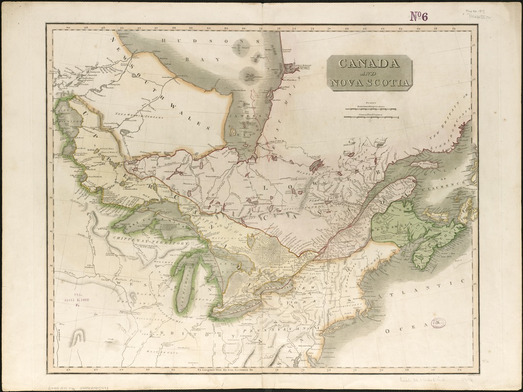
- Canada and Nova Scotia
- Description:
-
Shows Great Lakes region.
- Creator:
- Thomson, John, 19th cent
- Name on Item:
-
engd. by W. Dassauville.
- Date:
-
[1817]
- Format:
-
Maps/Atlases
- Location:
-
Boston Public Library
Norman B. Leventhal Map Center - Collection (local):
-
Norman B. Leventhal Map Center Collection
- Subjects:
-
Canada--Maps
Great Lakes Region (North America)--Maps
- Places:
-
Great Lakes Region (area)
Canada
- Extent:
- 1 map : col. ; 47 x 58 cm.
- Terms of Use:
-
No known copyright restrictions.
No known restrictions on use.
- Publisher:
-
Edinburgh :
Printed by G. Ramsay and Co., for J. Thomson and Co.
- Scale:
-
Scale ca. 1:5,700,000.
- Language:
-
English
- Notes:
-
Relief shown by hachures.
Cataloging, conservation, and digitization made possible in part by The National Endowment for the Humanities: Exploring the human endeavor.
- Notes (date):
-
This date is inferred.
- Identifier:
-
06_01_006188
- Call #:
-
G3400 1817 .T46
- Barcode:
-
39999059021178


