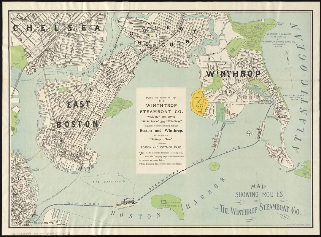
Map showing the routes of The Winthrop Steamboat Co
Item Information
- Title:
- Map showing the routes of The Winthrop Steamboat Co
- Title (alt.):
-
Pocket map of Winthrop, Mass. showing route of Winthrop Steamboat Co
- Creator:
- Geo. H. Walker & Co
- Date:
-
[ca. 1896]
- Format:
-
Maps/Atlases
- Location:
-
Boston Public Library
Norman B. Leventhal Map Center - Collection (local):
-
Norman B. Leventhal Map Center Collection
- Subjects:
-
Winthrop Steamboat Co
Steamboat lines--Massachusetts--Boston Harbor--Maps
Winthrop (Mass.)--Maps
Boston Harbor (Mass.)--Maps
- Places:
-
Boston Harbor
Suffolk (county)Winthrop
- Extent:
- 1 map : col. ; 49 x 69 cm.
- Terms of Use:
-
No known copyright restrictions.
No known restrictions on use.
- Publisher:
-
Boston :
Geo. H. Walker & Co.
- Scale:
-
Scale not given.
- Language:
-
English
- Notes:
-
Oriented with north toward the upper left.
Shows steamboat routes connecting Winthrop and Boston.
Covers also parts of East Boston and Chelsea.
Includes advertisements.
- Identifier:
-
06_01_005580
- Call #:
-
G3762.B65P54 1896 .G4
- Barcode:
-
39999059015253