Map of the town of Upton, Worcester Co., Mass : surveyed by authority of the town
Item Information
- Title:
- Map of the town of Upton, Worcester Co., Mass : surveyed by authority of the town
- Creator:
- Walling, Henry Francis, 1825-1888
- Name on Item:
-
by H.F. Walling.
- Date:
-
1851
- Format:
-
Maps/Atlases
- Location:
-
Boston Public Library
Norman B. Leventhal Map Center - Collection (local):
-
Norman B. Leventhal Map Center Collection
- Subjects:
-
Real property--Massachusetts--Upton (Town)--Maps
Landowners--Massachusetts--Upton (Town)--Maps
Upton (Mass. : Town)--Maps
- Places:
-
Worcester (county)Upton
- Extent:
- 1 map ; 82 x 53 cm.
- Terms of Use:
-
No known copyright restrictions.
No known restrictions on use.
- Publisher:
-
Phil[adelphi]a :
A. Kollner's Lithy. & Printing Establmt
- Scale:
-
Scale [ca. 1:16,200].
- Language:
-
English
- Notes:
-
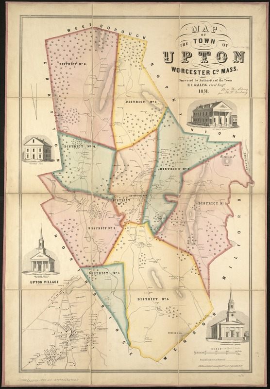
Relief shown by hachures.
Shows buildings with names of property owners and town districts.
Inset: Upton Village.
Includes 4 views of town buildings.
- Identifier:
-
06_01_005470
- Call #:
-
G3764.U6G46 1851 .W3
- Barcode:
-
39999059014538


