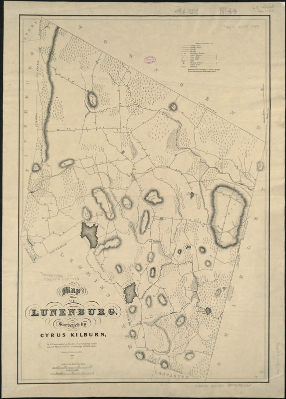
Map of Lunenburg
Item Information
- Title:
- Map of Lunenburg
- Creator:
- Kilburn, Cyrus.
- Name on Item:
-
surveyed by Cyrus Kilburn.
- Date:
-
1833
- Format:
-
Maps/Atlases
- Location:
-
Boston Public Library
Norman B. Leventhal Map Center - Collection (local):
-
Norman B. Leventhal Map Center Collection
- Subjects:
-
Landowners--Massachusetts--Lunenburg (Town)--Maps
Lunenburg (Mass. : Town)--Maps
- Places:
-
Worcester (county)Lunenburg
- Extent:
- 1 map ; 68 x 47 cm + pamphlet (8 p.)
- Terms of Use:
-
No known copyright restrictions.
No known restrictions on use.
- Publisher:
-
Lancaster, Mass :
[engraved at Carter, Andrews & Co's]
- Scale:
-
Scale [ca. 1;21,120].
- Language:
-
English
- Notes:
-
Relief shown by hachures.
Accompanied by: Lunenburg Directory, for 1834; index of landowners.
"In 1831, pursuant to a Resolve of our General Court passed March 1st 1830; containing 17494 acres."
- Identifier:
-
06_01_005373
- Call #:
-
G3764.L85 1833 .K5x
- Barcode:
-
39999059013464


